TopoQuest Logo
Do you find TopoQuest useful?
Help keep TopoQuest running and adding new maps/features by donating!
Bitcoin:  19c7KJd3qBynnjoSw5npx9KScwjBe4ifkT
Litecoin:  LXs6TkuXGGXo1vDsWCkWVdjQX94eUKd6ui
Home View Maps Find Maps Find Places Resources & Links


Adrian, West Virginia Topographic Map

USGS Map Title: Adrian, WV
USGS Map MRC: 38080H3
DRG (GeoTIFF) Download: o38080h3.tif


Neighboring USGS Topographic Map Quads:


  Weston, WV  
39080A4
 

  Berlin, WV  
39080A3
 

  Century, WV  
39080A2
 

  Roanoke, WV  
38080H4
 

  Adrian, WV  
38080H3
 

  Buckhannon, WV  
38080H2
 

  Walkersville, WV  
38080G4
 

  Rock Cave, WV  
38080G3
 

  Alton, WV  
38080G2


Map MRC Location:

N39°
W81°
N39°
W80°
H8 H7 H6 H5 H4 H3 H2 H1
G8 G7 G6 G5 G4 G3 G2 G1
F8 F7 F6 F5 F4 F3 F2 F1
E8 E7 E6 E5 E4 E3 E2 E1
D8 D7 D6 D5 D4 D3 D2 D1
C8 C7 C6 C5 C4 C3 C2 C1
B8 B7 B6 B5 B4 B3 B2 B1
A8 A7 A6 A5 A4 A3 A2 A1
N38°
W81°
N38°
W80°

Adrian, WV USGS 1:24K Topographic Map Preview:
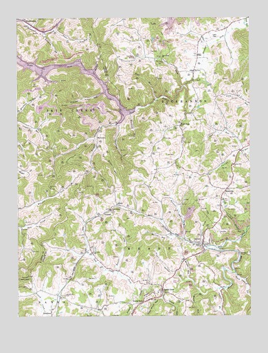
Adrian, WV USGS Topographic Map
Click on map above to begin viewing in our Map Viewer.

This topographic map contains these locations and features:
Feature Name Type Latitude Longitude GNIS ID View Map
AbbottPopulated PlaceN38.9218°W80.3215°1553685View Map
AdrianPopulated PlaceN38.9054°W80.2756°1553699View Map
Adrian Post OfficePost OfficeN38.9048°W80.2757°1696631View Map
Adrian Volunteer Fire DepartmentBuildingN38.8985°W80.2849°2577963View Map
AtlasPopulated PlaceN38.9776°W80.2798°1549573View Map
Bear RunStreamN38.9654°W80.3001°1535393View Map
Beaver RunStreamN38.8929°W80.3218°1535453View Map
Beechlick RunStreamN38.9937°W80.3595°1535564View Map
Beechtown CemeteryCemeteryN38.8840°W80.3492°1535566View Map
Blacklick RunStreamN38.9073°W80.2865°1536061View Map
Brush RunStreamN38.8840°W80.2970°1536481View Map
Brushlick RunStreamN38.9604°W80.3145°1536484View Map
Brushy ForkStreamN38.9957°W80.2509°1536502View Map
Brushy Fork Seventh Day Adventist SchoolSchoolN38.9948°W80.2714°2088144View Map
Buckhannon District (historical)CivilN38.9804°W80.2770°1928172View Map
Buckhannon MountainSummitN38.9607°W80.3495°1728526View Map
Bull RunStreamN38.9037°W80.2737°1536704View Map
Bull Run School (historical)SchoolN38.9234°W80.3118°1696657View Map
Cleavenger School (historical)SchoolN38.9840°W80.3104°1696674View Map
Crooked RunStreamN38.9107°W80.2523°1537849View Map
Day Helmick SpringSpringN38.9273°W80.2584°1678163View Map
Fall RunStreamN38.9712°W80.2851°1538847View Map
First DistrictCivilN38.9942°W80.2697°1928270View Map
FreemanPopulated PlaceN38.9179°W80.3284°1554506View Map
French CreekPopulated PlaceN38.8857°W80.2973°1554511View Map
French Creek Elementary SchoolSchoolN38.8901°W80.2909°1696689View Map
French Creek Post OfficePost OfficeN38.8911°W80.2938°1696690View Map
French Creek Presbyterian ChurchChurchN38.8862°W80.2976°1696691View Map
Frenchton Post OfficePost OfficeN38.8757°W80.3570°1696692View Map
Glady ForkStreamN38.9709°W80.2862°1539447View Map
Glady School (historical)SchoolN38.9415°W80.2879°1696696View Map
GouldPopulated PlaceN38.9009°W80.2554°1554587View Map
Grand Camp RunStreamN38.8929°W80.2584°1539567View Map
Grub HollowValleyN38.8901°W80.2873°1539776View Map
HinklevillePopulated PlaceN38.9268°W80.2623°1540316View Map
Hoover TownPopulated PlaceN38.8807°W80.3076°1554737View Map
Kittle RunStreamN38.8854°W80.2776°1541255View Map
Laurel ForkStreamN38.8859°W80.2667°1541463View Map
Lebanon ChurchChurchN38.9465°W80.3320°1541599View Map
Lick RunStreamN38.9443°W80.2551°1541915View Map
Little Brush RunStreamN38.8823°W80.2973°1542040View Map
Log Hollow RunStreamN38.9457°W80.3331°1542308View Map
Lower Brushy Fork School (historical)SchoolN38.9951°W80.2623°1696730View Map
McCuetownPopulated PlaceN38.9498°W80.3318°1555082View Map
Miller Crossing (historical)LocaleN38.9987°W80.3518°1728642View Map
Morgan RunStreamN38.8898°W80.2834°1543547View Map
Mount Olive ChurchChurchN38.9234°W80.2654°1543711View Map
Mount Olive ChurchChurchN38.9290°W80.3573°1543712View Map
Mudlick RunStreamN38.9084°W80.2898°1543961View Map
New Found RunStreamN38.9051°W80.2765°1544116View Map
Oak Grove School (historical)SchoolN38.8987°W80.2845°1696748View Map
Pigeonroost RunStreamN38.9554°W80.3212°1544835View Map
Pleasant Dale ChurchChurchN38.9382°W80.2590°1544981View Map
Point Pleasant ChurchChurchN38.9193°W80.3245°1545098View Map
Pringle ForkStreamN38.9612°W80.3195°1545274View Map
Reger ChapelChurchN38.9843°W80.2781°1545501View Map
Rocky FordPopulated PlaceN38.9548°W80.2876°1549902View Map
Slab Camp CemeteryCemeteryN38.9018°W80.3345°1546878View Map
Slab Camp ForkStreamN38.8840°W80.3118°1546879View Map
Slab Camp School (historical)SchoolN38.9023°W80.3354°1696779View Map
Snyder RunStreamN38.9948°W80.3554°1547048View Map
Snyder School (historical)SchoolN38.9368°W80.3340°1696780View Map
Spruce ForkStreamN38.9712°W80.2862°1547238View Map
Spruce Fork ChurchChurchN38.9837°W80.2968°1547248View Map
Stonecoal Lake Wildlife Management AreaParkN38.9709°W80.3304°1728677View Map
Stonecoal ReservoirReservoirN38.9803°W80.3476°1547473View Map
Straight RunStreamN38.9690°W80.3273°1547573View Map
Upshur County Regional AirportAirportN38.9988°W80.2780°1558779View Map
Willow Brook School (historical)SchoolN38.9598°W80.3148°1696809View Map
Wilson SidingLocaleN38.9993°W80.3718°1549233View Map
Wolfpen RunStreamN38.9768°W80.3340°1549344View Map

Note: Coordinates in the location and feature list above are referenced to NAD83 datum.


Copyright (C) 2008-2024 Ryan Niemi / Sunset Dynamics ... All Rights Reserved