TopoQuest Logo
Do you find TopoQuest useful?
Help keep TopoQuest running and adding new maps/features by donating!
Bitcoin:  19c7KJd3qBynnjoSw5npx9KScwjBe4ifkT
Litecoin:  LXs6TkuXGGXo1vDsWCkWVdjQX94eUKd6ui
Home View Maps Find Maps Find Places Resources & Links


Industrial, Mississippi Topographic Map

USGS Map Title: Industrial, MS
USGS Map MRC: 30089E7
DRG (GeoTIFF) Download: o30089e7.tif


Neighboring USGS Topographic Map Quads:


  Sun, LA  
30089F8
 

  Henleyfield, MS  
30089F7
 

  McNeill, MS  
30089F6
 

  Bush, LA  
30089E8
 

  Industrial, MS  
30089E7
 

  Picayune, MS  
30089E6
 

  Saint Tammany, LA  
30089D8
 

  Hickory, LA  
30089D7
 

  Nicholson, MS  
30089D6


Map MRC Location:

N31°
W90°
N31°
W89°
H8 H7 H6 H5 H4 H3 H2 H1
G8 G7 G6 G5 G4 G3 G2 G1
F8 F7 F6 F5 F4 F3 F2 F1
E8 E7 E6 E5 E4 E3 E2 E1
D8 D7 D6 D5 D4 D3 D2 D1
C8 C7 C6 C5 C4 C3 C2 C1
B8 B7 B6 B5 B4 B3 B2 B1
A8 A7 A6 A5 A4 A3 A2 A1
N30°
W90°
N30°
W89°

Industrial, MS USGS 1:24K Topographic Map Preview:
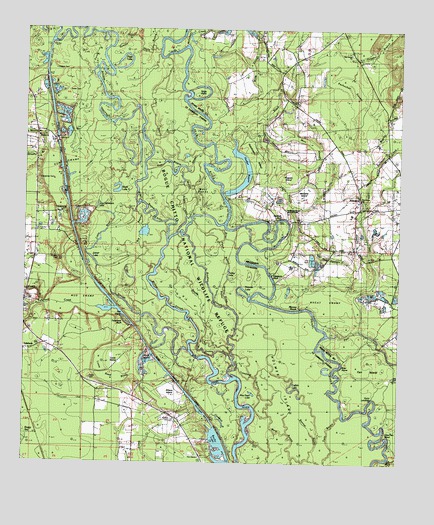
Industrial, MS USGS Topographic Map
Click on map above to begin viewing in our Map Viewer.

This topographic map contains these locations and features:
Feature Name Type Latitude Longitude GNIS ID View Map
Anders BayouGutN30.5319°W89.8109°1628841View Map
Becky LakeLakeN30.5031°W89.8100°1628860View Map
Big BayouStreamN30.5721°W89.8384°560163View Map
Big CreekStreamN30.6232°W89.8503°560177View Map
Black CreekStreamN30.5921°W89.8117°667208View Map
Black Creek CutoffChannelN30.5844°W89.8140°688109View Map
Black LakeLakeN30.5782°W89.8446°1628865View Map
Boar StoneIslandN30.5291°W89.7692°690870View Map
Bogue ChittoStreamN30.5846°W89.8353°560237View Map
Bogue Chitto National Wildlife RefugeParkN30.5504°W89.7981°690871View Map
Bradley SloughStreamN30.5255°W89.8062°560264View Map
Brier Patch BayouStreamN30.5446°W89.8073°560274View Map
Brushy BranchStreamN30.5902°W89.8687°560287View Map
Byrd BayouStreamN30.5957°W89.8362°560313View Map
Carpenter CemeteryCemeteryN30.5819°W89.8709°560365View Map
Casey BayouStreamN30.5346°W89.8170°560371View Map
Catfish LakeLakeN30.5215°W89.7846°560380View Map
Circle IslandIslandN30.5646°W89.8478°560430View Map
Clements BayouLakeN30.5128°W89.8096°1628889View Map
Copper CemeteryCemeteryN30.6132°W89.8662°560465View Map
Cow BayouStreamN30.5910°W89.8334°560503View Map
Cow Hammock LakeLakeN30.5742°W89.8510°560506View Map
Cow Pen BendBendN30.5085°W89.7542°690874View Map
Crawford BayouStreamN30.5199°W89.7970°560525View Map
Cryer SloughStreamN30.5421°W89.8359°560553View Map
Daves IslandIslandN30.5030°W89.7701°560587View Map
Dobson BayouStreamN30.6191°W89.8473°560632View Map
East Bogue ChittoStreamN30.5910°W89.8151°560683View Map
Farr IslandAreaN30.5257°W89.7590°669917View Map
Gum LandingLocaleN30.5191°W89.7584°690877View Map
Gum PondLakeN30.5312°W89.8349°1629359View Map
Hebron CemeteryCemeteryN30.5938°W89.8701°1628917View Map
Hebron ChurchChurchN30.5932°W89.8712°560951View Map
Hells Gate BayouStreamN30.6130°W89.8465°560953View Map
Hickory CreekStreamN30.6235°W89.8417°560963View Map
Hogpen BranchStreamN30.6094°W89.7662°671269View Map
Hogpen IslandIslandN30.5841°W89.7870°671271View Map
Holmes IslandIslandN30.5146°W89.7853°560985View Map
Hutchinson IslandIslandN30.5899°W89.7967°671646View Map
IndustrialPopulated PlaceN30.5763°W89.7634°671706View Map
Industrial Elementary School (historical)SchoolN30.5788°W89.7640°710159View Map
Jarrell CreekStreamN30.6246°W89.8153°690882View Map
Jenkins Ridge BayouGutN30.5488°W89.8084°1628931View Map
Joiner LakeLakeN30.5566°W89.8484°1627817View Map
Keller BayouStreamN30.5435°W89.7801°1627388View Map
Keller CemeteryCemeteryN30.6069°W89.8617°1627389View Map
Leslie SloughGutN30.5785°W89.7884°672408View Map
Leslies LandingLocaleN30.5707°W89.7884°710160View Map
Little Brushy BranchStreamN30.5902°W89.8681°1627506View Map
Little Cannon LakeLakeN30.5827°W89.8398°1627509View Map
Little RiverStreamN30.5749°W89.8376°1627536View Map
Lock Number TwoDamN30.5929°W89.8644°1627553View Map
Lotts CreekStreamN30.5388°W89.7623°672891View Map
Louie IslandIslandN30.5285°W89.8445°1627569View Map
Louie Reed BrakeSwampN30.5245°W89.8431°1628947View Map
Mars SloughGutN30.5946°W89.7848°673153View Map
McCarty IslandIslandN30.5780°W89.7823°673297View Map
McGee CemeteryCemeteryN30.5121°W89.8256°1627630View Map
Middle Bogue ChittoStreamN30.5635°W89.8278°1627644View Map
Moody BranchStreamN30.5902°W89.7603°673752View Map
Moses BranchStreamN30.5452°W89.8703°1627701View Map
Mud SwampSwampN30.5469°W89.8582°1627729View Map
Nances LakeLakeN30.5506°W89.8022°1628962View Map
Nances ReachChannelN30.5444°W89.7862°690888View Map
Nicks PointCapeN30.6071°W89.8142°1628966View Map
Old Mud SwampSwampN30.5589°W89.7713°675217View Map
Old Tar LandingLocaleN30.6199°W89.8209°688143View Map
Page LakeLakeN30.6139°W89.8426°1627855View Map
Parker BayouLakeN30.5792°W89.8041°675451View Map
Parker BranchStreamN30.5132°W89.7737°1627868View Map
Parker CemeteryCemeteryN30.5244°W89.8534°1627870View Map
Parkers HammockIslandN30.5863°W89.8042°688144View Map
Pea RidgeRidgeN30.6238°W89.7570°710163View Map
Pearl River Canal Pool Number TwoReservoirN30.6202°W89.8667°1628762View Map
Pearl River County Game RefugeParkN30.6002°W89.7945°711173View Map
Pechochen SwampSwampN30.6081°W89.7680°675568View Map
Pen IslandIslandN30.5416°W89.8415°1627895View Map
Pine Grove ChurchChurchN30.5805°W89.7631°690891View Map
Pine Grove ChurchChurchN30.6180°W89.7667°675818View Map
Pine Grove Volunteer Fire Department Station 1 HeadquartersBuildingN30.5797°W89.7637°2332797View Map
Purns BayouStreamN30.6138°W89.8523°1628011View Map
Rice Patch LakeLakeN30.5203°W89.7985°1628048View Map
Saint Tammany Parish Fire District 7 Station 1BuildingN30.5018°W89.8160°2332379View Map
Saint Tammany Parish Sheriff's OfficeBuildingN30.5341°W89.8680°2334200View Map
Soloman CreekStreamN30.5866°W89.7590°677971View Map
Stewarts BluffCliffN30.5538°W89.7920°678287View Map
Stock IslandIslandN30.5285°W89.8342°1628295View Map
Talisheek BluffCliffN30.5407°W89.8417°1629038View Map
Talisheek CreekStreamN30.5449°W89.8706°1628326View Map
Talisheek Post OfficePost OfficeN30.5329°W89.8747°1632291View Map
Thomas CemeteryCemeteryN30.5585°W89.8637°1628352View Map
Turkey PondLakeN30.5330°W89.8070°1628393View Map
Twin BayouStreamN30.5021°W89.7742°1628397View Map
Walkiah (historical)Populated PlaceN30.5707°W89.7870°688178View Map
Walkiah BluffCliffN30.5710°W89.7895°690899View Map
Walkiah Bluff Water ParkParkN30.5724°W89.7873°690900View Map
West Bogue ChittoStreamN30.5635°W89.8278°1628465View Map
West PondsLakeN30.5788°W89.8170°1629054View Map
Wheat SwampSwampN30.5473°W89.7721°679551View Map
White Oak Ridge LakeLakeN30.5380°W89.7945°1628496View Map
Willis SloughGutN30.6119°W89.7992°679734View Map
Wilson IslandIslandN30.5213°W89.8262°1628518View Map
Wilson SloughStreamN30.5324°W89.8195°1628519View Map

Note: Coordinates in the location and feature list above are referenced to NAD83 datum.


Copyright (C) 2008-2024 Ryan Niemi / Sunset Dynamics ... All Rights Reserved