TopoQuest Logo
Do you find TopoQuest useful?
Help keep TopoQuest running and adding new maps/features by donating!
Bitcoin:  19c7KJd3qBynnjoSw5npx9KScwjBe4ifkT
Litecoin:  LXs6TkuXGGXo1vDsWCkWVdjQX94eUKd6ui
Home View Maps Find Maps Find Places Resources & Links


Inglenook, California Topographic Map

USGS Map Title: Inglenook, CA
USGS Map MRC: 39123E7
DRG (GeoTIFF) Download: o39123e7.tif


Neighboring USGS Topographic Map Quads:


  Westport, CA  
39123F7
 

  Lincoln Ridge, CA  
39123F6


  Inglenook, CA  
39123E7
 

  Dutchmans Knoll, CA  
39123E6


  Fort Bragg, CA  
39123D7
 

  Noyo Hill, CA  
39123D6


Map MRC Location:

N40°
W124°
N40°
W123°
H8 H7 H6 H5 H4 H3 H2 H1
G8 G7 G6 G5 G4 G3 G2 G1
F8 F7 F6 F5 F4 F3 F2 F1
E8 E7 E6 E5 E4 E3 E2 E1
D8 D7 D6 D5 D4 D3 D2 D1
C8 C7 C6 C5 C4 C3 C2 C1
B8 B7 B6 B5 B4 B3 B2 B1
A8 A7 A6 A5 A4 A3 A2 A1
N39°
W124°
N39°
W123°

Inglenook, CA USGS 1:24K Topographic Map Preview:
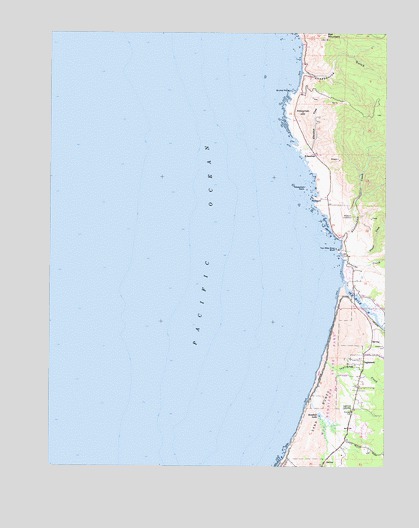
Inglenook, CA USGS Topographic Map
Click on map above to begin viewing in our Map Viewer.

This topographic map contains these locations and features:
Feature Name Type Latitude Longitude GNIS ID View Map
Abalobadiah CreekStreamN39.5654°W123.7672°217934View Map
Bell MountainSummitN39.6243°W123.7734°255064View Map
Bruhel PointCapeN39.6077°W123.7864°219917View Map
Chadbourne GulchValleyN39.6132°W123.7820°220873View Map
Fort Bragg GrangeBuildingN39.5160°W123.7633°1666812View Map
Frazer CreekStreamN39.5588°W123.7625°223846View Map
InglenookPopulated PlaceN39.5296°W123.7589°1658823View Map
Inglenook CemeteryCemeteryN39.5165°W123.7633°225926View Map
Inglenook Census Designated PlaceCensusN39.5218°W123.7525°2628742View Map
Inglenook CreekStreamN39.5307°W123.7745°225927View Map
Inglenook FenSwampN39.5117°W123.7721°1723247View Map
Inglenook Fen-Ten Mile Dunes Natural PreserveReserveN39.5225°W123.7714°2741219View Map
KibesillahPopulated PlaceN39.5902°W123.7778°252713View Map
Kibesillah CreekStreamN39.5915°W123.7825°234108View Map
Kibesillah HillSummitN39.6021°W123.7820°1658900View Map
Kibesillah RockIslandN39.5804°W123.7806°226566View Map
NewportPopulated PlaceN39.5774°W123.7747°1659222View Map
Newport CemeteryCemeteryN39.5720°W123.7634°229522View Map
Sandhill LakeLakeN39.5146°W123.7753°232514View Map
Seaside CreekStreamN39.5596°W123.7656°232765View Map
Seaside Creek BeachBeachN39.5591°W123.7664°1723258View Map
Ten Mile BeachBeachN39.5263°W123.7764°1723260View Map
Ten Mile DunesAreaN39.5196°W123.7739°1723261View Map
Ten Mile RiverStreamN39.5527°W123.7670°255123View Map
Ten Mile River BluffCapeN39.5627°W123.7692°236101View Map
Whale Rock ArchArchN39.5553°W123.7678°2709994View Map

Note: Coordinates in the location and feature list above are referenced to NAD83 datum.


Copyright (C) 2008-2024 Ryan Niemi / Sunset Dynamics ... All Rights Reserved