TopoQuest Logo
Do you find TopoQuest useful?
Help keep TopoQuest running and adding new maps/features by donating!
Bitcoin:  19c7KJd3qBynnjoSw5npx9KScwjBe4ifkT
Litecoin:  LXs6TkuXGGXo1vDsWCkWVdjQX94eUKd6ui
Home View Maps Find Maps Find Places Resources & Links


Bakersfield, Missouri Topographic Map

USGS Map Title: Bakersfield, MO
USGS Map MRC: 36092E2
DRG (GeoTIFF) Download: o36092e2.tif


Neighboring USGS Topographic Map Quads:


  Sycamore, MO  
36092F3
 

  Cureall NW, MO  
36092F2
 

  Pottersville, MO  
36092F1
 

  Udall, MO  
36092E3
 

  Bakersfield, MO  
36092E2
 

  Caulfield, MO  
36092E1
 

  Clarkridge, AR  
36092D3
 

  Gamaliel, AR  
36092D2
 

  Gepp, AR  
36092D1


Map MRC Location:

N37°
W93°
N37°
W92°
H8 H7 H6 H5 H4 H3 H2 H1
G8 G7 G6 G5 G4 G3 G2 G1
F8 F7 F6 F5 F4 F3 F2 F1
E8 E7 E6 E5 E4 E3 E2 E1
D8 D7 D6 D5 D4 D3 D2 D1
C8 C7 C6 C5 C4 C3 C2 C1
B8 B7 B6 B5 B4 B3 B2 B1
A8 A7 A6 A5 A4 A3 A2 A1
N36°
W93°
N36°
W92°

Bakersfield, MO USGS 1:24K Topographic Map Preview:
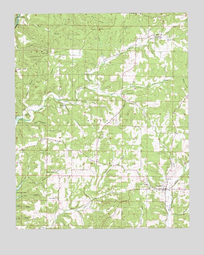
Bakersfield, MO USGS Topographic Map
Click on map above to begin viewing in our Map Viewer.

This topographic map contains these locations and features:
Feature Name Type Latitude Longitude GNIS ID View Map
BakersfieldPopulated PlaceN36.5226°W92.1421°735494View Map
Bakersfield Post OfficePost OfficeN36.5224°W92.1431°2782793View Map
Bakersfield Volunteer Fire DepartmentBuildingN36.5232°W92.1432°2620844View Map
Baptist Hill ChurchChurchN36.5784°W92.1693°713628View Map
Barren Creek SchoolLocaleN36.5453°W92.1915°742338View Map
Blair HollowValleyN36.6231°W92.2468°714345View Map
Bluff SpringSpringN36.5287°W92.1413°733852View Map
Brown HollowValleyN36.5953°W92.1874°714777View Map
Butram HollowValleyN36.5737°W92.1707°715131View Map
Cedar BluffCliffN36.5665°W92.2407°715561View Map
Central PlateauAreaN36.6248°W92.1254°754099View Map
Cloud 9 Ranch ClubBuildingN36.6231°W92.1448°2621668View Map
Cold Springs Church (historical)ChurchN36.5690°W92.1946°742337View Map
ElijahPopulated PlaceN36.6117°W92.1490°717443View Map
Fairview SchoolLocaleN36.5990°W92.1496°742335View Map
Fore CemeteryCemeteryN36.5128°W92.1421°718071View Map
Gillette HollowValleyN36.5742°W92.2049°718452View Map
Halford SpringSpringN36.5331°W92.2224°718999View Map
Hasty Pudding HollowValleyN36.5623°W92.2385°719200View Map
Hawkins RidgeRidgeN36.5201°W92.2232°736095View Map
Hawkins Ridge ChurchChurchN36.5178°W92.2207°719241View Map
Hawkins Ridge School (historical)LocaleN36.5176°W92.2202°742339View Map
Hickory Stump HollowValleyN36.5703°W92.2404°719494View Map
Manes HollowValleyN36.6017°W92.1746°721789View Map
Mineral Point ChurchChurchN36.5901°W92.1996°722430View Map
Mount Pleasant ChurchChurchN36.5520°W92.2318°722857View Map
Needle BranchStreamN36.5065°W92.1399°723141View Map
North Bridges CreekStreamN36.5809°W92.1943°723433View Map
Paint RidgeRidgeN36.5648°W92.1690°723962View Map
Petty HollowValleyN36.5301°W92.2418°724272View Map
Petty SpringSpringN36.5270°W92.2360°724273View Map
Plumb HollowValleyN36.5278°W92.1402°735798View Map
Plumb Hollow School (historical)SchoolN36.5634°W92.1527°742336View Map
Rattlesnake BranchStreamN36.5745°W92.2193°725113View Map
Roberts BranchStreamN36.5773°W92.1752°725393View Map
Scofield HollowValleyN36.5867°W92.1293°726137View Map
SharpPopulated PlaceN36.6003°W92.2077°740602View Map
Sharp Post Office (historical)Post OfficeN36.6003°W92.2077°759923View Map
South Bridges CreekStreamN36.5809°W92.1943°726704View Map
Spoon SpringSpringN36.6115°W92.1488°726872View Map
Taylor SpringSpringN36.6095°W92.1399°727500View Map
Tecumseh Lookout TowerTowerN36.6001°W92.2313°755430View Map
Tecumseh Volunteer Fire DepartmentBuildingN36.5925°W92.2475°2621666View Map
ThuroyPopulated PlaceN36.5051°W92.2029°733851View Map
Township of Bayou ICivilN36.5377°W92.1977°2397773View Map
Township of Bayou IICivilN36.6206°W92.1634°2397774View Map
VaughnLocaleN36.5345°W92.2085°740288View Map
Vaughn Post Office (historical)Post OfficeN36.5345°W92.2085°759925View Map
Village of BakersfieldCivilN36.5238°W92.1442°2398020View Map
White Oak CemeteryCemeteryN36.6023°W92.2254°728740View Map
Wolf HollowValleyN36.5220°W92.1988°729062View Map

Note: Coordinates in the location and feature list above are referenced to NAD83 datum.


Copyright (C) 2008-2024 Ryan Niemi / Sunset Dynamics ... All Rights Reserved