TopoQuest Logo
Do you find TopoQuest useful?
Help keep TopoQuest running and adding new maps/features by donating!
Bitcoin:  19c7KJd3qBynnjoSw5npx9KScwjBe4ifkT
Litecoin:  LXs6TkuXGGXo1vDsWCkWVdjQX94eUKd6ui
Home View Maps Find Maps Find Places Resources & Links


Iota, Louisiana Topographic Map

USGS Map Title: Iota, LA
USGS Map MRC: 30092C4
DRG (GeoTIFF) Download: o30092c4.tif


Neighboring USGS Topographic Map Quads:


  Basile, LA  
30092D5
 

  Eunice South, LA  
30092D4
 

  Richard, LA  
30092D3
 

  Evangeline, LA  
30092C5
 

  Iota, LA  
30092C4
 

  Branch, LA  
30092C3
 

  Mermentau, LA  
30092B5
 

  Crowley West, LA  
30092B4
 

  Crowley East, LA  
30092B3


Map MRC Location:

N31°
W93°
N31°
W92°
H8 H7 H6 H5 H4 H3 H2 H1
G8 G7 G6 G5 G4 G3 G2 G1
F8 F7 F6 F5 F4 F3 F2 F1
E8 E7 E6 E5 E4 E3 E2 E1
D8 D7 D6 D5 D4 D3 D2 D1
C8 C7 C6 C5 C4 C3 C2 C1
B8 B7 B6 B5 B4 B3 B2 B1
A8 A7 A6 A5 A4 A3 A2 A1
N30°
W93°
N30°
W92°

Iota, LA USGS 1:24K Topographic Map Preview:
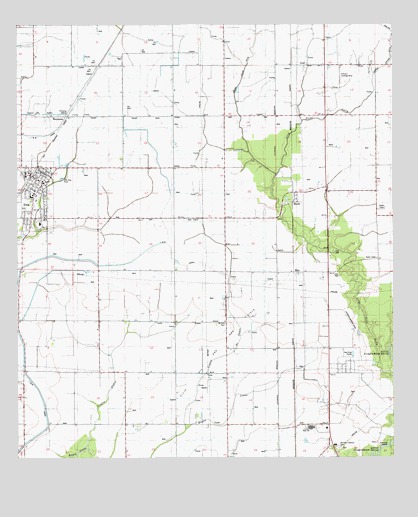
Iota, LA USGS Topographic Map
Click on map above to begin viewing in our Map Viewer.

This topographic map contains these locations and features:
Feature Name Type Latitude Longitude GNIS ID View Map
Acadia ParishCivilN30.2905°W92.4120°558389View Map
Acadia Parish Library Iota BranchBuildingN30.3313°W92.4944°2603012View Map
Acadia Parish Police JuryBuildingN30.3338°W92.4888°2334065View Map
Andrepont School (historical)SchoolN30.3705°W92.4949°544704View Map
Coulee AndreStreamN30.2527°W92.4782°534168View Map
Coulee de SauleStreamN30.2585°W92.4443°534167View Map
Crowley High SchoolSchoolN30.2589°W92.4027°541891View Map
Daigle School (historical)SchoolN30.3635°W92.4315°544709View Map
Echo Post Office (historical)Post OfficeN30.3191°W92.4137°1630095View Map
EllisPopulated PlaceN30.3035°W92.4068°543174View Map
Ellis Church of the NazareneChurchN30.3033°W92.4068°544347View Map
Ellis TabernacleChurchN30.3085°W92.3968°534802View Map
German Lutheran CemeteryCemeteryN30.2533°W92.3932°541894View Map
Grand Coulee Oil and Gas FieldOilfieldN30.3633°W92.4401°535332View Map
Hundley's Agriculture MuseumBuildingN30.3278°W92.3922°2603217View Map
IotaPopulated PlaceN30.3313°W92.4957°554837View Map
Iota Fire DepartmentBuildingN30.3315°W92.4948°2332496View Map
Iota High SchoolSchoolN30.3260°W92.4948°544365View Map
Iota Middle SchoolSchoolN30.3264°W92.4944°2493332View Map
Iota Police DepartmentBuildingN30.3310°W92.4948°2333978View Map
Iota Volunteer Fire DepartmentBuildingN30.3301°W92.4967°2332542View Map
JuddPopulated PlaceN30.3630°W92.4040°543348View Map
KeystonePopulated PlaceN30.3483°W92.4835°536179View Map
KLFY-TV (Lafayette)TowerN30.3219°W92.3782°1632496View Map
Lawson FieldAirportN30.2884°W92.3890°1632680View Map
Llis Oil and Gas FieldOilfieldN30.2724°W92.4293°536643View Map
MaxiePopulated PlaceN30.3252°W92.4079°543453View Map
Maxie ChurchChurchN30.3135°W92.3965°536940View Map
Maxie Gospel TabernacleChurchN30.3235°W92.4101°544373View Map
Maxie Oil and Gas FieldOilfieldN30.3124°W92.3899°536941View Map
Maxie School (historical)SchoolN30.3241°W92.4068°544727View Map
Moreland School (historical)SchoolN30.2596°W92.4557°544729View Map
Parish Governing Authority District 16 (historical)CivilN30.2727°W92.4882°1929861View Map
Reed AirfieldAirportN30.3468°W92.4331°1632769View Map
Saint Francis SchoolSchoolN30.3181°W92.4925°544408View Map
Saint John Lutheran ChurchChurchN30.3318°W92.4921°2602653View Map
Saint Joseph ChurchChurchN30.3189°W92.4919°2602670View Map
Schultz Landing StripAirportN30.3605°W92.3926°544416View Map
Town of IotaCivilN30.3261°W92.4956°2405891View Map

Note: Coordinates in the location and feature list above are referenced to NAD83 datum.


Copyright (C) 2008-2025 Ryan Niemi / Sunset Dynamics ... All Rights Reserved