TopoQuest Logo
Do you find TopoQuest useful?
Help keep TopoQuest running and adding new maps/features by donating!
Bitcoin:  19c7KJd3qBynnjoSw5npx9KScwjBe4ifkT
Litecoin:  LXs6TkuXGGXo1vDsWCkWVdjQX94eUKd6ui
Home View Maps Find Maps Find Places Resources & Links


Ireton, Iowa Topographic Map

USGS Map Title: Ireton, IA
USGS Map MRC: 42096H3
DRG (GeoTIFF) Download: o42096h3.tif


Neighboring USGS Topographic Map Quads:


  Hawarden North, IA  
43096A4
 

  Lebanon, IA  
43096A3
 

  Sioux Center, IA  
43096A2
 

  Hawarden South, IA  
42096H4
 

  Ireton, IA  
42096H3
 

  Maurice, IA  
42096H2
 

  Ireton SW, IA  
42096G4
 

  Brunsville, IA  
42096G3
 

  Le Mars, IA  
42096G2


Map MRC Location:

N43°
W97°
N43°
W96°
H8 H7 H6 H5 H4 H3 H2 H1
G8 G7 G6 G5 G4 G3 G2 G1
F8 F7 F6 F5 F4 F3 F2 F1
E8 E7 E6 E5 E4 E3 E2 E1
D8 D7 D6 D5 D4 D3 D2 D1
C8 C7 C6 C5 C4 C3 C2 C1
B8 B7 B6 B5 B4 B3 B2 B1
A8 A7 A6 A5 A4 A3 A2 A1
N42°
W97°
N42°
W96°

Ireton, IA USGS 1:24K Topographic Map Preview:
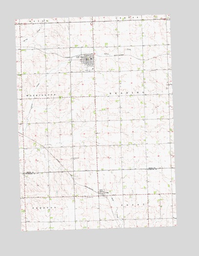
Ireton, IA USGS Topographic Map
Click on map above to begin viewing in our Map Viewer.

This topographic map contains these locations and features:
Feature Name Type Latitude Longitude GNIS ID View Map
Bacon Ridge FarmLocaleN42.9983°W96.3619°2712765View Map
Christian Reformed ChurchChurchN42.9747°W96.3139°1906563View Map
City of CraigCivilN42.8956°W96.3096°2393660View Map
City of IretonCivilN42.9749°W96.3216°2395434View Map
Corn Valley (historical)LocaleN42.9828°W96.3586°1906374View Map
Corn Valley Post Office (historical)Post OfficeN42.9828°W96.3542°1906375View Map
CraigPopulated PlaceN42.8958°W96.3097°455692View Map
Craig (historical)LocaleN42.8944°W96.3086°1906953View Map
Craig Post Office (historical)Post OfficeN42.8958°W96.3097°1906954View Map
Deweerd FarmsLocaleN42.9806°W96.3500°2712761View Map
Dunkard CemeteryCemeteryN42.9171°W96.3325°456064View Map
Farmers Cooperative Company ElevatorLocaleN42.8958°W96.3097°1906955View Map
Farmers Cooperative Society ElevatorLocaleN42.9747°W96.3184°1906554View Map
First Reformed ChurchChurchN42.9736°W96.3145°1906562View Map
Hulshof FarmsLocaleN42.9231°W96.3333°2712760View Map
IretonPopulated PlaceN42.9747°W96.3184°457850View Map
Ireton (historical)LocaleN42.9780°W96.3184°1906564View Map
Ireton Christian SchoolSchoolN42.9740°W96.3132°1906565View Map
Ireton Community Fire DepartmentBuildingN42.9751°W96.3193°1906555View Map
Ireton Elementary SchoolSchoolN42.9751°W96.3148°1906566View Map
Ireton Family Practice BuildingHospitalN42.9753°W96.3181°1906559View Map
Ireton Medical ClinicHospitalN42.9753°W96.3186°1906557View Map
Ireton Post OfficePost OfficeN42.9750°W96.3186°1906556View Map
Methodist ChurchChurchN42.9742°W96.3189°1906561View Map
OshkoshLocaleN42.9775°W96.2536°466315View Map
Pleasant Hill CemeteryCemeteryN42.9680°W96.3147°460256View Map
Rowan DamDamN42.9250°W96.3686°1770012View Map
Rowan ReservoirReservoirN42.9250°W96.3686°1770013View Map
Saint Johns CemeteryCemeteryN42.8939°W96.3228°461031View Map
Saint Johns ChurchChurchN42.9586°W96.2539°461061View Map
Saint Johns Evangelical Lutheran CemeteryCemeteryN42.9586°W96.2550°1906348View Map
Saint Johns Lutheran ChurchChurchN42.9583°W96.2539°1906567View Map
Saint Pauls Lutheran CemeteryCemeteryN42.9680°W96.3142°1906347View Map
Saint Pauls Lutheran ChurchChurchN42.9725°W96.3189°1906560View Map
Sioux County Sheriffs OfficeBuildingN42.9753°W96.3186°1906558View Map
Ten Napel Brothers Incorporated ElevatorLocaleN42.9747°W96.3184°1906553View Map
Township of ReadingCivilN42.9532°W96.2727°468591View Map
Triple K FarmsLocaleN42.9319°W96.3150°2712767View Map
Vlotho FarmsLocaleN42.8936°W96.3131°2740389View Map

Note: Coordinates in the location and feature list above are referenced to NAD83 datum.


Copyright (C) 2008-2024 Ryan Niemi / Sunset Dynamics ... All Rights Reserved