TopoQuest Logo
Do you find TopoQuest useful?
Help keep TopoQuest running and adding new maps/features by donating!
Bitcoin:  19c7KJd3qBynnjoSw5npx9KScwjBe4ifkT
Litecoin:  LXs6TkuXGGXo1vDsWCkWVdjQX94eUKd6ui
Home View Maps Find Maps Find Places Resources & Links


Brunsville, Iowa Topographic Map

USGS Map Title: Brunsville, IA
USGS Map MRC: 42096G3
DRG (GeoTIFF) Download: o42096g3.tif


Neighboring USGS Topographic Map Quads:


  Hawarden South, IA  
42096H4
 

  Ireton, IA  
42096H3
 

  Maurice, IA  
42096H2
 

  Ireton SW, IA  
42096G4
 

  Brunsville, IA  
42096G3
 

  Le Mars, IA  
42096G2
 

  Millnerville, IA  
42096F4
 

  Hinton, IA  
42096F3
 

  Union Center NW, IA  
42096F2


Map MRC Location:

N43°
W97°
N43°
W96°
H8 H7 H6 H5 H4 H3 H2 H1
G8 G7 G6 G5 G4 G3 G2 G1
F8 F7 F6 F5 F4 F3 F2 F1
E8 E7 E6 E5 E4 E3 E2 E1
D8 D7 D6 D5 D4 D3 D2 D1
C8 C7 C6 C5 C4 C3 C2 C1
B8 B7 B6 B5 B4 B3 B2 B1
A8 A7 A6 A5 A4 A3 A2 A1
N42°
W97°
N42°
W96°

Brunsville, IA USGS 1:24K Topographic Map Preview:
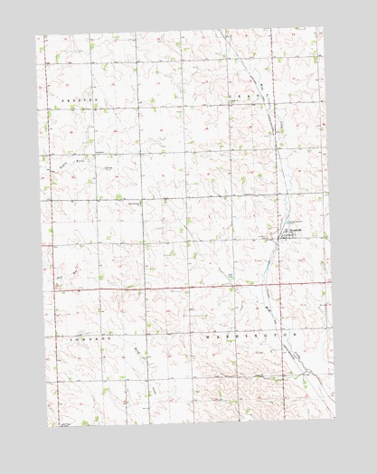
Brunsville, IA USGS Topographic Map
Click on map above to begin viewing in our Map Viewer.

This topographic map contains these locations and features:
Feature Name Type Latitude Longitude GNIS ID View Map
Barker FarmLocaleN42.8703°W96.3728°2712768View Map
Beitelspacher FarmLocaleN42.8672°W96.2661°2740438View Map
BrunsvillePopulated PlaceN42.8097°W96.2692°454876View Map
Brunsville (historical)LocaleN42.8092°W96.2714°1906961View Map
Brunsville Post OfficePost OfficeN42.8097°W96.2692°1906956View Map
Bulldog FarmsLocaleN42.8133°W96.3103°2740436View Map
Buys FarmLocaleN42.7872°W96.3689°2740440View Map
Christ ChurchChurchN42.8514°W96.2906°455400View Map
Christ Lutheran CemeteryCemeteryN42.8515°W96.2902°1906828View Map
City of BrunsvilleCivilN42.8110°W96.2667°2393444View Map
CrathornePopulated PlaceN42.8072°W96.3314°464093View Map
Crathorne Post Office (historical)Post OfficeN42.8072°W96.3314°1906813View Map
Deboer FarmsLocaleN42.8553°W96.3522°2740392View Map
Double U FarmsLocaleN42.7775°W96.2822°2740444View Map
First Plymouth ChurchChurchN42.8203°W96.3314°456605View Map
Haage FarmsLocaleN42.8072°W96.3581°2740398View Map
Holley Post Office (historical)Post OfficeN42.7778°W96.3420°1906818View Map
J T FarmsLocaleN42.8414°W96.2753°2740432View Map
Jelken FarmsLocaleN42.7822°W96.2661°2740434View Map
MammenPopulated PlaceN42.8514°W96.2922°464092View Map
Mammen Post Office (historical)Post OfficeN42.8508°W96.2922°1906965View Map
Plymouth Presbyterian CemeteryCemeteryN42.8210°W96.3318°1906960View Map
Prairie Rose Golf ClubLocaleN42.8097°W96.2692°1906959View Map
Premium Feed and Grain ElevatorLocaleN42.8097°W96.2692°1906958View Map
Saint Peter Lutheran ChurchChurchN42.8097°W96.2692°1906957View Map
Saint Peters CemeteryCemeteryN42.8080°W96.2770°461321View Map
Tekamah Creek Dam 41-ADamN42.7883°W96.3220°1769692View Map
Tekamah Creek Reservoir 41-AReservoirN42.7883°W96.3220°1769693View Map
Township of GrantCivilN42.8657°W96.2727°467950View Map
Township of WashingtonCivilN42.7786°W96.2723°468933View Map

Note: Coordinates in the location and feature list above are referenced to NAD83 datum.


Copyright (C) 2008-2024 Ryan Niemi / Sunset Dynamics ... All Rights Reserved