TopoQuest Logo
Do you find TopoQuest useful?
Help keep TopoQuest running and adding new maps/features by donating!
Bitcoin:  19c7KJd3qBynnjoSw5npx9KScwjBe4ifkT
Litecoin:  LXs6TkuXGGXo1vDsWCkWVdjQX94eUKd6ui
Home View Maps Find Maps Find Places Resources & Links


Iris, Colorado Topographic Map

USGS Map Title: Iris, CO
USGS Map MRC: 38106D7
DRG (GeoTIFF) Download: o38106d7.tif


Neighboring USGS Topographic Map Quads:


  Gunnison, CO  
38106E8
 

  Signal Peak, CO  
38106E7
 

  Parlin, CO  
38106E6
 

  Iris NW, CO  
38106D8
 

  Iris, CO  
38106D7
 

  Houston Gulch, CO  
38106D6
 

  Spring Hill Creek, CO  
38106C8
 

  Sawtooth Mountain, CO  
38106C7
 

  Razor Creek Dome, CO  
38106C6


Map MRC Location:

N39°
W107°
N39°
W106°
H8 H7 H6 H5 H4 H3 H2 H1
G8 G7 G6 G5 G4 G3 G2 G1
F8 F7 F6 F5 F4 F3 F2 F1
E8 E7 E6 E5 E4 E3 E2 E1
D8 D7 D6 D5 D4 D3 D2 D1
C8 C7 C6 C5 C4 C3 C2 C1
B8 B7 B6 B5 B4 B3 B2 B1
A8 A7 A6 A5 A4 A3 A2 A1
N38°
W107°
N38°
W106°

Iris, CO USGS 1:24K Topographic Map Preview:
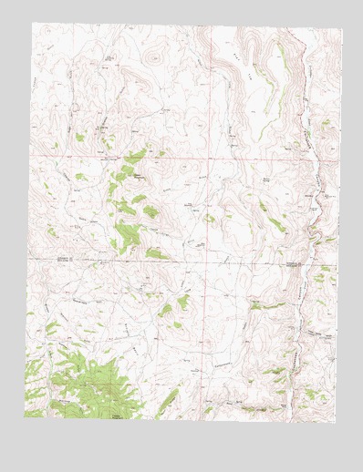
Iris, CO USGS Topographic Map
Click on map above to begin viewing in our Map Viewer.

This topographic map contains these locations and features:
Feature Name Type Latitude Longitude GNIS ID View Map
Balls Lode MineMineN38.3869°W106.7570°1745817View Map
Barrel SpringSpringN38.4517°W106.7781°189629View Map
Bead CreekStreamN38.3803°W106.7678°189620View Map
Black Cat MineMineN38.3905°W106.7725°189618View Map
Blackjack GulchValleyN38.3813°W106.8638°189608View Map
Camp Kettle GulchValleyN38.4042°W106.7643°189635View Map
ChancePopulated PlaceN38.4372°W106.8498°189622View Map
Cottonwood GulchValleyN38.4119°W106.7668°189616View Map
Denver City MineMineN38.4172°W106.8289°189626View Map
Dirigo GulchValleyN38.4483°W106.7976°189638View Map
Dutch GulchValleyN38.4519°W106.7951°189637View Map
Flat TopSummitN38.4678°W106.7845°203381View Map
Flick HomesteadLocaleN38.4894°W106.8450°189636View Map
Freeman Group MineMineN38.3905°W106.7592°1745818View Map
Grayback GulchValleyN38.4085°W106.8668°189610View Map
Green MountainSummitN38.4522°W106.8337°189623View Map
Hathaway MineMineN38.4050°W106.7670°189617View Map
IrisPopulated PlaceN38.4161°W106.8289°189613View Map
Iris CemeteryCemeteryN38.4050°W106.8223°189614View Map
Jones HomesteadLocaleN38.4486°W106.8092°189628View Map
Kline HomesteadLocaleN38.4300°W106.8039°189627View Map
Kreuger RanchLocaleN38.4428°W106.7611°189631View Map
Lucky Strike MineMineN38.4353°W106.8542°189625View Map
Lula MineMineN38.4278°W106.8459°204760View Map
Maple Leaf MineMineN38.4469°W106.7564°189632View Map
Meadow GulchValleyN38.3993°W106.8662°189607View Map
Merry-go-round GulchValleyN38.4150°W106.8657°189611View Map
Mick HomesteadLocaleN38.4572°W106.8431°189624View Map
Mineral Hill MineMineN38.4242°W106.8453°189621View Map
Mitchell RanchLocaleN38.3800°W106.7698°189619View Map
Mud GulchValleyN38.3947°W106.8662°189609View Map
Post HomesteadLocaleN38.3911°W106.8048°189615View Map
Post RidgeRidgeN38.3797°W106.8175°203399View Map
Sage Hen GulchValleyN38.4996°W106.8593°189634View Map
Schisto BasinBasinN38.4000°W106.8331°189612View Map
SillsvillePopulated PlaceN38.4467°W106.7611°189630View Map
Yukon MineMineN38.3955°W106.7509°189639View Map

Note: Coordinates in the location and feature list above are referenced to NAD83 datum.


Copyright (C) 2008-2024 Ryan Niemi / Sunset Dynamics ... All Rights Reserved