TopoQuest Logo
Do you find TopoQuest useful?
Help keep TopoQuest running and adding new maps/features by donating!
Bitcoin:  19c7KJd3qBynnjoSw5npx9KScwjBe4ifkT
Litecoin:  LXs6TkuXGGXo1vDsWCkWVdjQX94eUKd6ui
Home View Maps Find Maps Find Places Resources & Links


Island Falls, Maine Topographic Map

USGS Map Title: Island Falls, ME
USGS Map MRC: 46068A3
DRG (GeoTIFF) Download: o46068a3.tif


Neighboring USGS Topographic Map Quads:


  Green Mountain, ME  
46068B4
 

  Knowles Corner, ME  
46068B3
 

  Smyrna Mills, ME  
46068B2
 

  Mount Chase, ME  
46068A4
 

  Island Falls, ME  
46068A3
 

  Oakfield, ME  
46068A2
 

  Patten, ME  
45068H4
 

  Crystal, ME  
45068H3
 

  Mattawamkeag Lake, ME  
45068H2


Map MRC Location:

N47°
W69°
N47°
W68°
H8 H7 H6 H5 H4 H3 H2 H1
G8 G7 G6 G5 G4 G3 G2 G1
F8 F7 F6 F5 F4 F3 F2 F1
E8 E7 E6 E5 E4 E3 E2 E1
D8 D7 D6 D5 D4 D3 D2 D1
C8 C7 C6 C5 C4 C3 C2 C1
B8 B7 B6 B5 B4 B3 B2 B1
A8 A7 A6 A5 A4 A3 A2 A1
N46°
W69°
N46°
W68°

Island Falls, ME USGS 1:24K Topographic Map Preview:
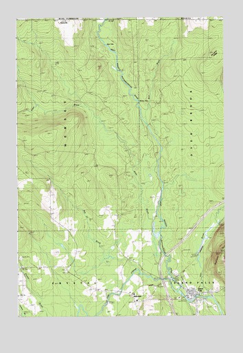
Island Falls, ME USGS Topographic Map
Click on map above to begin viewing in our Map Viewer.

This topographic map contains these locations and features:
Feature Name Type Latitude Longitude GNIS ID View Map
Alder BrookStreamN46.0270°W68.2884°561142View Map
Bates CemeteryCemeteryN46.1242°W68.3461°561718View Map
Bear BrookStreamN46.0801°W68.2978°561826View Map
Belvedere ChurchChurchN46.0056°W68.3034°562032View Map
Bog BrookStreamN46.0195°W68.3042°562658View Map
Dyer BrookStreamN46.0081°W68.2609°565454View Map
Fish StreamStreamN46.0106°W68.2789°566225View Map
Hackett SchoolSchoolN46.0212°W68.3536°567409View Map
Hersey SchoolSchoolN46.0506°W68.3567°567982View Map
Interchange 59CrossingN46.0067°W68.2842°1910426View Map
Island FallsPopulated PlaceN46.0092°W68.2714°568690View Map
Island Falls Ambulance ServiceBuildingN46.0093°W68.2699°2666796View Map
Island Falls Fire DepartmentBuildingN46.0093°W68.2700°2552800View Map
Island Falls Opera HouseBuildingN46.0092°W68.2717°1910432View Map
Island Falls Post OfficePost OfficeN46.0088°W68.2695°1910433View Map
Island Falls United Baptist ChurchChurchN46.0103°W68.2711°1910434View Map
Katahdin Public LibraryBuildingN46.0091°W68.2697°1910441View Map
Robinson MountainSummitN46.0260°W68.2512°574328View Map
Saint Agnes Roman Catholic ChurchChurchN46.0106°W68.2731°1910593View Map
Sly BrookStreamN46.0053°W68.2725°575557View Map
Stair FallsFallsN46.1145°W68.3234°576233View Map
Stevens SchoolSchoolN46.1234°W68.2648°576332View Map
Town of HerseyCivilN46.0801°W68.3689°1729675View Map
Warren FallsFallsN46.0898°W68.3039°577844View Map
Whittier Congregational ChurchChurchN46.0089°W68.2697°1910710View Map
Wilbur SchoolSchoolN46.0106°W68.3184°578463View Map

Note: Coordinates in the location and feature list above are referenced to NAD83 datum.


Copyright (C) 2008-2025 Ryan Niemi / Sunset Dynamics ... All Rights Reserved