TopoQuest Logo
Do you find TopoQuest useful?
Help keep TopoQuest running and adding new maps/features by donating!
Bitcoin:  19c7KJd3qBynnjoSw5npx9KScwjBe4ifkT
Litecoin:  LXs6TkuXGGXo1vDsWCkWVdjQX94eUKd6ui
Home View Maps Find Maps Find Places Resources & Links


Patten, Maine Topographic Map

USGS Map Title: Patten, ME
USGS Map MRC: 45068H4
DRG (GeoTIFF) Download: o45068h4.tif


Neighboring USGS Topographic Map Quads:


  Shin Pond, ME  
46068A5
 

  Mount Chase, ME  
46068A4
 

  Island Falls, ME  
46068A3
 

  Lookout Mountain, ME  
45068H5
 

  Patten, ME  
45068H4
 

  Crystal, ME  
45068H3
 

  Stacyville, ME  
45068G5
 

  Benedicta, ME  
45068G4
 

  Monarda, ME  
45068G3


Map MRC Location:

N46°
W69°
N46°
W68°
H8 H7 H6 H5 H4 H3 H2 H1
G8 G7 G6 G5 G4 G3 G2 G1
F8 F7 F6 F5 F4 F3 F2 F1
E8 E7 E6 E5 E4 E3 E2 E1
D8 D7 D6 D5 D4 D3 D2 D1
C8 C7 C6 C5 C4 C3 C2 C1
B8 B7 B6 B5 B4 B3 B2 B1
A8 A7 A6 A5 A4 A3 A2 A1
N45°
W69°
N45°
W68°

Patten, ME USGS 1:24K Topographic Map Preview:
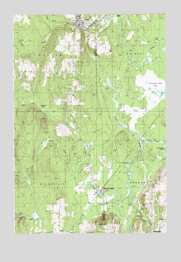
Patten, ME USGS Topographic Map
Click on map above to begin viewing in our Map Viewer.

This topographic map contains these locations and features:
Feature Name Type Latitude Longitude GNIS ID View Map
Ash HillSummitN45.9541°W68.4524°561313View Map
Bear BrookStreamN45.8931°W68.4142°561824View Map
Blackwell BogSwampN45.9487°W68.4745°562534View Map
Boot Swamp BrookStreamN45.9256°W68.3775°562755View Map
Caldwell BrookStreamN45.9256°W68.3770°563348View Map
Calvary Baptist ChurchChurchN45.8953°W68.4248°1910272View Map
East Branch Molunkus StreamStreamN45.8973°W68.4039°565555View Map
Katahdin Elementary SchoolSchoolN45.9262°W68.4379°2737918View Map
Katahdin Junior High SchoolSchoolN45.9260°W68.4378°1913638View Map
Katahdin Middle / High SchoolSchoolN45.9246°W68.4393°1913637View Map
Lost PondLakeN45.9854°W68.3798°570413View Map
Mud PondLakeN45.8760°W68.4054°571950View Map
PattenPopulated PlaceN45.9964°W68.4461°573062View Map
Patten Ambulance ServiceBuildingN45.9955°W68.4487°2666799View Map
Patten Fire DepartmentBuildingN45.9955°W68.4486°2552719View Map
Patten Grammar SchoolSchoolN45.9998°W68.4464°1913798View Map
Patten JunctionPopulated PlaceN45.9134°W68.4128°579604View Map
Patten Post OfficePost OfficeN45.9969°W68.4476°2768964View Map
Patten Post Office (historical)Post OfficeN45.9967°W68.4478°1913800View Map
Patten Primary SchoolSchoolN45.9998°W68.4464°1913801View Map
Patten United Methodist ChurchChurchN45.9951°W68.4217°1913802View Map
Peavey BrookStreamN45.9959°W68.4703°573122View Map
Sandy BrookStreamN45.9139°W68.4450°574874View Map
Scudder BrookStreamN45.9281°W68.3945°575073View Map
Sherman Mills CemeteryCemeteryN45.8778°W68.3792°575392View Map
Sherman StationPopulated PlaceN45.8992°W68.4295°575394View Map
SiberiaPopulated PlaceN45.8759°W68.4634°579692View Map
South Patten SchoolSchoolN45.9631°W68.4511°575879View Map
Stacyville Elementary SchoolSchoolN45.9028°W68.4342°1913916View Map
Stacyville Post OfficePost OfficeN45.9003°W68.4311°1913877View Map
Stacyville Volunteer Fire DepartmentBuildingN45.8980°W68.4279°2552889View Map
Stafford HillSummitN45.8814°W68.4267°576221View Map
Thousand Acre BogSwampN45.9570°W68.3856°577045View Map
Town of PattenCivilN45.9900°W68.4954°582666View Map
Town of StacyvilleCivilN45.8997°W68.4925°582743View Map
Veterans Memorial LibraryBuildingN45.9972°W68.4475°2738425View Map
Webb BrookStreamN45.9931°W68.4411°577920View Map
Webster BrookStreamN45.9998°W68.4153°577946View Map
Weeks BrookStreamN45.9939°W68.4331°577970View Map
West Branch Molunkus StreamStreamN45.8970°W68.4039°578069View Map
Wheelabrator-Sherman HeliportAirportN45.8992°W68.4367°582231View Map

Note: Coordinates in the location and feature list above are referenced to NAD83 datum.


Copyright (C) 2008-2025 Ryan Niemi / Sunset Dynamics ... All Rights Reserved