TopoQuest Logo
Do you find TopoQuest useful?
Help keep TopoQuest running and adding new maps/features by donating!
Bitcoin:  19c7KJd3qBynnjoSw5npx9KScwjBe4ifkT
Litecoin:  LXs6TkuXGGXo1vDsWCkWVdjQX94eUKd6ui
Home View Maps Find Maps Find Places Resources & Links


Isonville, Kentucky Topographic Map

USGS Map Title: Isonville, KY
USGS Map MRC: 38083A1
DRG (GeoTIFF) Download: o38083a1.tif


Neighboring USGS Topographic Map Quads:


  Ault, KY  
38083B2
 

  Bruin, KY  
38083B1
 

  Willard, KY  
38082B8
 

  Sandy Hook, KY  
38083A2
 

  Isonville, KY  
38083A1
 

  Mazie, KY  
38082A8
 

  Lenox, KY  
37083H2
 

  Dingus, KY  
37083H1
 

  Redbush, KY  
37082H8


Map MRC Location:

N39°
W84°
N39°
W83°
H8 H7 H6 H5 H4 H3 H2 H1
G8 G7 G6 G5 G4 G3 G2 G1
F8 F7 F6 F5 F4 F3 F2 F1
E8 E7 E6 E5 E4 E3 E2 E1
D8 D7 D6 D5 D4 D3 D2 D1
C8 C7 C6 C5 C4 C3 C2 C1
B8 B7 B6 B5 B4 B3 B2 B1
A8 A7 A6 A5 A4 A3 A2 A1
N38°
W84°
N38°
W83°

Isonville, KY USGS 1:24K Topographic Map Preview:
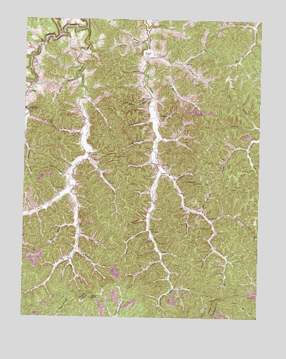
Isonville, KY USGS Topographic Map
Click on map above to begin viewing in our Map Viewer.

This topographic map contains these locations and features:
Feature Name Type Latitude Longitude GNIS ID View Map
Albert Post Office (historical)Post OfficeN38.0503°W83.0569°2337475View Map
Anderson BranchStreamN38.0779°W83.0546°485932View Map
Arthur Bays CemeteryCemeteryN38.0242°W83.1000°2337108View Map
Bandy BranchStreamN38.1012°W83.0966°486311View Map
Beech BranchStreamN38.0337°W83.0952°486693View Map
Bentley BranchStreamN38.0673°W83.0546°486883View Map
Big ForkStreamN38.0718°W83.0054°487175View Map
Bill BranchStreamN38.0448°W83.0307°487300View Map
Boggs BranchStreamN38.0837°W83.0557°487616View Map
Brack Adkins School (historical)SchoolN38.0242°W83.0517°2337678View Map
Brier ForkStreamN38.0668°W83.0916°487901View Map
Buck ForkStreamN38.0251°W83.0993°488222View Map
Buck KnobSummitN38.0081°W83.0879°488230View Map
BurkePopulated PlaceN38.1073°W83.0399°507621View Map
Burton BranchStreamN38.1162°W83.0602°488472View Map
Burton CemeteryCemeteryN38.1133°W83.0697°2337109View Map
Burton CemeteryCemeteryN38.1167°W83.0753°2079671View Map
Butcher BranchStreamN38.0748°W83.0927°488495View Map
Charity Post Office (historical)Post OfficeN38.1236°W83.0067°2337160View Map
City of Sandy HookCivilN38.0929°W83.1241°2405416View Map
Coal HollowValleyN38.0387°W83.0977°489732View Map
Collins BranchStreamN38.1154°W83.0629°489856View Map
Dick BranchStreamN38.0126°W83.0441°490870View Map
EldridgePopulated PlaceN38.0362°W83.0571°507917View Map
Eldridge BranchStreamN38.0126°W83.0443°491617View Map
Eldridge Post Office (historical)Post OfficeN38.0364°W83.0581°2337164View Map
Elk Fork Post Office (historical)Post OfficeN38.0046°W83.0673°2362614View Map
Elkhorn BranchStreamN38.0456°W83.0363°491684View Map
Elliott CountyCivilN38.1179°W83.0976°516878View Map
Elliott County Volunteer Fire and RescueBuildingN38.0878°W83.1240°2637254View Map
Fairview School (historical)SchoolN38.0989°W83.0533°2337682View Map
FanninPopulated PlaceN38.0684°W83.0896°507977View Map
Fannin Post Office (historical)Post OfficeN38.0681°W83.0906°2337165View Map
Fraley ChapelChurchN38.0918°W83.0579°492424View Map
Fraley Chapel BranchStreamN38.0926°W83.0560°492425View Map
Fraley FlatFlatN38.1112°W83.0596°492426View Map
Gilbert ForkStreamN38.0273°W83.0968°492819View Map
Gilliam CemeteryCemeteryN38.0583°W83.0439°2337118View Map
Green BranchStreamN38.0809°W83.0016°493258View Map
Henson FlatFlatN38.0958°W83.0222°2337140View Map
Holly Grove School (historical)SchoolN38.1072°W83.0614°2120909View Map
IsonvillePopulated PlaceN38.0651°W83.0527°495056View Map
Isonville DivisionCivilN38.0982°W83.0156°1937075View Map
Isonville Post Office (historical)Post OfficeN38.0644°W83.0525°2337170View Map
Isonville SchoolSchoolN38.0604°W83.0471°495057View Map
Isonville School (historical)SchoolN38.0594°W83.0550°2120911View Map
Isonville Volunteer Fire DepartmentBuildingN38.0586°W83.0441°2636398View Map
Jim Oliver BranchStreamN38.0420°W83.0579°495270View Map
Laurel BranchStreamN38.1212°W83.0593°496020View Map
Laurel CreekStreamN38.1181°W83.1071°513242View Map
Left Fork Hipple Fork Little Sandy RiverStreamN38.0518°W83.1002°496222View Map
Left Fork Rocky BranchStreamN38.1068°W83.0404°496254View Map
Lick ForkStreamN38.0615°W83.0521°496506View Map
Logan BranchStreamN38.0326°W83.0252°496975View Map
Lucille Post Office (historical)Post OfficeN38.0450°W83.1183°2337666View Map
Mason BranchStreamN38.0290°W83.0232°497653View Map
Middle Fork Little Sandy RiverStreamN38.1215°W83.0918°498129View Map
NewcombePopulated PlaceN38.0845°W83.0541°508698View Map
Newcombe Post Office (historical)Post OfficeN38.0842°W83.0547°2337669View Map
Oliver BranchStreamN38.0368°W83.0582°499928View Map
Patrick HollowValleyN38.0592°W83.1028°500247View Map
Peters HillSummitN38.0568°W83.0343°500477View Map
Peters Hill Look Out TowerTowerN38.0569°W83.0336°2120931View Map
Rice HollowValleyN38.0740°W83.0560°501779View Map
Riddle Post Office (historical)Post OfficeN38.0414°W83.0247°2120883View Map
Right Fork Middle Fork Little Sandy RiverStreamN38.0518°W83.1004°501907View Map
Right Fork Newcombe CreekStreamN38.0615°W83.0521°501913View Map
Right Fork Rocky BranchStreamN38.1076°W83.0482°501922View Map
Rocky BranchStreamN38.1109°W83.0618°502230View Map
Rocky Branch School (historical)SchoolN38.1064°W83.0411°2337690View Map
RoscoePopulated PlaceN38.0340°W83.0946°508970View Map
Roscoe Post Office (historical)Post OfficeN38.0350°W83.0947°2120884View Map
Roscoe Post Office (historical)Post OfficeN38.0078°W83.1231°2120885View Map
Roscoe SchoolSchoolN38.0237°W83.1024°502312View Map
Shanty HollowValleyN38.1026°W83.0620°503249View Map
Sheepskin BranchStreamN38.0915°W83.0904°503311View Map
Stinson BranchStreamN38.0237°W83.0510°504431View Map
Terry BranchStreamN38.0501°W83.1054°505091View Map
Town CemeteryCemeteryN38.0857°W83.1217°2079998View Map
Town HillRidgeN38.0736°W83.1056°2337677View Map
Vansant's Mill (historical)LocaleN38.1072°W83.1194°2337144View Map
Watson CemeteryCemeteryN38.0344°W83.0944°2337130View Map
Watson ChurchChurchN38.0350°W83.0942°2337135View Map
Wright Watson SchoolSchoolN38.0531°W83.1029°507169View Map
Zach Rice HollowValleyN38.0832°W83.0579°507265View Map

Note: Coordinates in the location and feature list above are referenced to NAD83 datum.


Copyright (C) 2008-2024 Ryan Niemi / Sunset Dynamics ... All Rights Reserved