TopoQuest Logo
Do you find TopoQuest useful?
Help keep TopoQuest running and adding new maps/features by donating!
Bitcoin:  19c7KJd3qBynnjoSw5npx9KScwjBe4ifkT
Litecoin:  LXs6TkuXGGXo1vDsWCkWVdjQX94eUKd6ui
Home View Maps Find Maps Find Places Resources & Links


Lenox, Kentucky Topographic Map

USGS Map Title: Lenox, KY
USGS Map MRC: 37083H2
DRG (GeoTIFF) Download: o37083h2.tif


Neighboring USGS Topographic Map Quads:


  Wrigley, KY  
38083A3
 

  Sandy Hook, KY  
38083A2
 

  Isonville, KY  
38083A1
 

  West Liberty, KY  
37083H3
 

  Lenox, KY  
37083H2
 

  Dingus, KY  
37083H1
 

  Cannel City, KY  
37083G3
 

  White Oak, KY  
37083G2
 

  Salyersville North, KY  
37083G1


Map MRC Location:

N38°
W84°
N38°
W83°
H8 H7 H6 H5 H4 H3 H2 H1
G8 G7 G6 G5 G4 G3 G2 G1
F8 F7 F6 F5 F4 F3 F2 F1
E8 E7 E6 E5 E4 E3 E2 E1
D8 D7 D6 D5 D4 D3 D2 D1
C8 C7 C6 C5 C4 C3 C2 C1
B8 B7 B6 B5 B4 B3 B2 B1
A8 A7 A6 A5 A4 A3 A2 A1
N37°
W84°
N37°
W83°

Lenox, KY USGS 1:24K Topographic Map Preview:
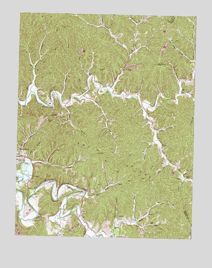
Lenox, KY USGS Topographic Map
Click on map above to begin viewing in our Map Viewer.

This topographic map contains these locations and features:
Feature Name Type Latitude Longitude GNIS ID View Map
Adkins CemeteryCemeteryN37.9581°W83.1324°485780View Map
Alice Post Office (historical)Post OfficeN37.9520°W83.1625°2362598View Map
Bethany ChurchChurchN37.8990°W83.1932°486937View Map
Big Mandy CreekStreamN37.9784°W83.1716°487219View Map
Bolin BranchStreamN37.9190°W83.1435°487639View Map
Bolin RidgeRidgeN37.9204°W83.1796°487640View Map
Caskey Settement (historical)Populated PlaceN37.9524°W83.2117°2362572View Map
Cattle Post Office (historical)Post OfficeN37.8887°W83.2038°2362607View Map
Conley BranchStreamN37.9545°W83.1652°489960View Map
CottlePopulated PlaceN37.8890°W83.2038°507766View Map
Cottle BendBendN37.9009°W83.2038°490138View Map
Cottle CemeteryCemeteryN37.8892°W83.2385°490139View Map
Cottle CemeteryCemeteryN37.9026°W83.2138°490140View Map
Cow BranchStreamN37.9520°W83.2066°490179View Map
Dunnie BranchStreamN37.8881°W83.1560°498109View Map
Easterling CemeteryCemeteryN37.8812°W83.1788°491506View Map
ElamtonPopulated PlaceN37.9276°W83.1474°507915View Map
Elamton Post Office (historical)Post OfficeN37.9273°W83.1471°2362611View Map
Elamton Post Office (historical)Post OfficeN37.9043°W83.1832°2362612View Map
ElkforkPopulated PlaceN37.9648°W83.1330°507922View Map
Fairfield HillSummitN37.9633°W83.2288°2362724View Map
Fannins ForkStreamN37.9565°W83.1341°491979View Map
Ferguson BranchStreamN37.9306°W83.1510°492027View Map
Flores Post Office (historical)Post OfficeN37.8848°W83.1778°2362618View Map
FlorressPopulated PlaceN37.8854°W83.1771°508018View Map
Forest Post Office (historical)Post OfficeN37.8766°W83.2195°2362619View Map
Goodsey Post Office (historical)Post OfficeN37.9495°W83.2159°2362621View Map
Gordon FordPopulated PlaceN37.8834°W83.2380°508114View Map
Gordon Ford Post Office (historical)Post OfficeN37.8837°W83.2382°2362622View Map
Grampus BranchStreamN37.9087°W83.1307°493089View Map
Granddaddy KnobSummitN37.9729°W83.1516°493094View Map
Harper BranchStreamN37.9159°W83.2282°493780View Map
Hutchinson School (historical)SchoolN37.9463°W83.1486°2362699View Map
Indian CreekStreamN37.9548°W83.2218°494921View Map
John Williams CemeteryCemeteryN37.9090°W83.1291°506809View Map
Jones CreekStreamN37.8854°W83.2180°495494View Map
Jones Creek (historical)Populated PlaceN37.8775°W83.2190°2362580View Map
Jones Creek Enterprise Baptist ChurchChurchN37.8759°W83.2191°495495View Map
Lacy CemeteryCemeteryN37.8865°W83.1738°495894View Map
Lacy Creek Church of Enterprise BaptistChurchN37.8851°W83.1646°495897View Map
Left Fork Lacy CreekStreamN37.8845°W83.1646°496229View Map
Left Fork Laurel ForkStreamN37.9756°W83.1257°496231View Map
Lennox Post Office (historical)Post OfficeN37.9572°W83.2015°2362636View Map
Lennox SchoolSchoolN37.9599°W83.1901°2362701View Map
LenoxPopulated PlaceN37.9573°W83.2013°508445View Map
Lick BranchStreamN37.9476°W83.2155°496438View Map
Lick Branch Community ChurchChurchN37.9426°W83.2221°496462View Map
Lick Branch School (historical)SchoolN37.9509°W83.2186°2362702View Map
Limekiln KnobSummitN37.9693°W83.1927°496542View Map
Manker Post Office (historical)Post OfficeN37.9592°W83.1480°2362643View Map
McClain School (historical)SchoolN37.9537°W83.2024°2362704View Map
Middle Fork Elk ForkStreamN37.9562°W83.1346°498120View Map
Middle Fork Lacy CreekStreamN37.8845°W83.1646°498126View Map
Mill BranchStreamN37.9170°W83.2396°498215View Map
Mill BranchStreamN37.9531°W83.2055°498217View Map
Mordica BranchStreamN37.9559°W83.2407°498573View Map
Mordica School (historical)SchoolN37.9608°W83.2386°2362705View Map
Muddy BranchStreamN37.9631°W83.1343°499030View Map
Park HillSummitN37.9217°W83.2478°2362727View Map
Patton CemeteryCemeteryN37.8876°W83.2427°500265View Map
Paws Creek School (historical)SchoolN37.9164°W83.2288°2362709View Map
Pelfery CemeteryCemeteryN37.8834°W83.1543°500360View Map
Pelfrey BranchStreamN37.9351°W83.1521°500361View Map
Right Fork Lacy CreekStreamN37.8837°W83.1655°501895View Map
Right Fork Laurel ForkStreamN37.9756°W83.1254°501896View Map
Rockhouse BranchStreamN37.9948°W83.1660°502183View Map
Rush BranchStreamN37.9648°W83.2007°502478View Map
Rush Branch (historical)Populated PlaceN37.9709°W83.2052°2362591View Map
Simpson BranchStreamN37.9120°W83.1338°510166View Map
Spaws CreekStreamN37.9170°W83.2393°504038View Map
Stable BranchStreamN37.8998°W83.2002°504210View Map
Steele Post Office (historical)Post OfficeN37.9808°W83.1673°2362669View Map
Straight CreekStreamN37.9584°W83.1863°504549View Map
Sugar Camp BranchStreamN37.8843°W83.1796°504636View Map
Tantroft BranchStreamN37.9209°W83.1457°504943View Map
War CreekStreamN37.8993°W83.2024°506210View Map
War Creek School (historical)SchoolN37.9005°W83.1894°2362717View Map
West Liberty DivisionCivilN37.8921°W83.2288°1937313View Map
West Liberty Lookout TowerTowerN37.9370°W83.2214°2362732View Map
White Oak CreekStreamN37.8762°W83.1996°506617View Map
White Oak Post Office (historical)Post OfficeN37.8889°W83.2024°2362674View Map
White Oak Volunteer Fire DepartmentBuildingN37.8991°W83.1929°2637263View Map
Williams CreekStreamN37.9470°W83.1599°506817View Map

Note: Coordinates in the location and feature list above are referenced to NAD83 datum.


Copyright (C) 2008-2024 Ryan Niemi / Sunset Dynamics ... All Rights Reserved