TopoQuest Logo
Do you find TopoQuest useful?
Help keep TopoQuest running and adding new maps/features by donating!
Bitcoin:  19c7KJd3qBynnjoSw5npx9KScwjBe4ifkT
Litecoin:  LXs6TkuXGGXo1vDsWCkWVdjQX94eUKd6ui
Home View Maps Find Maps Find Places Resources & Links


Itta Bena, Mississippi Topographic Map

USGS Map Title: Itta Bena, MS
USGS Map MRC: 33090D3
DRG (GeoTIFF) Download: o33090d3.tif


Neighboring USGS Topographic Map Quads:


  Bear Gut Bayou, MS  
33090E4
 

  Shellmound, MS  
33090E3
 

  Greenwood, MS  
33090E2
 

  Colony Town, MS  
33090D4
 

  Itta Bena, MS  
33090D3
 

  Sidon, MS  
33090D2
 

  Swiftown, MS  
33090C4
 

  Montgomery, MS  
33090C3
 

  Cruger, MS  
33090C2


Map MRC Location:

N34°
W91°
N34°
W90°
H8 H7 H6 H5 H4 H3 H2 H1
G8 G7 G6 G5 G4 G3 G2 G1
F8 F7 F6 F5 F4 F3 F2 F1
E8 E7 E6 E5 E4 E3 E2 E1
D8 D7 D6 D5 D4 D3 D2 D1
C8 C7 C6 C5 C4 C3 C2 C1
B8 B7 B6 B5 B4 B3 B2 B1
A8 A7 A6 A5 A4 A3 A2 A1
N33°
W91°
N33°
W90°

Itta Bena, MS USGS 1:24K Topographic Map Preview:
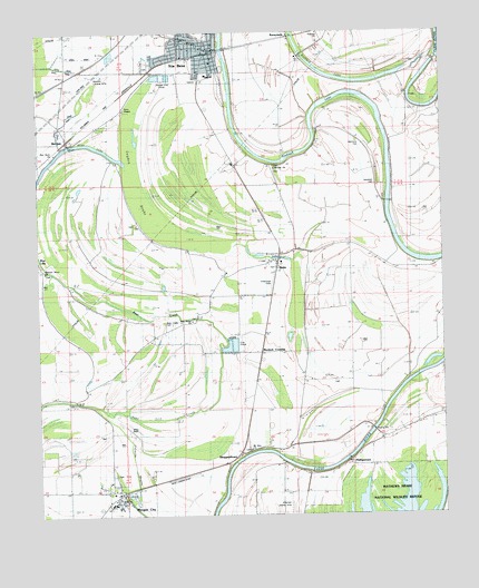
Itta Bena, MS USGS Topographic Map
Click on map above to begin viewing in our Map Viewer.

This topographic map contains these locations and features:
Feature Name Type Latitude Longitude GNIS ID View Map
Bear Creek CemeteryCemeteryN33.4251°W90.3365°666649View Map
BerclairPopulated PlaceN33.4718°W90.3651°666839View Map
Blue LakeLakeN33.4712°W90.3627°667311View Map
Christ Temple Apostolic Faith ChurchChurchN33.4960°W90.3306°684139View Map
Church of GodChurchN33.4396°W90.2995°668467View Map
E D Strains Pond DamDamN33.3785°W90.3451°682029View Map
First Baptist ChurchChurchN33.4923°W90.3204°684146View Map
First Methodist ChurchChurchN33.4935°W90.3201°684150View Map
Fry BrakeSwampN33.4252°W90.2743°684159View Map
Gayden BrakeSwampN33.4519°W90.3400°670343View Map
Itta BenaPopulated PlaceN33.4951°W90.3198°671749View Map
Itta Bena Police DepartmentBuildingN33.4949°W90.3216°2754114View Map
Itta Bena Post OfficePost OfficeN33.4956°W90.3212°2768569View Map
Itta Bena Volunteer Fire StationBuildingN33.4964°W90.3223°2665706View Map
Itta Bena-Morgan City Presbyterian ChurchChurchN33.4968°W90.3198°684183View Map
Jeremiah CemeteryCemeteryN33.4604°W90.2706°684187View Map
Jeremiah ChurchChurchN33.4612°W90.2715°671844View Map
Kimbrough Field (historical)AirportN33.4376°W90.3043°680385View Map
L S Rogers Elementary SchoolSchoolN33.3779°W90.3529°706508View Map
Leflore County High SchoolSchoolN33.4890°W90.3209°706503View Map
Mathis BrakeSwampN33.3885°W90.2607°684204View Map
McIntyre CemeteryCemeteryN33.4721°W90.2770°673374View Map
McLean ChurchChurchN33.4651°W90.3020°673394View Map
McLean SpurLocaleN33.4660°W90.3143°673395View Map
Midway ChurchChurchN33.3829°W90.3570°684208View Map
Morgan CityPopulated PlaceN33.3807°W90.3504°673809View Map
Morgan City Baptist ChurchChurchN33.3793°W90.3498°684211View Map
Morgan City Post OfficePost OfficeN33.3803°W90.3497°2768718View Map
Morgan City Volunteer Fire DepartmentBuildingN33.3800°W90.3511°2665859View Map
Mosquito LakeLakeN33.4415°W90.2997°673872View Map
Mount Zion ChurchChurchN33.3923°W90.3104°674383View Map
Murdock CrossingPopulated PlaceN33.4171°W90.3065°692091View Map
Murphey Flying Service Airport (historical)AirportN33.4890°W90.3570°680393View Map
New Bethel Baptist ChurchChurchN33.4971°W90.3304°684216View Map
New Home ChurchChurchN33.4257°W90.3279°674650View Map
Newton Landing (historical)LocaleN33.3932°W90.2751°706518View Map
Payne ChurchChurchN33.4418°W90.3012°675520View Map
Pelucia BayouGutN33.3876°W90.3465°675583View Map
Perry ChapelChurchN33.4787°W90.3490°675624View Map
Phillipston Landing (historical)LocaleN33.3890°W90.2798°706523View Map
Phillipston Volunteer Fire DepartmentBuildingN33.3980°W90.2616°2665818View Map
PhillipstownPopulated PlaceN33.3893°W90.2790°675694View Map
Phillipstown Baptist ChurchChurchN33.3948°W90.2695°684227View Map
Pickens Landing (historical)LocaleN33.3773°W90.3218°706525View Map
Pleasant Grove ChurchChurchN33.4371°W90.3729°684231View Map
Plesant Grove ChurchChurchN33.4382°W90.3734°676150View Map
QuitoPopulated PlaceN33.4387°W90.3012°676441View Map
Roebuck LakeLakeN33.4690°W90.2937°676813View Map
Roebuck School (historical)SchoolN33.4673°W90.2645°684237View Map
RunnymedePopulated PlaceN33.4968°W90.3106°692194View Map
Saint Mary Missionary Baptist ChurchChurchN33.4962°W90.3245°684248View Map
Saint Rest Church of God in ChristChurchN33.4937°W90.3298°684251View Map
Shell Bluff Landing (historical)LocaleN33.3898°W90.3137°706548View Map
SheppardtownPopulated PlaceN33.3915°W90.3134°692226View Map
Southworths Ferry (historical)CrossingN33.4057°W90.2651°684258View Map
Supervisor District 4CivilN33.4720°W90.3346°711961View Map
Sweethour ChurchChurchN33.4673°W90.2651°678488View Map
Town of Morgan CityCivilN33.3787°W90.3462°2406193View Map
Truevine ChurchChurchN33.4998°W90.2887°678904View Map
Yazoo ChurchChurchN33.4932°W90.2531°684276View Map
Zion Rock ChurchChurchN33.4701°W90.3656°680039View Map

Note: Coordinates in the location and feature list above are referenced to NAD83 datum.


Copyright (C) 2008-2024 Ryan Niemi / Sunset Dynamics ... All Rights Reserved