TopoQuest Logo
Do you find TopoQuest useful?
Help keep TopoQuest running and adding new maps/features by donating!
Bitcoin:  19c7KJd3qBynnjoSw5npx9KScwjBe4ifkT
Litecoin:  LXs6TkuXGGXo1vDsWCkWVdjQX94eUKd6ui
Home View Maps Find Maps Find Places Resources & Links


Sidon, Mississippi Topographic Map

USGS Map Title: Sidon, MS
USGS Map MRC: 33090D2
DRG (GeoTIFF) Download: o33090d2.tif


Neighboring USGS Topographic Map Quads:


  Shellmound, MS  
33090E3
 

  Greenwood, MS  
33090E2
 

  Browning, MS  
33090E1
 

  Itta Bena, MS  
33090D3
 

  Sidon, MS  
33090D2
 

  Gravel Hill, MS  
33090D1
 

  Montgomery, MS  
33090C3
 

  Cruger, MS  
33090C2
 

  Black Hawk, MS  
33090C1


Map MRC Location:

N34°
W91°
N34°
W90°
H8 H7 H6 H5 H4 H3 H2 H1
G8 G7 G6 G5 G4 G3 G2 G1
F8 F7 F6 F5 F4 F3 F2 F1
E8 E7 E6 E5 E4 E3 E2 E1
D8 D7 D6 D5 D4 D3 D2 D1
C8 C7 C6 C5 C4 C3 C2 C1
B8 B7 B6 B5 B4 B3 B2 B1
A8 A7 A6 A5 A4 A3 A2 A1
N33°
W91°
N33°
W90°

Sidon, MS USGS 1:24K Topographic Map Preview:
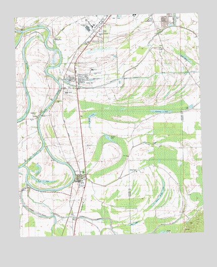
Sidon, MS USGS Topographic Map
Click on map above to begin viewing in our Map Viewer.

This topographic map contains these locations and features:
Feature Name Type Latitude Longitude GNIS ID View Map
Beautiful Zion ChurchChurchN33.4585°W90.1851°666687View Map
Bee LakeLakeN33.3812°W90.1725°666750View Map
Catfish BayouGutN33.3857°W90.2151°668159View Map
Craig CanalCanalN33.4985°W90.1806°684138View Map
Douglass Landing (historical)LocaleN33.4643°W90.2226°706483View Map
Durden LakeLakeN33.4302°W90.1880°673194View Map
Ellis SchoolSchoolN33.4665°W90.2195°669738View Map
Fish LakeLakeN33.4069°W90.2340°669978View Map
Fort Loring LandingPopulated PlaceN33.4893°W90.2468°691868View Map
Grand View Landing (historical)LocaleN33.4862°W90.2470°706491View Map
Greenwood Memorial ParkCemeteryN33.4890°W90.1931°684174View Map
Holly GrovePopulated PlaceN33.4110°W90.1701°671312View Map
Holly Grove ChurchChurchN33.4196°W90.1751°671325View Map
Ingelside Landing (historical)LocaleN33.4657°W90.2259°706499View Map
Ingleside CemeteryCemeteryN33.4451°W90.2376°684181View Map
Jones ChapelChurchN33.4812°W90.1515°671981View Map
Leflore County Sheriff's OfficeBuildingN33.4804°W90.2101°2754111View Map
Leflore Landing Strip (historical)AirportN33.3915°W90.2081°1959797View Map
Magenta Landing (historical)LocaleN33.4823°W90.2265°706509View Map
Mount Pisgah CemeteryCemeteryN33.4098°W90.2051°684213View Map
Murdocks Ferry (historical)CrossingN33.4496°W90.2279°684215View Map
New ChapelChurchN33.3937°W90.2165°674602View Map
O Dell CemeteryCemeteryN33.4265°W90.1579°706519View Map
O Dell ChurchChurchN33.4246°W90.1540°684219View Map
Oakwood Landing (historical)LocaleN33.4354°W90.2359°706520View Map
ODell LakeLakeN33.4270°W90.1633°674994View Map
Palusha Creek CanalCanalN33.4662°W90.1501°684223View Map
Pelucia CreekStreamN33.4629°W90.2215°666112View Map
Pleasant LakeLakeN33.4447°W90.1523°676095View Map
Pleasant View Landing (historical)LocaleN33.4918°W90.2262°706527View Map
Rising SunPopulated PlaceN33.4587°W90.2087°676672View Map
Rising Sun Elementary SchoolSchoolN33.4693°W90.1981°711696View Map
Rising Sun Landing (historical)LocaleN33.4612°W90.2201°706534View Map
Robinsons Landing (historical)LocaleN33.4162°W90.2162°706537View Map
RoebuckPopulated PlaceN33.4448°W90.2345°676811View Map
Roebuck Landing (historical)LocaleN33.4465°W90.2320°706538View Map
Roebuck Landing (historical)LocaleN33.4601°W90.2209°706539View Map
Rose Bower Landing (historical)LocaleN33.4693°W90.2287°706540View Map
Round LakeLakeN33.4431°W90.2002°676908View Map
Round LakeLakeN33.3755°W90.1531°676914View Map
Saint John ChurchChurchN33.4415°W90.2406°677062View Map
Saint Paul CemeteryCemeteryN33.4451°W90.2373°677177View Map
Saint Paul ChurchChurchN33.4429°W90.2359°677198View Map
Second LakeLakeN33.3840°W90.2254°677490View Map
Sedgefield Landing (historical)LocaleN33.4185°W90.2256°706545View Map
SidonPopulated PlaceN33.4082°W90.2040°677770View Map
Sidon Cut-OffBendN33.4212°W90.2393°677771View Map
Sidon Cutoff LakeLakeN33.4015°W90.2265°684257View Map
Sidon Landing Number One (historical)LocaleN33.4118°W90.2120°706552View Map
Sidon Landing Number Three (historical)LocaleN33.4057°W90.2134°706554View Map
Sidon Landing Number Two (historical)LocaleN33.4096°W90.2118°706553View Map
Sidon Post OfficePost OfficeN33.4094°W90.2086°2768821View Map
Sidon Volunteer Fire DepartmentBuildingN33.4085°W90.2111°2665819View Map
Swan LakeLakeN33.4746°W90.1345°678449View Map
Third Bridge LakeLakeN33.3975°W90.1534°678675View Map
Town of SidonCivilN33.4079°W90.2081°2407334View Map
Travel Rest CemeteryCemeteryN33.4518°W90.2231°684264View Map
Union Grove ChurchChurchN33.4896°W90.1820°679080View Map
Valley Farm ChurchChurchN33.3848°W90.1393°679171View Map
Walker Lake CanalCanalN33.4957°W90.2118°684270View Map
Walker Lake Pumping PlantBuildingN33.4873°W90.2234°684271View Map
Water Front Landing (historical)LocaleN33.4862°W90.2281°706568View Map

Note: Coordinates in the location and feature list above are referenced to NAD83 datum.


Copyright (C) 2008-2025 Ryan Niemi / Sunset Dynamics ... All Rights Reserved