TopoQuest Logo
Do you find TopoQuest useful?
Help keep TopoQuest running and adding new maps/features by donating!
Bitcoin:  19c7KJd3qBynnjoSw5npx9KScwjBe4ifkT
Litecoin:  LXs6TkuXGGXo1vDsWCkWVdjQX94eUKd6ui
Home View Maps Find Maps Find Places Resources & Links


Jackson Prairie, Washington Topographic Map

USGS Map Title: Jackson Prairie, WA
USGS Map MRC: 46122E7
DRG (GeoTIFF) Download: o46122e7.tif


Neighboring USGS Topographic Map Quads:


  Centralia, WA  
46122F8
 

  Logan Hill, WA  
46122F7
 

  Onalaska NW, WA  
46122F6
 

  Napavine, WA  
46122E8
 

  Jackson Prairie, WA  
46122E7
 

  Onalaska, WA  
46122E6
 

  Winlock, WA  
46122D8
 

  Toledo, WA  
46122D7
 

  Eden Valley, WA  
46122D6


Map MRC Location:

N47°
W123°
N47°
W122°
H8 H7 H6 H5 H4 H3 H2 H1
G8 G7 G6 G5 G4 G3 G2 G1
F8 F7 F6 F5 F4 F3 F2 F1
E8 E7 E6 E5 E4 E3 E2 E1
D8 D7 D6 D5 D4 D3 D2 D1
C8 C7 C6 C5 C4 C3 C2 C1
B8 B7 B6 B5 B4 B3 B2 B1
A8 A7 A6 A5 A4 A3 A2 A1
N46°
W123°
N46°
W122°

Jackson Prairie, WA USGS 1:24K Topographic Map Preview:
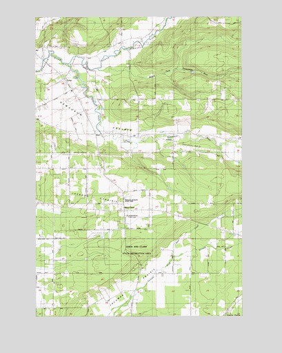
Jackson Prairie, WA USGS Topographic Map
Click on map above to begin viewing in our Map Viewer.

This topographic map contains these locations and features:
Feature Name Type Latitude Longitude GNIS ID View Map
Baker CreekStreamN46.5243°W122.7937°1503129View Map
Dwight FieldAirportN46.6170°W122.8262°1534170View Map
Fantasy Field AirstripAirportN46.5889°W122.8685°2443425View Map
ForestPopulated PlaceN46.5990°W122.8579°1504954View Map
Foster HeliportAirportN46.5554°W122.8554°1533848View Map
GuerrierLocaleN46.5748°W122.8137°1512964View Map
Harris AirportAirportN46.5161°W122.7922°1533999View Map
Jackson Court House State ParkParkN46.5421°W122.8221°1512969View Map
Jackson HouseBuildingN46.5415°W122.8215°1509733View Map
Jackson PrairieFlatN46.5540°W122.8285°1505782View Map
KlausPopulated PlaceN46.5762°W122.8387°1510306View Map
Lewis and Clark State ParkParkN46.5248°W122.8154°1511524View Map
Lewis County Fire District 5 Station 2BuildingN46.6019°W122.8632°2643297View Map
Lewis County Fire District 5 Station 3BuildingN46.5484°W122.8224°2643298View Map
Marys CornerPopulated PlaceN46.5471°W122.8226°1511127View Map
Matilda Jackson State ParkParkN46.5482°W122.8257°1506512View Map
Middle Fork Newaukum RiverStreamN46.6032°W122.8376°1523076View Map
Mount Saint Helens Visitors CenterBuildingN46.5229°W122.8132°1514049View Map
North Fork Newaukum RiverStreamN46.6048°W122.8557°1523810View Map
South Fork Newaukum RiverStreamN46.6051°W122.8557°1526220View Map

Note: Coordinates in the location and feature list above are referenced to NAD83 datum.


Copyright (C) 2008-2025 Ryan Niemi / Sunset Dynamics ... All Rights Reserved