TopoQuest Logo
Do you find TopoQuest useful?
Help keep TopoQuest running and adding new maps/features by donating!
Bitcoin:  19c7KJd3qBynnjoSw5npx9KScwjBe4ifkT
Litecoin:  LXs6TkuXGGXo1vDsWCkWVdjQX94eUKd6ui
Home View Maps Find Maps Find Places Resources & Links


Logan Hill, Washington Topographic Map

USGS Map Title: Logan Hill, WA
USGS Map MRC: 46122F7
DRG (GeoTIFF) Download: o46122f7.tif


Neighboring USGS Topographic Map Quads:


  Violet Prairie, WA  
46122G8
 

  Bucoda, WA  
46122G7
 

  Vail, WA  
46122G6
 

  Centralia, WA  
46122F8
 

  Logan Hill, WA  
46122F7
 

  Onalaska NW, WA  
46122F6
 

  Napavine, WA  
46122E8
 

  Jackson Prairie, WA  
46122E7
 

  Onalaska, WA  
46122E6


Map MRC Location:

N47°
W123°
N47°
W122°
H8 H7 H6 H5 H4 H3 H2 H1
G8 G7 G6 G5 G4 G3 G2 G1
F8 F7 F6 F5 F4 F3 F2 F1
E8 E7 E6 E5 E4 E3 E2 E1
D8 D7 D6 D5 D4 D3 D2 D1
C8 C7 C6 C5 C4 C3 C2 C1
B8 B7 B6 B5 B4 B3 B2 B1
A8 A7 A6 A5 A4 A3 A2 A1
N46°
W123°
N46°
W122°

Logan Hill, WA USGS 1:24K Topographic Map Preview:
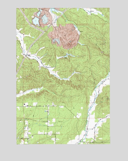
Logan Hill, WA USGS Topographic Map
Click on map above to begin viewing in our Map Viewer.

This topographic map contains these locations and features:
Feature Name Type Latitude Longitude GNIS ID View Map
Bear CreekStreamN46.6620°W122.7715°1503222View Map
Dam Number 1-ADamN46.7498°W122.8446°1532292View Map
Dam Number 3BDamN46.7415°W122.8346°1532494View Map
Dam Number EightDamN46.7048°W122.8146°1532305View Map
Dam Number FiveDamN46.7498°W122.8312°1532303View Map
Dam Number FourDamN46.7465°W122.8312°1532296View Map
Dam Number SevenDamN46.7065°W122.8096°1532307View Map
Dam Number ThreeDamN46.7465°W122.8446°1532298View Map
Dam Number TwoDamN46.7465°W122.8429°1532300View Map
HanafordLocaleN46.7479°W122.7762°1510297View Map
KopiahPopulated PlaceN46.7059°W122.8079°1511078View Map
Lewis County Fire District 6 Logan Hill Station 63BuildingN46.6348°W122.8340°2643302View Map
Lewis County Fire District 6 Northfork Road Station 65BuildingN46.6267°W122.7925°2643897View Map
Logan HillSummitN46.6590°W122.8148°1512398View Map
Logan Hill ChurchChurchN46.6595°W122.8335°1506252View Map
Logan Hill DivisionCivilN46.6784°W122.7743°1939541View Map
Lucas CreekStreamN46.6365°W122.7807°1522557View Map
MendotaLocaleN46.7254°W122.7904°1506624View Map
Meridian HillSummitN46.7101°W122.7546°1512458View Map
Mitchell CreekStreamN46.6870°W122.7535°1523290View Map
Nulls CrossingPopulated PlaceN46.7062°W122.8623°1511197View Map
Pond Number 1-AReservoirN46.7500°W122.8444°1532293View Map
Pond Number EightReservoirN46.7048°W122.8146°1532306View Map
Pond Number FiveReservoirN46.7500°W122.8281°1532304View Map
Pond Number FourReservoirN46.7478°W122.8299°1532297View Map
Pond Number SevenSwampN46.7070°W122.8050°1532308View Map
Pond Number ThreeReservoirN46.7444°W122.8462°1532299View Map
Pond Number TwoReservoirN46.7478°W122.8433°1532301View Map

Note: Coordinates in the location and feature list above are referenced to NAD83 datum.


Copyright (C) 2008-2025 Ryan Niemi / Sunset Dynamics ... All Rights Reserved