TopoQuest Logo
Do you find TopoQuest useful?
Help keep TopoQuest running and adding new maps/features by donating!
Bitcoin:  19c7KJd3qBynnjoSw5npx9KScwjBe4ifkT
Litecoin:  LXs6TkuXGGXo1vDsWCkWVdjQX94eUKd6ui
Home View Maps Find Maps Find Places Resources & Links


Baldwinville, Georgia Topographic Map

USGS Map Title: Baldwinville, GA
USGS Map MRC: 32084F4
DRG (GeoTIFF) Download: o32084f4.tif


Neighboring USGS Topographic Map Quads:


  Manchester, GA  
32084G5
 

  Roland, GA  
32084G4
 

  Lincoln Park, GA  
32084G3
 

  Talbotton, GA  
32084F5
 

  Baldwinville, GA  
32084F4
 

  Prattsburg, GA  
32084F3
 

  Geneva, GA  
32084E5
 

  Junction City, GA  
32084E4
 

  Butler West, GA  
32084E3


Map MRC Location:

N33°
W85°
N33°
W84°
H8 H7 H6 H5 H4 H3 H2 H1
G8 G7 G6 G5 G4 G3 G2 G1
F8 F7 F6 F5 F4 F3 F2 F1
E8 E7 E6 E5 E4 E3 E2 E1
D8 D7 D6 D5 D4 D3 D2 D1
C8 C7 C6 C5 C4 C3 C2 C1
B8 B7 B6 B5 B4 B3 B2 B1
A8 A7 A6 A5 A4 A3 A2 A1
N32°
W85°
N32°
W84°

Baldwinville, GA USGS 1:24K Topographic Map Preview:
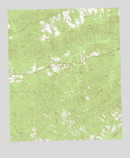
Baldwinville, GA USGS Topographic Map
Click on map above to begin viewing in our Map Viewer.

This topographic map contains these locations and features:
Feature Name Type Latitude Longitude GNIS ID View Map
Adams CemeteryCemeteryN32.6449°W84.4485°310394View Map
BaldwinvillePopulated PlaceN32.6507°W84.4496°326165View Map
Bethel ChurchChurchN32.6915°W84.4074°311184View Map
CentervillePopulated PlaceN32.6949°W84.4555°355088View Map
Centerville School (historical)SchoolN32.7043°W84.4713°350810View Map
Floyds LakeReservoirN32.7218°W84.4549°340432View Map
Floyds Lake DamDamN32.7218°W84.4549°340431View Map
Jumpin j Airport (historical)AirportN32.6918°W84.4971°351925View Map
Matthews LakeReservoirN32.6323°W84.4306°340588View Map
Matthews Lake DamDamN32.6318°W84.4316°340587View Map
Matthews Lake EastReservoirN32.6355°W84.4204°338028View Map
Matthews Lake East DamDamN32.6335°W84.4199°338027View Map
Mill CreekStreamN32.7043°W84.4227°318194View Map
Mount Airy ChurchChurchN32.7357°W84.4527°318549View Map
Mount Zion ChurchChurchN32.6504°W84.4494°318984View Map
New Salem ChurchChurchN32.6951°W84.4527°319534View Map
Philadelphia ChurchChurchN32.7365°W84.4519°320433View Map
Pine Level ChurchChurchN32.6446°W84.4321°320633View Map
Po Biddy CrossroadsPopulated PlaceN32.6904°W84.4719°326474View Map
Poplar CrossroadsPopulated PlaceN32.7049°W84.3985°326475View Map
Potters CreekStreamN32.7221°W84.3766°321095View Map
Rock ChurchChurchN32.6304°W84.4733°321717View Map
Spinks Chapel (historical)ChurchN32.6812°W84.4121°350841View Map
Talbotton DivisionCivilN32.7012°W84.4879°1936573View Map
YpsilantiPopulated PlaceN32.7426°W84.4133°356660View Map

Note: Coordinates in the location and feature list above are referenced to NAD83 datum.


Copyright (C) 2008-2024 Ryan Niemi / Sunset Dynamics ... All Rights Reserved