TopoQuest Logo
Do you find TopoQuest useful?
Help keep TopoQuest running and adding new maps/features by donating!
Bitcoin:  19c7KJd3qBynnjoSw5npx9KScwjBe4ifkT
Litecoin:  LXs6TkuXGGXo1vDsWCkWVdjQX94eUKd6ui
Home View Maps Find Maps Find Places Resources & Links


Prattsburg, Georgia Topographic Map

USGS Map Title: Prattsburg, GA
USGS Map MRC: 32084F3
DRG (GeoTIFF) Download: o32084f3.tif


Neighboring USGS Topographic Map Quads:


  Roland, GA  
32084G4
 

  Lincoln Park, GA  
32084G3
 

  Logtown, GA  
32084G2
 

  Baldwinville, GA  
32084F4
 

  Prattsburg, GA  
32084F3
 

  Fickling Mill, GA  
32084F2
 

  Junction City, GA  
32084E4
 

  Butler West, GA  
32084E3
 

  Butler East, GA  
32084E2


Map MRC Location:

N33°
W85°
N33°
W84°
H8 H7 H6 H5 H4 H3 H2 H1
G8 G7 G6 G5 G4 G3 G2 G1
F8 F7 F6 F5 F4 F3 F2 F1
E8 E7 E6 E5 E4 E3 E2 E1
D8 D7 D6 D5 D4 D3 D2 D1
C8 C7 C6 C5 C4 C3 C2 C1
B8 B7 B6 B5 B4 B3 B2 B1
A8 A7 A6 A5 A4 A3 A2 A1
N32°
W85°
N32°
W84°

Prattsburg, GA USGS 1:24K Topographic Map Preview:
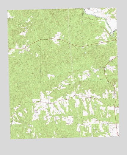
Prattsburg, GA USGS Topographic Map
Click on map above to begin viewing in our Map Viewer.

This topographic map contains these locations and features:
Feature Name Type Latitude Longitude GNIS ID View Map
Antioch Baptist ChurchChurchN32.6988°W84.2582°354342View Map
Antioch CemeteryCemeteryN32.6987°W84.2582°344132View Map
Antioch ChurchChurchN32.6918°W84.2691°344133View Map
Barfield CreekStreamN32.7499°W84.3380°310794View Map
Bethel ChurchChurchN32.6624°W84.2519°311182View Map
CarsonvillePopulated PlaceN32.7132°W84.2896°331329View Map
Corinth Methodist ChurchChurchN32.7121°W84.3566°350813View Map
Crossroad ChurchChurchN32.7407°W84.3696°313172View Map
Duck CreekStreamN32.7218°W84.2538°313696View Map
Five PointsPopulated PlaceN32.6926°W84.2652°331717View Map
Green LakeReservoirN32.7436°W84.2604°340370View Map
Green Lake DamDamN32.7418°W84.2616°340369View Map
Hobar ChurchChurchN32.6460°W84.3749°315471View Map
JarrellPopulated PlaceN32.6635°W84.2813°326340View Map
PrattsburgPopulated PlaceN32.7126°W84.3577°326480View Map
Prattsburg AirportAirportN32.7283°W84.3566°351926View Map
Scott-Bussy CemeteryCemeteryN32.6507°W84.3444°344155View Map
Shiloh ChurchChurchN32.6463°W84.3719°322872View Map
Swift CreekStreamN32.7437°W84.2774°323844View Map
Taylor County Fire Rescue Department Central StationBuildingN32.6699°W84.2537°2604731View Map
Three Fingered LakeReservoirN32.7498°W84.2798°324141View Map
Union ChurchChurchN32.6379°W84.2635°324524View Map
WesleyPopulated PlaceN32.6590°W84.3302°326583View Map
Wesley CemeteryCemeteryN32.6585°W84.3302°344166View Map
Wesley ChurchChurchN32.6588°W84.3305°344167View Map
Zion Hill ChurchChurchN32.6626°W84.2813°344168View Map

Note: Coordinates in the location and feature list above are referenced to NAD83 datum.


Copyright (C) 2008-2024 Ryan Niemi / Sunset Dynamics ... All Rights Reserved