TopoQuest Logo
Do you find TopoQuest useful?
Help keep TopoQuest running and adding new maps/features by donating!
Bitcoin:  19c7KJd3qBynnjoSw5npx9KScwjBe4ifkT
Litecoin:  LXs6TkuXGGXo1vDsWCkWVdjQX94eUKd6ui
Home View Maps Find Maps Find Places Resources & Links


Jarbidge North, Nevada Topographic Map

USGS Map Title: Jarbidge North, NV
USGS Map MRC: 41115H4
DRG (GeoTIFF) Download: o41115h4.tif


Neighboring USGS Topographic Map Quads:


  Cowan Reservoir, ID  
42115A5
 

  Dishpan, ID  
42115A4
 

  Murphy Hot Springs, ID  
42115A3
 

  Bearpaw Mountain, NV  
41115H5
 

  Jarbidge North, NV  
41115H4
 

  Robinson Creek, NV  
41115H3
 

  Coon Creek, NV  
41115G5
 

  Jarbidge South, NV  
41115G4
 

  Gods Pocket Peak, NV  
41115G3


Map MRC Location:

N42°
W116°
N42°
W115°
H8 H7 H6 H5 H4 H3 H2 H1
G8 G7 G6 G5 G4 G3 G2 G1
F8 F7 F6 F5 F4 F3 F2 F1
E8 E7 E6 E5 E4 E3 E2 E1
D8 D7 D6 D5 D4 D3 D2 D1
C8 C7 C6 C5 C4 C3 C2 C1
B8 B7 B6 B5 B4 B3 B2 B1
A8 A7 A6 A5 A4 A3 A2 A1
N41°
W116°
N41°
W115°

Jarbidge North, NV USGS 1:24K Topographic Map Preview:
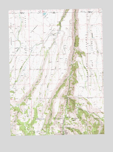
Jarbidge North, NV USGS Topographic Map
Click on map above to begin viewing in our Map Viewer.

This topographic map contains these locations and features:
Feature Name Type Latitude Longitude GNIS ID View Map
Big IslandAreaN41.9694°W115.3972°858894View Map
Columbet TableAreaN41.9957°W115.4554°857663View Map
Corral CreekStreamN41.9796°W115.4331°859356View Map
Corral Creek CanyonValleyN41.9791°W115.4323°862671View Map
Cottonwood SpringSpringN41.8893°W115.4184°862345View Map
Cow CreekStreamN41.9577°W115.4504°859404View Map
Cow Creek CanyonValleyN41.9582°W115.4492°862670View Map
Deer CreekStreamN41.9332°W115.4223°859495View Map
East Fork Buck CreekStreamN41.9063°W115.4890°862348View Map
East Fork Rattlesnake CanyonValleyN41.9818°W115.3942°862672View Map
Fawn CreekStreamN41.9613°W115.4876°859699View Map
Freighters DefeatStreamN41.9599°W115.4142°862344View Map
Golden Queen MineMineN41.8766°W115.4387°852488View Map
Jack CreekStreamN41.9116°W115.4265°860160View Map
Jack Creek CampPopulated PlaceN41.8994°W115.4023°852522View Map
Jarbidge Elementary SchoolSchoolN41.8763°W115.4309°855098View Map
Jarbidge TownshipCivilN41.8791°W115.4240°857613View Map
Jarbidge Volunteer Fire DepartmentBuildingN41.8755°W115.4304°2581239View Map
Jenny CreekStreamN41.9013°W115.4123°860202View Map
Jones Spring WashStreamN41.9996°W115.4148°841416View Map
Larios RanchLocaleN41.9796°W115.4340°860304View Map
Mahoney Ranger StationLocaleN41.8924°W115.4278°860462View Map
Midnight MineMineN41.9027°W115.4098°852521View Map
Moore GulchValleyN41.8827°W115.4309°860636View Map
Sanovia CreekStreamN41.9757°W115.4381°861267View Map
Sawmill National Forest CampgroundLocaleN41.8855°W115.4295°862328View Map
Virginus MineMineN41.8924°W115.3823°852487View Map
Virginus Number One MineMineN41.8921°W115.3801°852485View Map
Virginus Number Two MineMineN41.8910°W115.3812°852486View Map
Ward RanchLocaleN41.9632°W115.4659°861888View Map
West Fork Rattlesnake CanyonValleyN41.9818°W115.3942°862673View Map
Wilkins IslandAreaN41.9708°W115.3806°858529View Map

Note: Coordinates in the location and feature list above are referenced to NAD83 datum.


Copyright (C) 2008-2025 Ryan Niemi / Sunset Dynamics ... All Rights Reserved