TopoQuest Logo
Do you find TopoQuest useful?
Help keep TopoQuest running and adding new maps/features by donating!
Bitcoin:  19c7KJd3qBynnjoSw5npx9KScwjBe4ifkT
Litecoin:  LXs6TkuXGGXo1vDsWCkWVdjQX94eUKd6ui
Home View Maps Find Maps Find Places Resources & Links


Jean, Nevada Topographic Map

USGS Map Title: Jean, NV
USGS Map MRC: 35115G3
DRG (GeoTIFF) Download: o35115g3.tif


Neighboring USGS Topographic Map Quads:


  Cottonwood Pass, NV  
35115H4
 

  Bird Spring, NV  
35115H3
 

  Sloan, NV  
35115H2
 

  Goodsprings, NV  
35115G4
 

  Jean, NV  
35115G3
 

  Hidden Valley, NV  
35115G2
 

  State Line Pass, CA  
35115F4
 

  Roach, NV  
35115F3
 

  McCullough Pass, NV  
35115F2


Map MRC Location:

N36°
W116°
N36°
W115°
H8 H7 H6 H5 H4 H3 H2 H1
G8 G7 G6 G5 G4 G3 G2 G1
F8 F7 F6 F5 F4 F3 F2 F1
E8 E7 E6 E5 E4 E3 E2 E1
D8 D7 D6 D5 D4 D3 D2 D1
C8 C7 C6 C5 C4 C3 C2 C1
B8 B7 B6 B5 B4 B3 B2 B1
A8 A7 A6 A5 A4 A3 A2 A1
N35°
W116°
N35°
W115°

Jean, NV USGS 1:24K Topographic Map Preview:
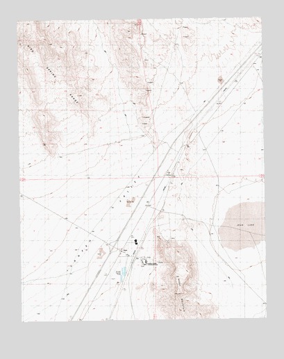
Jean, NV USGS Topographic Map
Click on map above to begin viewing in our Map Viewer.

This topographic map contains these locations and features:
Feature Name Type Latitude Longitude GNIS ID View Map
Clark County Fire Department Station 87BuildingN35.7751°W115.3283°2473052View Map
Goodsprings TownshipCivilN35.7925°W115.3183°857597View Map
Ivanpah ValleyValleyN35.8666°W115.2508°255505View Map
JeanPopulated PlaceN35.7789°W115.3239°845519View Map
Jean AirportAirportN35.7719°W115.3291°864068View Map
Jean LakeLakeN35.7892°W115.2581°845311View Map
Jean Post OfficePost OfficeN35.7789°W115.3239°865012View Map
Jean StationLocaleN35.7769°W115.3183°851574View Map
Nevada Highway Patrol Southern Command Jean SubstationBuildingN35.7789°W115.3238°2740062View Map
Nevada State PrisonBuildingN35.7744°W115.3136°851526View Map
Sandy Valley Elementary SchoolSchoolN35.7794°W115.3247°856728View Map
Sheep MountainSummitN35.7608°W115.2961°843636View Map
Sutor (historical)LocaleN35.8316°W115.2833°851511View Map
Sutor Mining DistrictCivilN35.8305°W115.3508°852999View Map

Note: Coordinates in the location and feature list above are referenced to NAD83 datum.


Copyright (C) 2008-2025 Ryan Niemi / Sunset Dynamics ... All Rights Reserved