TopoQuest Logo
Do you find TopoQuest useful?
Help keep TopoQuest running and adding new maps/features by donating!
Bitcoin:  19c7KJd3qBynnjoSw5npx9KScwjBe4ifkT
Litecoin:  LXs6TkuXGGXo1vDsWCkWVdjQX94eUKd6ui
Home View Maps Find Maps Find Places Resources & Links


Goodsprings, Nevada Topographic Map

USGS Map Title: Goodsprings, NV
USGS Map MRC: 35115G4
DRG (GeoTIFF) Download: o35115g4.tif


Neighboring USGS Topographic Map Quads:


  Potosi, NV  
35115H5
 

  Cottonwood Pass, NV  
35115H4
 

  Bird Spring, NV  
35115H3
 

  Shenandoah Peak, NV  
35115G5
 

  Goodsprings, NV  
35115G4
 

  Jean, NV  
35115G3
 

  Mesquite Lake, CA  
35115F5
 

  State Line Pass, CA  
35115F4
 

  Roach, NV  
35115F3


Map MRC Location:

N36°
W116°
N36°
W115°
H8 H7 H6 H5 H4 H3 H2 H1
G8 G7 G6 G5 G4 G3 G2 G1
F8 F7 F6 F5 F4 F3 F2 F1
E8 E7 E6 E5 E4 E3 E2 E1
D8 D7 D6 D5 D4 D3 D2 D1
C8 C7 C6 C5 C4 C3 C2 C1
B8 B7 B6 B5 B4 B3 B2 B1
A8 A7 A6 A5 A4 A3 A2 A1
N35°
W116°
N35°
W115°

Goodsprings, NV USGS 1:24K Topographic Map Preview:
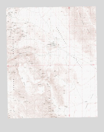
Goodsprings, NV USGS Topographic Map
Click on map above to begin viewing in our Map Viewer.

This topographic map contains these locations and features:
Feature Name Type Latitude Longitude GNIS ID View Map
Accident MineMineN35.7605°W115.4433°838369View Map
Alice MineMineN35.8419°W115.4972°854874View Map
Anchor MineMineN35.7503°W115.4408°854699View Map
Argentena MineMineN35.8130°W115.4675°854352View Map
Argentena Mine CampLocaleN35.8125°W115.4692°863779View Map
Belle MineMineN35.8266°W115.4914°838684View Map
Bullion MineMineN35.7569°W115.4406°839182View Map
Clark County Fire Department Station 78BuildingN35.8361°W115.4407°2473044View Map
Columbia MineMineN35.8205°W115.4756°839637View Map
Columbia PassGapN35.8225°W115.4789°845801View Map
Cosmopolitan MineMineN35.8289°W115.4894°839718View Map
Crystal PassGapN35.8022°W115.4361°839889View Map
Deadmans CanyonValleyN35.7697°W115.4344°854423View Map
Frederickson MineMineN35.8205°W115.4806°854921View Map
Good SpringSpringN35.8330°W115.4367°851575View Map
GoodspringsPopulated PlaceN35.8325°W115.4342°845306View Map
Goodsprings Census Designated PlaceCensusN35.8303°W115.4292°2408308View Map
Goodsprings Elementary SchoolSchoolN35.8315°W115.4355°855656View Map
Goodsprings ParkParkN35.8311°W115.4355°2473307View Map
Goodsprings Rural Station Post OfficePost OfficeN35.8325°W115.4342°864785View Map
Goodsprings ValleyBasinN35.8264°W115.4181°840719View Map
Green Copper MineMineN35.8516°W115.4856°840805View Map
Hermosa MineMineN35.8111°W115.4883°840959View Map
Hoosier MineMineN35.8022°W115.4911°841054View Map
Horseshoe GulchValleyN35.8575°W115.4842°857538View Map
Houghton MineMineN35.7722°W115.4417°854928View Map
Ireland MineMineN35.7628°W115.4183°841298View Map
Iron Gold MineMineN35.8403°W115.4764°841304View Map
Lavina MineMineN35.8436°W115.4769°841589View Map
Lincoln MineMineN35.7778°W115.4200°841645View Map
Lookout MineMineN35.8041°W115.4606°841818View Map
Lookout PeakSummitN35.8008°W115.4483°851527View Map
Middlesex MineMineN35.8458°W115.4867°842096View Map
Monte Cristo MineMineN35.7669°W115.4417°842203View Map
Mountain Top MineMineN35.7997°W115.4525°842281View Map
New England Mining Companys SpringSpringN35.8305°W115.4322°851573View Map
New England SpringsSpringN35.8028°W115.4481°846719View Map
Pilgrim MineMineN35.8700°W115.4881°842810View Map
Porphyry GulchValleyN35.8519°W115.4925°846718View Map
Porter MineMineN35.7655°W115.4478°842941View Map
Porter WashStreamN35.7555°W115.4153°842945View Map
Prairie Flower MineMineN35.8544°W115.4897°842970View Map
Puelz MineMineN35.7739°W115.4803°842992View Map
Red Cloud MineMineN35.8672°W115.4950°843137View Map
Ruth MineMineN35.8361°W115.4867°843399View Map
Star MineMineN35.7703°W115.4453°843974View Map
Surprise MineMineN35.8178°W115.4869°844116View Map
Table MountainSummitN35.8058°W115.4861°844154View Map
Valentine MineMineN35.7508°W115.4350°844565View Map
Volcano MineMineN35.8055°W115.4636°855667View Map
Yellow Pine MineMineN35.8503°W115.4950°845061View Map

Note: Coordinates in the location and feature list above are referenced to NAD83 datum.


Copyright (C) 2008-2024 Ryan Niemi / Sunset Dynamics ... All Rights Reserved