TopoQuest Logo
Do you find TopoQuest useful?
Help keep TopoQuest running and adding new maps/features by donating!
Bitcoin:  19c7KJd3qBynnjoSw5npx9KScwjBe4ifkT
Litecoin:  LXs6TkuXGGXo1vDsWCkWVdjQX94eUKd6ui
Home View Maps Find Maps Find Places Resources & Links


Baldy Mesa, California Topographic Map

USGS Map Title: Baldy Mesa, CA
USGS Map MRC: 34117D4
DRG (GeoTIFF) Download: o34117d4.tif


Neighboring USGS Topographic Map Quads:


  Shadow Mountains SE, CA  
34117E5
 

  Adelanto, CA  
34117E4
 

  Victorville, CA  
34117E3
 

  Phelan, CA  
34117D5
 

  Baldy Mesa, CA  
34117D4
 

  Hesperia, CA  
34117D3
 

  Telegraph Peak, CA  
34117C5
 

  Cajon, CA  
34117C4
 

  Silverwood Lake, CA  
34117C3


Map MRC Location:

N35°
W118°
N35°
W117°
H8 H7 H6 H5 H4 H3 H2 H1
G8 G7 G6 G5 G4 G3 G2 G1
F8 F7 F6 F5 F4 F3 F2 F1
E8 E7 E6 E5 E4 E3 E2 E1
D8 D7 D6 D5 D4 D3 D2 D1
C8 C7 C6 C5 C4 C3 C2 C1
B8 B7 B6 B5 B4 B3 B2 B1
A8 A7 A6 A5 A4 A3 A2 A1
N34°
W118°
N34°
W117°

Baldy Mesa, CA USGS 1:24K Topographic Map Preview:
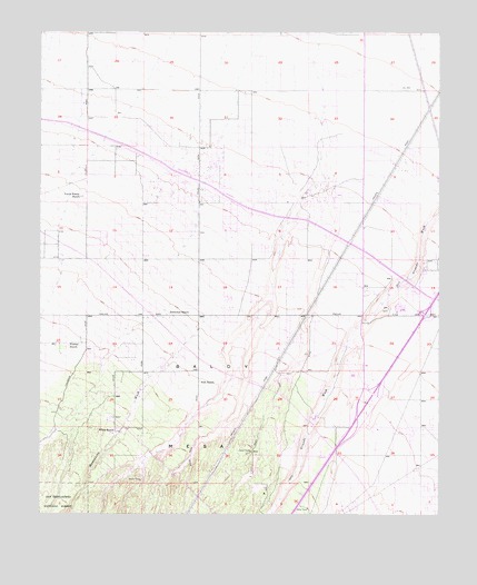
Baldy Mesa, CA USGS Topographic Map
Click on map above to begin viewing in our Map Viewer.

This topographic map contains these locations and features:
Feature Name Type Latitude Longitude GNIS ID View Map
Baldy MesaPopulated PlaceN34.4592°W117.4512°1841636View Map
Baldy Mesa Community BuildingBuildingN34.4631°W117.4467°1841637View Map
Baldy Mesa Elementary SchoolSchoolN34.4388°W117.4519°1841638View Map
Brylane Post OfficePost OfficeN34.4589°W117.4509°2025279View Map
Duncan CornersPopulated PlaceN34.4706°W117.3995°1841643View Map
Eagle RanchPopulated PlaceN34.4778°W117.4078°1841644View Map
Fish RanchLocaleN34.4094°W117.4506°271147View Map
Golden Valley AcresPopulated PlaceN34.4228°W117.4431°1841645View Map
Hesp Crest Desert Ecological Study AreaParkN34.4444°W117.3898°1841646View Map
High CountryPopulated PlaceN34.4050°W117.3814°1841647View Map
Hollyvale Elementary SchoolSchoolN34.4621°W117.3856°1841649View Map
KVVQ-AM (Hesperia)TowerN34.3886°W117.3923°1662631View Map
Manzanita WashStreamN34.4292°W117.4448°272336View Map
Oak HillsPopulated PlaceN34.3831°W117.3814°1841652View Map
Patterson RanchLocaleN34.4267°W117.4600°272891View Map
San Bernardino County Fire and Rescue Station 16 Baldly MesaBuildingN34.4651°W117.4454°2665049View Map
San Bernardino County Fire Department Station 305 HesperiaBuildingN34.4015°W117.4031°2665403View Map
San Bernardino County Fire Department Station 315 VictorvilleBuildingN34.4561°W117.3849°2665404View Map
Sunset RidgePopulated PlaceN34.4539°W117.3864°1841663View Map
Warner RanchLocaleN34.4189°W117.4914°274383View Map
Warner RanchLocaleN34.4108°W117.4670°1702011View Map
White RanchLocaleN34.3967°W117.4770°274478View Map
Yucca Forest RanchLocaleN34.4578°W117.4878°274600View Map

Note: Coordinates in the location and feature list above are referenced to NAD83 datum.


Copyright (C) 2008-2024 Ryan Niemi / Sunset Dynamics ... All Rights Reserved