TopoQuest Logo
Do you find TopoQuest useful?
Help keep TopoQuest running and adding new maps/features by donating!
Bitcoin:  19c7KJd3qBynnjoSw5npx9KScwjBe4ifkT
Litecoin:  LXs6TkuXGGXo1vDsWCkWVdjQX94eUKd6ui
Home View Maps Find Maps Find Places Resources & Links


Jefferson City NW, Missouri Topographic Map

USGS Map Title: Jefferson City NW, MO
USGS Map MRC: 38092F2
DRG (GeoTIFF) Download: o38092f2.tif


Neighboring USGS Topographic Map Quads:


  Ashland, MO  
38092G3
 

  Millersburg SW, MO  
38092G2
 

  Guthrie, MO  
38092G1
 

  Hartsburg, MO  
38092F3
 

  Jefferson City NW, MO  
38092F2
 

  New Bloomfield, MO  
38092F1
 

  Lohman, MO  
38092E3
 

  Jefferson City, MO  
38092E2
 

  Osage City, MO  
38092E1


Map MRC Location:

N39°
W93°
N39°
W92°
H8 H7 H6 H5 H4 H3 H2 H1
G8 G7 G6 G5 G4 G3 G2 G1
F8 F7 F6 F5 F4 F3 F2 F1
E8 E7 E6 E5 E4 E3 E2 E1
D8 D7 D6 D5 D4 D3 D2 D1
C8 C7 C6 C5 C4 C3 C2 C1
B8 B7 B6 B5 B4 B3 B2 B1
A8 A7 A6 A5 A4 A3 A2 A1
N38°
W93°
N38°
W92°

Jefferson City NW, MO USGS 1:24K Topographic Map Preview:
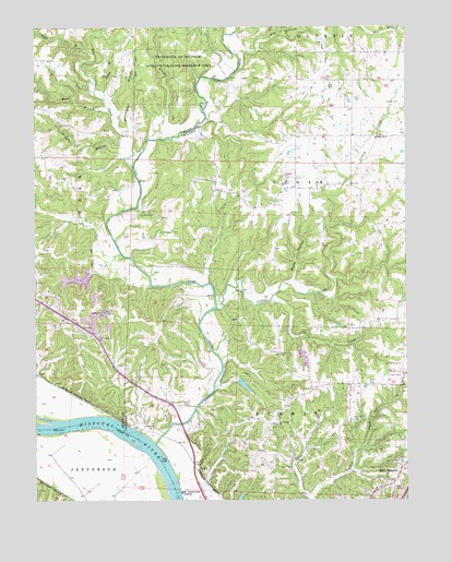
Jefferson City NW, MO USGS Topographic Map
Click on map above to begin viewing in our Map Viewer.

This topographic map contains these locations and features:
Feature Name Type Latitude Longitude GNIS ID View Map
Audrain PrairiesAreaN38.7498°W92.1255°758232View Map
Big BranchStreamN38.7428°W92.1819°748824View Map
Brushy CreekStreamN38.7203°W92.2116°749067View Map
Bump HollowValleyN38.6834°W92.1627°749108View Map
Burnett School (historical)SchoolN38.7489°W92.1946°759427View Map
Cedar CreekStreamN38.6400°W92.2102°749289View Map
Charlie Howard LakeReservoirN38.6555°W92.1802°762828View Map
Claysville School (historical)SchoolN38.6709°W92.2418°759364View Map
Clifton CreekStreamN38.6756°W92.1891°749386View Map
Conner CreekStreamN38.7481°W92.1849°749445View Map
Demarco LakeReservoirN38.6748°W92.2499°765328View Map
FolsomPopulated PlaceN38.7334°W92.1544°753753View Map
Foster BranchStreamN38.7434°W92.2305°749961View Map
Fowler CreekStreamN38.7131°W92.2169°749972View Map
Gravel School (historical)SchoolN38.6524°W92.1631°753755View Map
Hall School (historical)SchoolN38.6945°W92.1905°753756View Map
Hopewell ChurchChurchN38.7206°W92.1352°750389View Map
Howard Lake DamDamN38.6567°W92.1819°762827View Map
Lake ChampetraReservoirN38.6832°W92.2354°764726View Map
Lake Champetra DamDamN38.6850°W92.2319°764725View Map
Meng CemeteryCemeteryN38.6636°W92.1681°751019View Map
Middle BranchStreamN38.7295°W92.2263°751030View Map
Mount Vernon CemeteryCemeteryN38.6446°W92.1686°753764View Map
Mount Vernon ChurchChurchN38.6448°W92.1691°751201View Map
Mount Zion CemeteryCemeteryN38.7006°W92.2096°751203View Map
Nichols BranchStreamN38.7153°W92.2196°751310View Map
Nichols CreekStreamN38.7481°W92.2307°751311View Map
Oak Grove School (historical)SchoolN38.7455°W92.2208°759429View Map
Sheley CemeteryCemeteryN38.7297°W92.1274°752103View Map
Skunk CreekStreamN38.6775°W92.1710°752190View Map
Sycamore School (historical)SchoolN38.6992°W92.2319°759428View Map
Toneys BranchStreamN38.7311°W92.2266°752559View Map
Wallace CemeteryCemeteryN38.6464°W92.1433°752736View Map
West Sheely School (historical)SchoolN38.7230°W92.1775°753775View Map
Winterbows BranchStreamN38.7217°W92.2188°752942View Map

Note: Coordinates in the location and feature list above are referenced to NAD83 datum.


Copyright (C) 2008-2025 Ryan Niemi / Sunset Dynamics ... All Rights Reserved