TopoQuest Logo
Do you find TopoQuest useful?
Help keep TopoQuest running and adding new maps/features by donating!
Bitcoin:  19c7KJd3qBynnjoSw5npx9KScwjBe4ifkT
Litecoin:  LXs6TkuXGGXo1vDsWCkWVdjQX94eUKd6ui
Home View Maps Find Maps Find Places Resources & Links


Millersburg SW, Missouri Topographic Map

USGS Map Title: Millersburg SW, MO
USGS Map MRC: 38092G2
DRG (GeoTIFF) Download: o38092g2.tif


Neighboring USGS Topographic Map Quads:


  Columbia, MO  
38092H3
 

  Millersburg, MO  
38092H2
 

  Millersburg NE, MO  
38092H1
 

  Ashland, MO  
38092G3
 

  Millersburg SW, MO  
38092G2
 

  Guthrie, MO  
38092G1
 

  Hartsburg, MO  
38092F3
 

  Jefferson City NW, MO  
38092F2
 

  New Bloomfield, MO  
38092F1


Map MRC Location:

N39°
W93°
N39°
W92°
H8 H7 H6 H5 H4 H3 H2 H1
G8 G7 G6 G5 G4 G3 G2 G1
F8 F7 F6 F5 F4 F3 F2 F1
E8 E7 E6 E5 E4 E3 E2 E1
D8 D7 D6 D5 D4 D3 D2 D1
C8 C7 C6 C5 C4 C3 C2 C1
B8 B7 B6 B5 B4 B3 B2 B1
A8 A7 A6 A5 A4 A3 A2 A1
N38°
W93°
N38°
W92°

Millersburg SW, MO USGS 1:24K Topographic Map Preview:
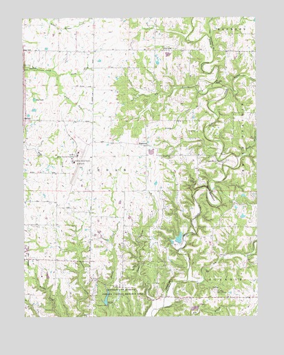
Millersburg SW, MO USGS Topographic Map
Click on map above to begin viewing in our Map Viewer.

This topographic map contains these locations and features:
Feature Name Type Latitude Longitude GNIS ID View Map
Ashland LakeReservoirN38.7566°W92.2066°760249View Map
Barger CemeteryCemeteryN38.8170°W92.1755°748668View Map
Barnes ChapelChurchN38.8617°W92.1746°748677View Map
Barnes School (historical)SchoolN38.8694°W92.1831°759353View Map
Bass LakeReservoirN38.8411°W92.2440°748703View Map
Big BranchStreamN38.8440°W92.1560°748822View Map
Cedar Creek Hiking TrailTrailN38.7511°W92.1927°754407View Map
Columbia Regional AirportAirportN38.8177°W92.2202°758647View Map
Curry LakeReservoirN38.8211°W92.2474°758370View Map
Devils BackboneRidgeN38.8023°W92.1505°749635View Map
Doctor Windmiller DamDamN38.7917°W92.1302°762825View Map
Doctor Windmiller ReservoirReservoirN38.7918°W92.1328°762826View Map
Dry ForkStreamN38.7648°W92.1630°749722View Map
Duley Mill BridgeBridgeN38.8023°W92.1496°753782View Map
Duncan School (historical)SchoolN38.8681°W92.1269°753781View Map
Ellis School (historical)SchoolN38.7914°W92.1969°759354View Map
EnglewoodPopulated PlaceN38.8217°W92.1844°749843View Map
Englewood School (historical)SchoolN38.8199°W92.1777°759355View Map
Eugene Windmiller LakeReservoirN38.7827°W92.1670°760248View Map
GinletPopulated PlaceN38.8598°W92.1924°759356View Map
Ginn LakeReservoirN38.8596°W92.1723°762007View Map
Ginn Lake DamDamN38.8600°W92.1719°762006View Map
Johnson CemeteryCemeteryN38.8273°W92.1568°750527View Map
Laboratory DamDamN38.7550°W92.2069°758299View Map
Mid Missouri P and DF Post OfficePost OfficeN38.8150°W92.2237°2782884View Map
Mill Site BluffCliffN38.8473°W92.1474°751086View Map
MillersPopulated PlaceN38.8528°W92.1413°754963View Map
Millers CreekStreamN38.8453°W92.1402°751098View Map
North Fork Turkey CreekStreamN38.8511°W92.2321°751346View Map
Oak ChapelChurchN38.7614°W92.1491°751368View Map
Owl CreekStreamN38.8664°W92.1491°751462View Map
Peterson LakeReservoirN38.7674°W92.2376°762009View Map
Peterson Lake DamDamN38.7667°W92.2385°762008View Map
Pine Ridge Picnic GroundsLocaleN38.7598°W92.1477°755363View Map
Smith CreekStreamN38.8162°W92.1352°752214View Map
South Fork Turkey CreekStreamN38.8511°W92.2321°752263View Map
Southern Boone County Fire Protection District Station 19BuildingN38.8249°W92.2248°2620544View Map
Stump CreekStreamN38.8453°W92.1485°752406View Map
Summerville (historical)Populated PlaceN38.8606°W92.2110°759358View Map
University of Missouri Ashland Wildlife Research AreaParkN38.7567°W92.1969°752671View Map
Windmiller Dam Number 1DamN38.7817°W92.1669°760247View Map
Windmiller Dam Number 2DamN38.7817°W92.1702°762396View Map

Note: Coordinates in the location and feature list above are referenced to NAD83 datum.


Copyright (C) 2008-2024 Ryan Niemi / Sunset Dynamics ... All Rights Reserved