TopoQuest Logo
Do you find TopoQuest useful?
Help keep TopoQuest running and adding new maps/features by donating!
Bitcoin:  19c7KJd3qBynnjoSw5npx9KScwjBe4ifkT
Litecoin:  LXs6TkuXGGXo1vDsWCkWVdjQX94eUKd6ui
Home View Maps Find Maps Find Places Resources & Links


Jemison West, Alabama Topographic Map

USGS Map Title: Jemison West, AL
USGS Map MRC: 32086H7
DRG (GeoTIFF) Download: o32086h7.tif


Neighboring USGS Topographic Map Quads:


  Aldrich, AL  
33086A8
 

  Montevallo, AL  
33086A7
 

  Ozan, AL  
33086A6
 

  Randolph, AL  
32086H8
 

  Jemison West, AL  
32086H7
 

  Jemison East, AL  
32086H6
 

  Maplesville West, AL  
32086G8
 

  Maplesville East, AL  
32086G7
 

  Clanton West, AL  
32086G6


Map MRC Location:

N33°
W87°
N33°
W86°
H8 H7 H6 H5 H4 H3 H2 H1
G8 G7 G6 G5 G4 G3 G2 G1
F8 F7 F6 F5 F4 F3 F2 F1
E8 E7 E6 E5 E4 E3 E2 E1
D8 D7 D6 D5 D4 D3 D2 D1
C8 C7 C6 C5 C4 C3 C2 C1
B8 B7 B6 B5 B4 B3 B2 B1
A8 A7 A6 A5 A4 A3 A2 A1
N32°
W87°
N32°
W86°

Jemison West, AL USGS 1:24K Topographic Map Preview:
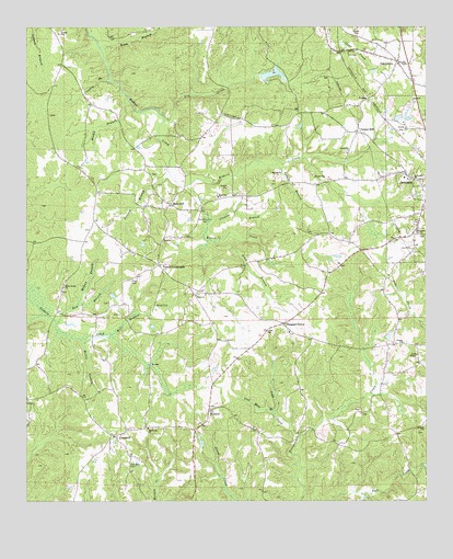
Jemison West, AL USGS Topographic Map
Click on map above to begin viewing in our Map Viewer.

This topographic map contains these locations and features:
Feature Name Type Latitude Longitude GNIS ID View Map
Abbott BranchStreamN32.9640°W86.7972°112883View Map
Beam BranchStreamN32.9948°W86.8519°113624View Map
BessiePopulated PlaceN32.9443°W86.8325°156057View Map
Beulah CemeteryCemeteryN32.8937°W86.7519°151259View Map
Beulah ChurchChurchN32.8940°W86.7511°151260View Map
Brantley LakeReservoirN32.9876°W86.7980°136657View Map
Brantley Lake DamDamN32.9868°W86.8017°131121View Map
Brown BranchStreamN32.9815°W86.8433°114978View Map
CampbellPopulated PlaceN32.8926°W86.8467°115489View Map
Campbell CemeteryCemeteryN32.8851°W86.8419°115491View Map
Center HillPopulated PlaceN32.9723°W86.7717°115843View Map
Center Hill CemeteryCemeteryN32.9671°W86.7753°151257View Map
Center Hill ChurchChurchN32.9671°W86.7747°115847View Map
Cobb CreekStreamN32.8921°W86.7903°116326View Map
Coppers BranchStreamN32.9862°W86.8500°116619View Map
Cressie BranchStreamN32.9496°W86.8183°116852View Map
Crumpton CemeteryCemeteryN32.9273°W86.8494°151265View Map
Demargo LakeReservoirN32.8835°W86.7550°131077View Map
Demargo Lake DamDamN32.8835°W86.7550°131078View Map
Dry CreekStreamN32.9754°W86.8317°117538View Map
Gold Mine BranchStreamN32.8985°W86.7975°119088View Map
Grove Hill ChurchChurchN32.9904°W86.7586°136686View Map
Holly Grove Baptist ChurchChurchN32.9468°W86.7528°151813View Map
Honey Cutts Mill (historical)LocaleN32.8926°W86.7900°136689View Map
HubbardPopulated PlaceN32.8990°W86.8180°156503View Map
Jemison DivisionCivilN32.9752°W86.7827°165692View Map
Jones CemeteryCemeteryN32.9243°W86.8461°149492View Map
KalonaPopulated PlaceN32.9807°W86.7692°156542View Map
Macedonia Baptist ChurchChurchN32.8943°W86.8369°152182View Map
Macedonia CemeteryCemeteryN32.8946°W86.8364°151264View Map
Mahan BranchStreamN32.9271°W86.8592°122222View Map
Mars HillPopulated PlaceN32.9535°W86.8300°152229View Map
Mars Hill ChurchChurchN32.9557°W86.8155°152231View Map
Mohorn CreekStreamN32.9579°W86.8253°122932View Map
Mollie BranchStreamN32.9179°W86.8586°122938View Map
New Mars Hill CemeteryCemeteryN32.9551°W86.8153°151262View Map
Oak GrovePopulated PlaceN32.9910°W86.7589°152723View Map
Oak Grove CemeteryCemeteryN32.9898°W86.7583°151256View Map
Old Mars CemeteryCemeteryN32.9498°W86.8194°124225View Map
Panther StadiumParkN32.9667°W86.7503°2352829View Map
Pates Chapel Baptist ChurchChurchN32.9137°W86.7528°152853View Map
Pates Chapel CemeteryCemeteryN32.9126°W86.7530°151258View Map
Pink BranchStreamN32.9454°W86.8097°124898View Map
Pleasant GrovePopulated PlaceN32.9218°W86.7947°156906View Map
Pleasant Grove Baptist ChurchChurchN32.9196°W86.7928°154138View Map
Pleasant Grove CemeteryCemeteryN32.9196°W86.7936°151261View Map
Posey CemeteryCemeteryN32.9340°W86.8414°125185View Map
Poseys CrossroadsPopulated PlaceN32.9368°W86.8330°156922View Map
Possum BranchStreamN32.9621°W86.8303°125193View Map
Reaves CreekStreamN32.9582°W86.8253°125464View Map
Saint James ChurchChurchN32.9598°W86.7536°126107View Map
Sam BranchStreamN32.9226°W86.8650°126279View Map
Shiloh Baptist ChurchChurchN32.9298°W86.8217°153422View Map
Shiloh CemeteryCemeteryN32.9298°W86.8216°151263View Map
Union Spring ChurchChurchN32.9315°W86.8636°153800View Map
Union Springs CemeteryCemeteryN32.9310°W86.8633°151266View Map
West Chilton Fire DepartmentBuildingN32.9413°W86.8332°2691487View Map
Will Redden BranchStreamN32.9190°W86.8492°128989View Map

Note: Coordinates in the location and feature list above are referenced to NAD83 datum.


Copyright (C) 2008-2025 Ryan Niemi / Sunset Dynamics ... All Rights Reserved