TopoQuest Logo
Do you find TopoQuest useful?
Help keep TopoQuest running and adding new maps/features by donating!
Bitcoin:  19c7KJd3qBynnjoSw5npx9KScwjBe4ifkT
Litecoin:  LXs6TkuXGGXo1vDsWCkWVdjQX94eUKd6ui
Home View Maps Find Maps Find Places Resources & Links


Jensen, Utah Topographic Map

USGS Map Title: Jensen, UT
USGS Map MRC: 40109C3
DRG (GeoTIFF) Download: o40109c3.tif


Neighboring USGS Topographic Map Quads:


  Naples, UT  
40109D4
 

  Dinosaur Quarry, UT  
40109D3
 

  Split Mountain, UT  
40109D2
 

  Rasmussen Hollow, UT  
40109C4
 

  Jensen, UT  
40109C3
 

  Cliff Ridge, UT  
40109C2
 

  Red Wash NW, UT  
40109B4
 

  Red Wash, UT  
40109B3
 

  Dinosaur NW, UT  
40109B2


Map MRC Location:

N41°
W110°
N41°
W109°
H8 H7 H6 H5 H4 H3 H2 H1
G8 G7 G6 G5 G4 G3 G2 G1
F8 F7 F6 F5 F4 F3 F2 F1
E8 E7 E6 E5 E4 E3 E2 E1
D8 D7 D6 D5 D4 D3 D2 D1
C8 C7 C6 C5 C4 C3 C2 C1
B8 B7 B6 B5 B4 B3 B2 B1
A8 A7 A6 A5 A4 A3 A2 A1
N40°
W110°
N40°
W109°

Jensen, UT USGS 1:24K Topographic Map Preview:
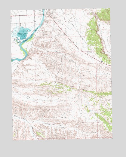
Jensen, UT USGS Topographic Map
Click on map above to begin viewing in our Map Viewer.

This topographic map contains these locations and features:
Feature Name Type Latitude Longitude GNIS ID View Map
Ashley CreekStreamN40.3416°W109.3649°1438282View Map
Bourdette DrawValleyN40.3625°W109.2643°1425908View Map
Clay BasinBasinN40.2714°W109.3110°1426677View Map
Escalante Trail Historical MarkerParkN40.3250°W109.2646°1435513View Map
JensenPopulated PlaceN40.3697°W109.3349°1429145View Map
Jensen Census Designated PlaceCensusN40.3695°W109.3556°2629950View Map
Jensen Post OfficePost OfficeN40.3702°W109.3369°2769064View Map
Kane HollowValleyN40.3361°W109.3576°1429279View Map
Left Fork Walker HollowValleyN40.2686°W109.3587°1429553View Map
Right Fork Walker HollowValleyN40.2686°W109.3587°1431817View Map
Sage BenchBenchN40.2750°W109.2868°1432085View Map
Stewart LakeReservoirN40.3537°W109.3564°1432979View Map
Stewart Lake Waterfowl Management AreaParkN40.3527°W109.3579°1432980View Map
The Church of Jesus Christ of Latter Day SaintsChurchN40.3697°W109.3593°1436964View Map
Uintah Fire District Fire Station - JensenBuildingN40.3701°W109.3626°2627320View Map

Note: Coordinates in the location and feature list above are referenced to NAD83 datum.


Copyright (C) 2008-2025 Ryan Niemi / Sunset Dynamics ... All Rights Reserved