TopoQuest Logo
Do you find TopoQuest useful?
Help keep TopoQuest running and adding new maps/features by donating!
Bitcoin:  19c7KJd3qBynnjoSw5npx9KScwjBe4ifkT
Litecoin:  LXs6TkuXGGXo1vDsWCkWVdjQX94eUKd6ui
Home View Maps Find Maps Find Places Resources & Links


Naples, Utah Topographic Map

USGS Map Title: Naples, UT
USGS Map MRC: 40109D4
DRG (GeoTIFF) Download: o40109d4.tif


Neighboring USGS Topographic Map Quads:


  Steinaker Reservoir, UT  
40109E5
 

  Donkey Flat, UT  
40109E4
 

  Jensen Ridge, UT  
40109E3
 

  Vernal NE, UT  
40109D5
 

  Naples, UT  
40109D4
 

  Dinosaur Quarry, UT  
40109D3
 

  Vernal SE, UT  
40109C5
 

  Rasmussen Hollow, UT  
40109C4
 

  Jensen, UT  
40109C3


Map MRC Location:

N41°
W110°
N41°
W109°
H8 H7 H6 H5 H4 H3 H2 H1
G8 G7 G6 G5 G4 G3 G2 G1
F8 F7 F6 F5 F4 F3 F2 F1
E8 E7 E6 E5 E4 E3 E2 E1
D8 D7 D6 D5 D4 D3 D2 D1
C8 C7 C6 C5 C4 C3 C2 C1
B8 B7 B6 B5 B4 B3 B2 B1
A8 A7 A6 A5 A4 A3 A2 A1
N40°
W110°
N40°
W109°

Naples, UT USGS 1:24K Topographic Map Preview:
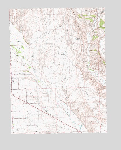
Naples, UT USGS Topographic Map
Click on map above to begin viewing in our Map Viewer.

This topographic map contains these locations and features:
Feature Name Type Latitude Longitude GNIS ID View Map
Bullwinkle ReservoirReservoirN40.4687°W109.4140°1426158View Map
Burns Bench ReservoirReservoirN40.4548°W109.4294°1426172View Map
City of NaplesCivilN40.4318°W109.4913°2411212View Map
Grace Baptist ChurchChurchN40.4000°W109.4801°1436723View Map
Herman-Sadlier DamDamN40.4033°W109.4390°1434807View Map
Herman-Sadlier ReservoirReservoirN40.4024°W109.4396°1434806View Map
Jehovahs Witnesses Vernal CongregationChurchN40.3961°W109.4801°1436737View Map
Jensen WashValleyN40.4913°W109.3843°1429150View Map
Mantle GulchValleyN40.3780°W109.4112°1430080View Map
NaplesPopulated PlaceN40.4269°W109.4993°1430636View Map
Naples Elementary SchoolSchoolN40.4276°W109.4957°1436021View Map
Naples Fire DepartmentBuildingN40.4289°W109.4979°2627165View Map
Steinaker DrawValleyN40.4500°W109.4840°1446126View Map
Sunshine BenchValleyN40.4069°W109.3946°1433083View Map
The Church of Jesus Christ of Latter Day SaintsChurchN40.3972°W109.4982°1450727View Map
The Church of Jesus Christ of Latter Day SaintsChurchN40.3961°W109.4799°1450728View Map
The Church of Jesus Christ of Latter Day SaintsChurchN40.4222°W109.4987°1450827View Map
Vernal Golf CourseLocaleN40.4466°W109.4887°1454551View Map
Vernal SubstationLocaleN40.3975°W109.4640°1454552View Map

Note: Coordinates in the location and feature list above are referenced to NAD83 datum.


Copyright (C) 2008-2025 Ryan Niemi / Sunset Dynamics ... All Rights Reserved