TopoQuest Logo
Do you find TopoQuest useful?
Help keep TopoQuest running and adding new maps/features by donating!
Bitcoin:  19c7KJd3qBynnjoSw5npx9KScwjBe4ifkT
Litecoin:  LXs6TkuXGGXo1vDsWCkWVdjQX94eUKd6ui
Home View Maps Find Maps Find Places Resources & Links


Jerry City, Ohio Topographic Map

USGS Map Title: Jerry City, OH
USGS Map MRC: 41083C5
DRG (GeoTIFF) Download: o41083c5.tif


Neighboring USGS Topographic Map Quads:


  Bowling Green North, OH  
41083D6
 

  Dunbridge, OH  
41083D5
 

  Pemberville, OH  
41083D4
 

  Bowling Green South, OH  
41083C6
 

  Jerry City, OH  
41083C5
 

  Bradner, OH  
41083C4
 

  North Baltimore, OH  
41083B6
 

  Bloomdale, OH  
41083B5
 

  Fostoria, OH  
41083B4


Map MRC Location:

N42°
W84°
N42°
W83°
H8 H7 H6 H5 H4 H3 H2 H1
G8 G7 G6 G5 G4 G3 G2 G1
F8 F7 F6 F5 F4 F3 F2 F1
E8 E7 E6 E5 E4 E3 E2 E1
D8 D7 D6 D5 D4 D3 D2 D1
C8 C7 C6 C5 C4 C3 C2 C1
B8 B7 B6 B5 B4 B3 B2 B1
A8 A7 A6 A5 A4 A3 A2 A1
N41°
W84°
N41°
W83°

Jerry City, OH USGS 1:24K Topographic Map Preview:
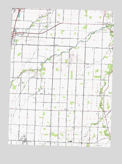
Jerry City, OH USGS Topographic Map
Click on map above to begin viewing in our Map Viewer.

This topographic map contains these locations and features:
Feature Name Type Latitude Longitude GNIS ID View Map
Aring FieldAirportN41.3609°W83.5491°1082508View Map
Bull CreekStreamN41.3189°W83.5888°1038509View Map
Carter ParkParkN41.3689°W83.6233°1050457View Map
Cessna DitchCanalN41.2953°W83.6133°1038973View Map
CloverdalePopulated PlaceN41.3414°W83.5738°1062702View Map
Cloverdale United Methodist ChurchChurchN41.3417°W83.5724°1050458View Map
Cuckle CreekStreamN41.3712°W83.5819°1039523View Map
East Branch Portage RiverStreamN41.2773°W83.5108°1065831View Map
East Branch South Branch Portage RiverStreamN41.2773°W83.5110°1039948View Map
Eckert DitchCanalN41.2817°W83.5841°1040066View Map
Elmwood Elementary SchoolSchoolN41.2546°W83.5525°1081266View Map
Elmwood High SchoolSchoolN41.2546°W83.5511°1040170View Map
Elmwood Middle SchoolSchoolN41.2547°W83.5517°1050470View Map
Fish CemeteryCemeteryN41.3700°W83.5038°1040462View Map
Hope ChurchChurchN41.3489°W83.5741°1056341View Map
Interchange 179CrossingN41.3512°W83.6227°1077477View Map
Interchange 181CrossingN41.3739°W83.6160°1077478View Map
Jerry CityPopulated PlaceN41.2539°W83.6044°1064910View Map
Jerry City CemeteryCemeteryN41.2581°W83.6049°1042086View Map
Jerry City Fire DepartmentBuildingN41.2540°W83.6028°2550584View Map
Jerry City Post OfficePost OfficeN41.2537°W83.6049°1951788View Map
Mennonite CemeteryCemeteryN41.2531°W83.5280°1731433View Map
Meyer FarmsLocaleN41.3103°W83.5458°2547152View Map
Mid - County Ambulance 120BuildingN41.3554°W83.6106°2550972View Map
Middle Branch Portage RiverStreamN41.3612°W83.5030°1065834View Map
Mount Zion CemeteryCemeteryN41.2667°W83.5446°1731435View Map
Mount Zion ChurchChurchN41.2676°W83.5447°1043670View Map
Myers CemeteryCemeteryN41.3622°W83.5034°1731436View Map
New RochesterPopulated PlaceN41.3626°W83.5074°1065135View Map
Portage SchoolSchoolN41.2970°W83.5877°1044707View Map
Rhodes DitchCanalN41.3276°W83.5191°1044961View Map
Saint Pauls ChurchChurchN41.3631°W83.5083°1045770View Map
Shelton AirportAirportN41.3625°W83.5475°1082513View Map
Six PointsPopulated PlaceN41.2826°W83.5547°1063019View Map
South Branch Portage RiverStreamN41.3612°W83.5027°1046451View Map
Township of PortageCivilN41.2977°W83.5925°1087196View Map
Village of Jerry CityCivilN41.2537°W83.6023°2398300View Map
Wood CountyCivilN41.3617°W83.6230°1074098View Map
Wood County Historical CenterParkN41.3503°W83.6152°1731454View Map
Wood County HomeBuildingN41.3509°W83.6172°1067104View Map
Wood County Sheriff's OfficeBuildingN41.3545°W83.6121°2732663View Map

Note: Coordinates in the location and feature list above are referenced to NAD83 datum.


Copyright (C) 2008-2024 Ryan Niemi / Sunset Dynamics ... All Rights Reserved