TopoQuest Logo
Do you find TopoQuest useful?
Help keep TopoQuest running and adding new maps/features by donating!
Bitcoin:  19c7KJd3qBynnjoSw5npx9KScwjBe4ifkT
Litecoin:  LXs6TkuXGGXo1vDsWCkWVdjQX94eUKd6ui
Home View Maps Find Maps Find Places Resources & Links


Jerusalem, Arkansas Topographic Map

USGS Map Title: Jerusalem, AR
USGS Map MRC: 35092D7
DRG (GeoTIFF) Download: o35092d7.tif


Neighboring USGS Topographic Map Quads:


  Solo, AR  
35092E8
 

  Lost Corner, AR  
35092E7
 

  Rex, AR  
35092E6
 

  Hector, AR  
35092D8
 

  Jerusalem, AR  
35092D7
 

  Cleveland, AR  
35092D6
 

  Moreland, AR  
35092C8
 

  Hattieville, AR  
35092C7
 

  Solgohachia, AR  
35092C6


Map MRC Location:

N36°
W93°
N36°
W92°
H8 H7 H6 H5 H4 H3 H2 H1
G8 G7 G6 G5 G4 G3 G2 G1
F8 F7 F6 F5 F4 F3 F2 F1
E8 E7 E6 E5 E4 E3 E2 E1
D8 D7 D6 D5 D4 D3 D2 D1
C8 C7 C6 C5 C4 C3 C2 C1
B8 B7 B6 B5 B4 B3 B2 B1
A8 A7 A6 A5 A4 A3 A2 A1
N35°
W93°
N35°
W92°

Jerusalem, AR USGS 1:24K Topographic Map Preview:
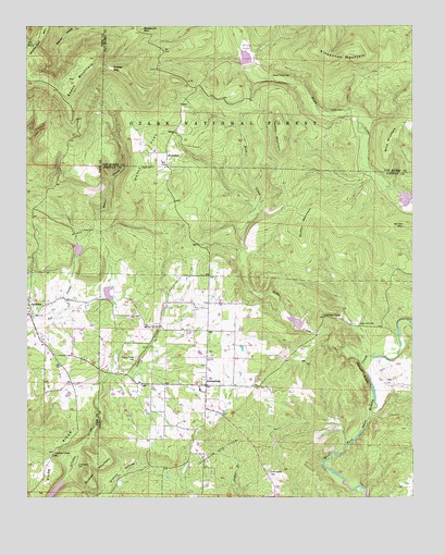
Jerusalem, AR USGS Topographic Map
Click on map above to begin viewing in our Map Viewer.

This topographic map contains these locations and features:
Feature Name Type Latitude Longitude GNIS ID View Map
AppletonPopulated PlaceN35.4254°W92.8743°76184View Map
Appleton Cumberland Presbyterian ChurchChurchN35.4281°W92.8741°62062View Map
Appleton Fire DepartmentBuildingN35.4240°W92.8749°2116086View Map
Appleton School (historical)SchoolN35.4242°W92.8746°62061View Map
Brock Creek LakeReservoirN35.4930°W92.8045°74494View Map
Brock Creek LakeReservoirN35.4851°W92.8018°79818View Map
Busted MountainSummitN35.3792°W92.8543°70940View Map
Cato CemeteryCemeteryN35.4629°W92.8343°71038View Map
Cedar Creek CemeteryCemeteryN35.4117°W92.8399°71082View Map
Cedar Grove ChurchChurchN35.4209°W92.7677°71087View Map
Doyle FlatFlatN35.4667°W92.8360°71416View Map
Dude RidgeRidgeN35.3873°W92.8674°71466View Map
Dude Ridge School (historical)SchoolN35.3867°W92.8663°62060View Map
Evans MountainSummitN35.4917°W92.8552°76888View Map
Gobblers PointPopulated PlaceN35.4229°W92.7788°71777View Map
Grassy GapGapN35.4890°W92.8479°71813View Map
Griffin MountainSummitN35.4473°W92.7871°71843View Map
JerusalemPopulated PlaceN35.4048°W92.8168°72182View Map
Jerusalem Fire StationBuildingN35.4051°W92.8190°2116633View Map
Jerusalem Gas FieldOilfieldN35.3873°W92.8116°72183View Map
Jerusalem Post OfficePost OfficeN35.4039°W92.8168°84364View Map
Lowder CemeteryCemeteryN35.4779°W92.7727°72510View Map
Molten BluffCliffN35.4079°W92.7660°72711View Map
Mount Zion CemeteryCemeteryN35.4201°W92.8335°75288View Map
Mount Zion ChurchChurchN35.4204°W92.8329°72777View Map
Robertsville CemeteryCemeteryN35.3815°W92.7968°73319View Map
Rock CreekStreamN35.4104°W92.7660°73329View Map
Rocky Valley CemeteryCemeteryN35.4870°W92.7957°73366View Map
StumptoePopulated PlaceN35.4659°W92.8299°73744View Map
Sulphur Springs CemeteryCemeteryN35.4276°W92.8738°78907View Map
Sulphur Springs School (historical)SchoolN35.4409°W92.8579°62070View Map
Tackett MountainSummitN35.4756°W92.7938°73814View Map
Tar Kiln MountainSummitN35.4470°W92.7529°73822View Map
Thompson CemeteryCemeteryN35.3834°W92.8588°73857View Map
Thompson ChapelChurchN35.3867°W92.8660°73859View Map
Township of GriffinCivilN35.4076°W92.8048°66439View Map
Upper Brock Creeek CampgroundLocaleN35.4898°W92.8063°74363View Map
West Fork Point Remove Creek Site 11 DamDamN35.3751°W92.8668°79843View Map
West Fork Point Remove Creek Site 11 ReservoirReservoirN35.3751°W92.8668°79844View Map
West Fork Point Remove Creek Site Eight DamDamN35.4417°W92.8585°79837View Map
West Fork Point Remove Creek Site Eight ReservoirReservoirN35.4409°W92.8585°79838View Map
West Fork Point Remove Creek Site Five DamDamN35.4534°W92.7518°79821View Map
West Fork Point Remove Creek Site Five ReservoirReservoirN35.4543°W92.7527°79822View Map
West Fork Point Remove Creek Site Seven DamDamN35.4284°W92.8502°79825View Map
West Fork Point Remove Creek Site Seven ReservoirReservoirN35.4291°W92.8490°79826View Map
West Fork Point Remove Creek Site Six DamDamN35.4184°W92.7852°79823View Map
West Fork Point Remove Creek Site Six ReservoirReservoirN35.4184°W92.7852°79824View Map
West Fork Point Remove Creek Site Three DamDamN35.4851°W92.8018°79817View Map
Wiley CemeteryCemeteryN35.4459°W92.8574°74155View Map
Wills MountainSummitN35.4712°W92.7552°74170View Map

Note: Coordinates in the location and feature list above are referenced to NAD83 datum.


Copyright (C) 2008-2024 Ryan Niemi / Sunset Dynamics ... All Rights Reserved