TopoQuest Logo
Do you find TopoQuest useful?
Help keep TopoQuest running and adding new maps/features by donating!
Bitcoin:  19c7KJd3qBynnjoSw5npx9KScwjBe4ifkT
Litecoin:  LXs6TkuXGGXo1vDsWCkWVdjQX94eUKd6ui
Home View Maps Find Maps Find Places Resources & Links


Jewel Basin, Montana Topographic Map

USGS Map Title: Jewel Basin, MT
USGS Map MRC: 48113B8
DRG (GeoTIFF) Download: o48113b8.tif


Neighboring USGS Topographic Map Quads:


  Doris Mountain, MT  
48114C1
 

  Nyack SW, MT  
48113C8
 

  Mount Grant, MT  
48113C7
 

  Hash Mountain, MT  
48114B1
 

  Jewel Basin, MT  
48113B8
 

  Pioneer Ridge, MT  
48113B7
 

  Bigfork, MT  
48114A1
 

  Crater Lake, MT  
48113A8
 

  Big Hawk Mountain, MT  
48113A7


Map MRC Location:

N49°
W114°
N49°
W113°
H8 H7 H6 H5 H4 H3 H2 H1
G8 G7 G6 G5 G4 G3 G2 G1
F8 F7 F6 F5 F4 F3 F2 F1
E8 E7 E6 E5 E4 E3 E2 E1
D8 D7 D6 D5 D4 D3 D2 D1
C8 C7 C6 C5 C4 C3 C2 C1
B8 B7 B6 B5 B4 B3 B2 B1
A8 A7 A6 A5 A4 A3 A2 A1
N48°
W114°
N48°
W113°

Jewel Basin, MT USGS 1:24K Topographic Map Preview:
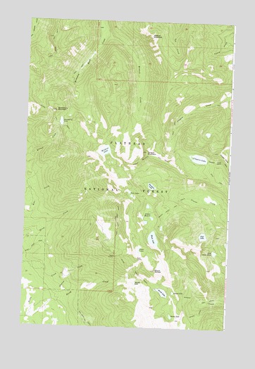
Jewel Basin, MT USGS Topographic Map
Click on map above to begin viewing in our Map Viewer.

This topographic map contains these locations and features:
Feature Name Type Latitude Longitude GNIS ID View Map
Aeneas Creek TrailTrailN48.1344°W113.8915°778878View Map
Aeneas LakeLakeN48.1396°W113.9080°778879View Map
Birch LakeLakeN48.1398°W113.9144°779934View Map
Black LakeLakeN48.1615°W113.9209°780001View Map
Blackfoot LakeLakeN48.1828°W113.9229°780036View Map
Clayton LakeLakeN48.1947°W113.8945°781345View Map
Cliff LakeLakeN48.1628°W113.8907°781388View Map
Foothills Cross Country Ski AreaLocaleN48.1430°W113.9926°1796089View Map
Foothills Cross-Country Ski AreaLocaleN48.1397°W113.9987°794280View Map
Graves Creek TrailTrailN48.1738°W113.9096°784229View Map
In-thlam-keh LakeLakeN48.1300°W113.9090°791365View Map
Jewel BasinBasinN48.1702°W113.9243°785477View Map
Jewel Basin Hiking AreaLocaleN48.1666°W113.9009°1796088View Map
Jimmie Ridge TrailTrailN48.2389°W113.9840°785491View Map
Lake Seven AcresLakeN48.1562°W113.8834°790244View Map
Martha LakeLakeN48.1433°W113.9317°786876View Map
Mount AeneasSummitN48.1486°W113.9193°778880View Map
Noisy Creek Notch TrailTrailN48.1683°W113.9426°788049View Map
Picnic LakesLakeN48.1561°W113.9294°788834View Map
Pioneer Ridge TrailTrailN48.1933°W113.8840°788942View Map
Station CreekStreamN48.1358°W113.9926°791465View Map
Strawberry LakeLakeN48.2085°W113.9791°777260View Map
Strawberry Lake Forest Service StationLocaleN48.2111°W113.9807°798858View Map
Strawberry MountainSummitN48.2130°W113.9815°791595View Map
Tongue MountainSummitN48.1969°W113.9257°792264View Map
Tongue Mountain TrailTrailN48.1950°W113.9221°777702View Map
Twin LakesLakeN48.1789°W113.9349°792523View Map
Wildcat CreekStreamN48.2433°W113.9554°793296View Map
Wildcat LakeLakeN48.1971°W113.9516°793299View Map
Wildcat MountainSummitN48.2439°W113.9246°793301View Map

Note: Coordinates in the location and feature list above are referenced to NAD83 datum.


Copyright (C) 2008-2024 Ryan Niemi / Sunset Dynamics ... All Rights Reserved