TopoQuest Logo
Do you find TopoQuest useful?
Help keep TopoQuest running and adding new maps/features by donating!
Bitcoin:  19c7KJd3qBynnjoSw5npx9KScwjBe4ifkT
Litecoin:  LXs6TkuXGGXo1vDsWCkWVdjQX94eUKd6ui
Home View Maps Find Maps Find Places Resources & Links


Jimmey Mountain, Maine Topographic Map

USGS Map Title: Jimmey Mountain, ME
USGS Map MRC: 45067F8
DRG (GeoTIFF) Download: o45067f8.tif


Neighboring USGS Topographic Map Quads:


  Alder Brook, ME  
45068G1
 

  Haynesville, ME  
45067G8
 

  Orient, ME  
45067G7
 

  Wytopitlock, ME  
45068F1
 

  Jimmey Mountain, ME  
45067F8
 

  Danforth, ME  
45067F7
 

  Potter Hill, ME  
45068E1
 

  Stetson Mountain, ME  
45067E8
 

  Brookton, ME  
45067E7


Map MRC Location:

N46°
W68°
N46°
W67°
H8 H7 H6 H5 H4 H3 H2 H1
G8 G7 G6 G5 G4 G3 G2 G1
F8 F7 F6 F5 F4 F3 F2 F1
E8 E7 E6 E5 E4 E3 E2 E1
D8 D7 D6 D5 D4 D3 D2 D1
C8 C7 C6 C5 C4 C3 C2 C1
B8 B7 B6 B5 B4 B3 B2 B1
A8 A7 A6 A5 A4 A3 A2 A1
N45°
W68°
N45°
W67°

Jimmey Mountain, ME USGS 1:24K Topographic Map Preview:
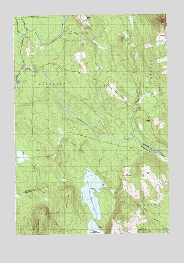
Jimmey Mountain, ME USGS Topographic Map
Click on map above to begin viewing in our Map Viewer.

This topographic map contains these locations and features:
Feature Name Type Latitude Longitude GNIS ID View Map
Baldwin BrookStreamN45.6253°W67.8770°561543View Map
Baskahegan StreamStreamN45.7192°W67.9931°561697View Map
Battle BrookStreamN45.7378°W67.9925°561730View Map
Black PointCapeN45.6509°W67.9367°562485View Map
Bonner SchoolSchoolN45.6506°W67.8925°562728View Map
Cropley TurnPopulated PlaceN45.6895°W67.8903°579221View Map
Daggett RidgeRidgeN45.6723°W67.9467°564736View Map
Dingey PondLakeN45.6973°W67.9036°565111View Map
Hardwood RidgeRidgeN45.6451°W67.9578°567630View Map
Hot BrookStreamN45.6815°W67.9339°568338View Map
Irish SettlementPopulated PlaceN45.6578°W67.9117°579432View Map
Jimmey MountainSummitN45.6302°W67.9800°568839View Map
Kinney CoveBayN45.6528°W67.9281°569218View Map
Little Battle BrookStreamN45.7412°W67.9878°569666View Map
Lower Hot Brook LakeLakeN45.6485°W67.9373°570508View Map
Mud CoveBayN45.6592°W67.9414°571859View Map
Peekaboo MountainSummitN45.7462°W67.8801°573128View Map
Pine CoveBayN45.6470°W67.9467°573350View Map
Russell Camp (historical)LocaleN45.6265°W67.9575°574608View Map
Shorey BrookStreamN45.7420°W67.9595°575434View Map
Shorey HillSummitN45.7483°W67.9407°575436View Map
Snow MountainSummitN45.6581°W67.8917°575685View Map
South BancroftPopulated PlaceN45.7209°W67.9853°579712View Map
The SandbarBarN45.6290°W67.9342°576917View Map
Toole Bean Spinney CemeteryCemeteryN45.7200°W67.9825°2678608View Map
Town of BancroftCivilN45.7020°W67.9752°582339View Map
Trout BrookStreamN45.6803°W67.9047°577325View Map
Trout Brook CemeteryCemeteryN45.6952°W67.9025°577337View Map
Trout Brook RidgeRidgeN45.7062°W67.9197°577341View Map
WestonPopulated PlaceN45.7331°W67.8781°579830View Map
Weston Community ChurchChurchN45.7334°W67.8761°1910706View Map

Note: Coordinates in the location and feature list above are referenced to NAD83 datum.


Copyright (C) 2008-2025 Ryan Niemi / Sunset Dynamics ... All Rights Reserved