TopoQuest Logo
Do you find TopoQuest useful?
Help keep TopoQuest running and adding new maps/features by donating!
Bitcoin:  19c7KJd3qBynnjoSw5npx9KScwjBe4ifkT
Litecoin:  LXs6TkuXGGXo1vDsWCkWVdjQX94eUKd6ui
Home View Maps Find Maps Find Places Resources & Links


Joaquin Rocks, California Topographic Map

USGS Map Title: Joaquin Rocks, CA
USGS Map MRC: 36120C4
DRG (GeoTIFF) Download: o36120c4.tif


Neighboring USGS Topographic Map Quads:


  Ciervo Mountain, CA  
36120D5
 

  Lillis Ranch, CA  
36120D4
 

  Tres Picos Farms, CA  
36120D3
 

  Santa Rita Peak, CA  
36120C5
 

  Joaquin Rocks, CA  
36120C4
 

  Domengine Ranch, CA  
36120C3
 

  Sherman Peak, CA  
36120B5
 

  Alcalde Hills, CA  
36120B4
 

  Coalinga, CA  
36120B3


Map MRC Location:

N37°
W121°
N37°
W120°
H8 H7 H6 H5 H4 H3 H2 H1
G8 G7 G6 G5 G4 G3 G2 G1
F8 F7 F6 F5 F4 F3 F2 F1
E8 E7 E6 E5 E4 E3 E2 E1
D8 D7 D6 D5 D4 D3 D2 D1
C8 C7 C6 C5 C4 C3 C2 C1
B8 B7 B6 B5 B4 B3 B2 B1
A8 A7 A6 A5 A4 A3 A2 A1
N36°
W121°
N36°
W120°

Joaquin Rocks, CA USGS 1:24K Topographic Map Preview:
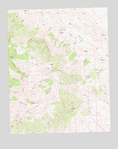
Joaquin Rocks, CA USGS Topographic Map
Click on map above to begin viewing in our Map Viewer.

This topographic map contains these locations and features:
Feature Name Type Latitude Longitude GNIS ID View Map
Anticline RidgeRidgeN36.3044°W120.4032°255266View Map
Big Blue HillsRangeN36.3563°W120.4038°1660332View Map
Black MountainSummitN36.3044°W120.4032°239427View Map
Domengine SpringSpringN36.3312°W120.4022°241550View Map
Donut RockSummitN36.2738°W120.4227°241565View Map
Double Trough SpringSpringN36.3510°W120.4359°241583View Map
Homestead SpringSpringN36.3468°W120.3799°243608View Map
Horsethief CanyonValleyN36.3716°W120.4846°243672View Map
Joaquin RocksPillarN36.3197°W120.4588°244070View Map
Joaquin SpringSpringN36.3152°W120.4532°244071View Map
KWEW-TV (Coalinga)TowerN36.3047°W120.4032°1663156View Map
Little Oak SpringSpringN36.3340°W120.3883°244934View Map
Mare SpringSpringN36.3593°W120.4240°245497View Map
Martinez SpringSpringN36.3396°W120.4162°245576View Map
Nehi CanyonValleyN36.2908°W120.4840°2061150View Map
Portuguese CanyonValleyN36.3041°W120.4871°247706View Map
Rattlesnake SpringSpringN36.3742°W120.4759°248009View Map
Sulphur Flat SpringSpringN36.3215°W120.3814°250044View Map
The ClearingFlatN36.3186°W120.4221°250370View Map
Twentyfive CanyonValleyN36.3716°W120.4602°250732View Map
Urruttia CanyonValleyN36.3688°W120.4415°250867View Map
Zalba SpringSpringN36.3272°W120.4947°2085443View Map

Note: Coordinates in the location and feature list above are referenced to NAD83 datum.


Copyright (C) 2008-2024 Ryan Niemi / Sunset Dynamics ... All Rights Reserved