TopoQuest Logo
Do you find TopoQuest useful?
Help keep TopoQuest running and adding new maps/features by donating!
Bitcoin:  19c7KJd3qBynnjoSw5npx9KScwjBe4ifkT
Litecoin:  LXs6TkuXGGXo1vDsWCkWVdjQX94eUKd6ui
Home View Maps Find Maps Find Places Resources & Links


Sherman Peak, California Topographic Map

USGS Map Title: Sherman Peak, CA
USGS Map MRC: 36120B5
DRG (GeoTIFF) Download: o36120b5.tif


Neighboring USGS Topographic Map Quads:


  San Benito Mountain, CA  
36120C6
 

  Santa Rita Peak, CA  
36120C5
 

  Joaquin Rocks, CA  
36120C4
 

  Priest Valley, CA  
36120B6
 

  Sherman Peak, CA  
36120B5
 

  Alcalde Hills, CA  
36120B4
 

  Slack Canyon, CA  
36120A6
 

  Smith Mountain, CA  
36120A5
 

  Curry Mountain, CA  
36120A4


Map MRC Location:

N37°
W121°
N37°
W120°
H8 H7 H6 H5 H4 H3 H2 H1
G8 G7 G6 G5 G4 G3 G2 G1
F8 F7 F6 F5 F4 F3 F2 F1
E8 E7 E6 E5 E4 E3 E2 E1
D8 D7 D6 D5 D4 D3 D2 D1
C8 C7 C6 C5 C4 C3 C2 C1
B8 B7 B6 B5 B4 B3 B2 B1
A8 A7 A6 A5 A4 A3 A2 A1
N36°
W121°
N36°
W120°

Sherman Peak, CA USGS 1:24K Topographic Map Preview:
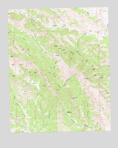
Sherman Peak, CA USGS Topographic Map
Click on map above to begin viewing in our Map Viewer.

This topographic map contains these locations and features:
Feature Name Type Latitude Longitude GNIS ID View Map
Bald MountainRidgeN36.1955°W120.5952°238920View Map
Barberry SpringSpringN36.1941°W120.6223°238981View Map
Barr SpringSpringN36.1967°W120.5304°238997View Map
Bear GulchValleyN36.2283°W120.6238°239101View Map
Bee CanyonValleyN36.1372°W120.6154°239145View Map
Center PeakSummitN36.2022°W120.6232°240406View Map
Chimney CanyonValleyN36.2259°W120.5302°2061148View Map
Coalinga Mineral SpringsSpringN36.1444°W120.5554°255483View Map
Devils GateGapN36.1827°W120.6218°241463View Map
Diaz CanyonValleyN36.2283°W120.5024°241491View Map
Dogwood CanyonValleyN36.1263°W120.6038°241531View Map
Dutchman CanyonValleyN36.1252°W120.5227°241689View Map
Elliot SpringSpringN36.1900°W120.5232°241975View Map
Flag PeakSummitN36.1783°W120.5310°242290View Map
Freitas SpringSpringN36.1816°W120.5210°242477View Map
Goat MountainSummitN36.2086°W120.6085°242761View Map
Goat SpringSpringN36.2046°W120.5543°242768View Map
Grabast CanyonValleyN36.1666°W120.5641°242874View Map
Gravelly FlatFlatN36.1744°W120.5932°242962View Map
Hans Grieve CanyonValleyN36.1302°W120.6046°243176View Map
Hollyhock SpringSpringN36.2118°W120.5649°243548View Map
Jack Hart SpringSpringN36.1794°W120.5134°243950View Map
Juniper RidgeRidgeN36.1883°W120.5429°244173View Map
Kreyenhagen PeakSummitN36.1588°W120.5477°244369View Map
Lewis CanyonValleyN36.2347°W120.5553°2084367View Map
Little Oak FlatFlatN36.1655°W120.5379°244933View Map
Live Oak SpringSpringN36.1939°W120.6123°244979View Map
Los Gatos Creek County ParkParkN36.2319°W120.5727°245171View Map
Markland CanyonValleyN36.1316°W120.5296°245538View Map
Middle SpringSpringN36.2072°W120.5591°245881View Map
Moonshine SpringSpringN36.1874°W120.5189°246172View Map
Mud RunStreamN36.2261°W120.5182°246325View Map
Pine CanyonValleyN36.2388°W120.5104°247490View Map
Robbers CanyonValleyN36.2233°W120.6141°248260View Map
Roberts CanyonValleyN36.2228°W120.6147°2084366View Map
Rock House SpringSpringN36.2272°W120.5099°2061151View Map
Sherman PeakSummitN36.2022°W120.5616°249400View Map
Skeleton SpringSpringN36.2056°W120.5386°249537View Map
Skelton SpringSpringN36.2058°W120.5383°2084424View Map
Stove CanyonValleyN36.1866°W120.5710°249972View Map
Stove RidgeRidgeN36.2005°W120.5468°249973View Map
Stove SpringSpringN36.2053°W120.5467°249974View Map
Studhorse CanyonValleyN36.2238°W120.5302°249995View Map
The GorgeValleyN36.2161°W120.6007°250379View Map
Tule SpringSpringN36.1862°W120.6014°250681View Map
West SpringSpringN36.2093°W120.5644°251379View Map
Willow SpringSpringN36.1856°W120.5947°251646View Map

Note: Coordinates in the location and feature list above are referenced to NAD83 datum.


Copyright (C) 2008-2024 Ryan Niemi / Sunset Dynamics ... All Rights Reserved