TopoQuest Logo
Do you find TopoQuest useful?
Help keep TopoQuest running and adding new maps/features by donating!
Bitcoin:  19c7KJd3qBynnjoSw5npx9KScwjBe4ifkT
Litecoin:  LXs6TkuXGGXo1vDsWCkWVdjQX94eUKd6ui
Home View Maps Find Maps Find Places Resources & Links


Ball Coulee, Montana Topographic Map

USGS Map Title: Ball Coulee, MT
USGS Map MRC: 48108A4
DRG (GeoTIFF) Download: o48108a4.tif


Neighboring USGS Topographic Map Quads:


  Lodge Pole NE, MT  
48108B5
 

  Big Flat West, MT  
48108B4
 

  Big Flat East, MT  
48108B3
 

  Lodge Pole, MT  
48108A5
 

  Ball Coulee, MT  
48108A4
 

  Ester Lake, MT  
48108A3
 

  Zortman, MT  
47108H5
 

  Bear Mountain, MT  
47108H4
 

  Coburn Butte, MT  
47108H3


Map MRC Location:

N49°
W109°
N49°
W108°
H8 H7 H6 H5 H4 H3 H2 H1
G8 G7 G6 G5 G4 G3 G2 G1
F8 F7 F6 F5 F4 F3 F2 F1
E8 E7 E6 E5 E4 E3 E2 E1
D8 D7 D6 D5 D4 D3 D2 D1
C8 C7 C6 C5 C4 C3 C2 C1
B8 B7 B6 B5 B4 B3 B2 B1
A8 A7 A6 A5 A4 A3 A2 A1
N48°
W109°
N48°
W108°

Ball Coulee, MT USGS 1:24K Topographic Map Preview:
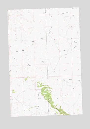
Ball Coulee, MT USGS Topographic Map
Click on map above to begin viewing in our Map Viewer.

This topographic map contains these locations and features:
Feature Name Type Latitude Longitude GNIS ID View Map
26N25E01ACAB01 WellWellN48.0417°W108.4418°825771View Map
26N25E11CAC_01 WellWellN48.0206°W108.4707°825578View Map
26N25E12CAC_01 WellWellN48.0211°W108.4499°825582View Map
26N25E12CDC_01 WellWellN48.0172°W108.4485°825561View Map
26N25E13BBA_01 WellWellN48.0147°W108.4515°825539View Map
27N25E25DACC01 WellWellN48.0636°W108.4385°825934View Map
27N25E25DADB01 WellWellN48.0658°W108.4365°825944View Map
27N26E17CBCB01 WellWellN48.0936°W108.4101°826167View Map
27N26E17CBCD01 WellWellN48.0931°W108.4099°826163View Map
27N26E18CBAB01 WellWellN48.0961°W108.4310°826195View Map
27N26E21ACB_01 WellWellN48.0847°W108.3799°826103View Map
27N26E29BCAC01 WellWellN48.0692°W108.4085°825983View Map
27N26E29BCBB01 WellWellN48.0706°W108.4121°826005View Map
Ball CouleeValleyN48.0808°W108.3810°768481View Map
Big Warm (historical)Populated PlaceN48.0203°W108.4493°1722408View Map
Big Warm CemeteryCemeteryN48.0072°W108.4662°768834View Map
Big Warm School (historical)SchoolN48.0200°W108.4499°1722310View Map
Chopwoid CemeteryCemeteryN48.0076°W108.4781°769858View Map
Fort Belknap Number 6 DamDamN48.1167°W108.4090°797985View Map
Fort Belknap Number 7 DamDamN48.1017°W108.3790°797986View Map
Fort Belknap Number 8 DamDamN48.0350°W108.4707°797964View Map
Government Field ReservoirReservoirN48.0845°W108.3837°771885View Map
Government Field Reservoir DamDamN48.0833°W108.3807°796441View Map
Judith River RidgeRidgeN48.0044°W108.4140°772917View Map
Kirkaldie CemeteryCemeteryN48.0267°W108.4512°773085View Map
Lodge Pole DistrictCivilN48.0798°W108.4599°2419002View Map
Lone Tree CouleeValleyN48.0983°W108.4243°773586View Map
Messerly CemeteryCemeteryN48.0630°W108.4393°774116View Map

Note: Coordinates in the location and feature list above are referenced to NAD83 datum.


Copyright (C) 2008-2025 Ryan Niemi / Sunset Dynamics ... All Rights Reserved