TopoQuest Logo
Do you find TopoQuest useful?
Help keep TopoQuest running and adding new maps/features by donating!
Bitcoin:  19c7KJd3qBynnjoSw5npx9KScwjBe4ifkT
Litecoin:  LXs6TkuXGGXo1vDsWCkWVdjQX94eUKd6ui
Home View Maps Find Maps Find Places Resources & Links


Lodge Pole, Montana Topographic Map

USGS Map Title: Lodge Pole, MT
USGS Map MRC: 48108A5
DRG (GeoTIFF) Download: o48108a5.tif


Neighboring USGS Topographic Map Quads:


  Lodge Pole NW, MT  
48108B6
 

  Lodge Pole NE, MT  
48108B5
 

  Big Flat West, MT  
48108B4
 

  Stiffarm Coulee, MT  
48108A6
 

  Lodge Pole, MT  
48108A5
 

  Ball Coulee, MT  
48108A4
 

  Hays, MT  
47108H6
 

  Zortman, MT  
47108H5
 

  Bear Mountain, MT  
47108H4


Map MRC Location:

N49°
W109°
N49°
W108°
H8 H7 H6 H5 H4 H3 H2 H1
G8 G7 G6 G5 G4 G3 G2 G1
F8 F7 F6 F5 F4 F3 F2 F1
E8 E7 E6 E5 E4 E3 E2 E1
D8 D7 D6 D5 D4 D3 D2 D1
C8 C7 C6 C5 C4 C3 C2 C1
B8 B7 B6 B5 B4 B3 B2 B1
A8 A7 A6 A5 A4 A3 A2 A1
N48°
W109°
N48°
W108°

Lodge Pole, MT USGS 1:24K Topographic Map Preview:
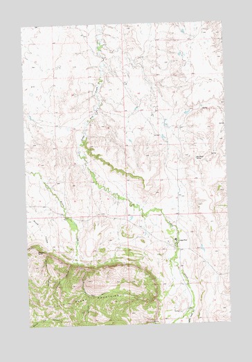
Lodge Pole, MT USGS Topographic Map
Click on map above to begin viewing in our Map Viewer.

This topographic map contains these locations and features:
Feature Name Type Latitude Longitude GNIS ID View Map
26N24E02ACB_01 WellWellN48.0400°W108.5932°825744View Map
26N25E05ACAD01 WellWellN48.0400°W108.5260°825743View Map
26N25E05BDDA01 WellWellN48.0394°W108.5321°825741View Map
26N25E05BDDA02 WellWellN48.0394°W108.5318°825740View Map
26N25E05BDDD01 WellWellN48.0389°W108.5318°825736View Map
26N25E05CAA_01 WellWellN48.0375°W108.5321°825727View Map
26N25E05CAA_02 WellWellN48.0372°W108.5329°825725View Map
26N25E05CAA_03 WellWellN48.0367°W108.5318°825716View Map
26N25E05CAAA01 WellWellN48.0381°W108.5324°825730View Map
26N25E05CAAA02 WellWellN48.0381°W108.5324°825731View Map
26N25E05CAAA03 WellWellN48.0372°W108.5324°825723View Map
26N25E05CAAA04 WellWellN48.0372°W108.5324°825724View Map
26N25E05CABD01 WellWellN48.0369°W108.5340°825721View Map
26N25E05CACA01 WellWellN48.0361°W108.5351°825708View Map
26N25E05CAD_01 WellWellN48.0356°W108.5313°825705View Map
26N25E05CAD_02 WellWellN48.0347°W108.5318°825698View Map
26N25E05CAD_03 WellWellN48.0350°W108.5318°825701View Map
26N25E05CADA01 WellWellN48.0356°W108.5315°825706View Map
26N25E05CBC_01 WellWellN48.0361°W108.5393°825709View Map
26N25E05CCA_01 WellWellN48.0342°W108.5379°825693View Map
26N25E05CCB_01 WellWellN48.0333°W108.5396°825686View Map
26N25E05CDA_01 WellWellN48.0344°W108.5332°825695View Map
26N25E05CDA_02 WellWellN48.0342°W108.5332°825692View Map
26N25E05CDA_03 WellWellN48.0344°W108.5329°825694View Map
26N25E05CDBD01 WellWellN48.0333°W108.5346°825685View Map
26N25E05CDC_01 WellWellN48.0319°W108.5360°825670View Map
26N25E05CDC_02 WellWellN48.0319°W108.5357°825669View Map
26N25E05CDC_03 WellWellN48.0314°W108.5349°825666View Map
26N25E05CDC_04 WellWellN48.0314°W108.5346°825665View Map
26N25E05DCC_01 WellWellN48.0317°W108.5301°825667View Map
26N25E06ACB_01 WellWellN48.0411°W108.5518°825769View Map
26N25E08ABA_01 WellWellN48.0314°W108.5276°825663View Map
26N25E08ABA_02 WellWellN48.0314°W108.5279°825664View Map
26N25E08BAB_01 WellWellN48.0297°W108.5343°825651View Map
26N25E08BAB_02 WellWellN48.0297°W108.5346°825652View Map
26N25E08BAD_01 WellWellN48.0278°W108.5324°825638View Map
26N25E08BBDA01 WellWellN48.0283°W108.5368°825642View Map
26N25E08BCA_01 WellWellN48.0269°W108.5376°825631View Map
26N25E08BCA_02 WellWellN48.0258°W108.5379°825618View Map
26N25E08BCDB01 WellWellN48.0247°W108.5385°825606View Map
26N25E08BDA_01 WellWellN48.0264°W108.5329°825621View Map
26N25E08BDAC01 WellWellN48.0261°W108.5335°825620View Map
26N25E08BDBC01 WellWellN48.0264°W108.5354°825622View Map
26N25E08BDC_01 WellWellN48.0247°W108.5343°825605View Map
26N25E08BDC_02 WellWellN48.0239°W108.5346°825600View Map
26N25E08BDC_03 WellWellN48.0239°W108.5363°825601View Map
26N25E08CCAA01 WellWellN48.0197°W108.5368°825573View Map
26N25E08DBC_01 WellWellN48.0214°W108.5304°825584View Map
26N25E08DCDC01 WellWellN48.0167°W108.5279°825556View Map
26N25E17ABBB01 WellWellN48.0158°W108.5299°825552View Map
26N25E17ABBB02 WellWellN48.0158°W108.5299°825553View Map
26N25E17BAAA01 WellWellN48.0156°W108.5313°825546View Map
26N25E17BCAB01 WellWellN48.0125°W108.5390°825527View Map
26N25E17CDD_01 WellWellN48.0019°W108.5318°825455View Map
26N25E17DACB01 WellWellN48.0064°W108.5254°825481View Map
26N25E20BABA01 WellWellN48.0014°W108.5338°825454View Map
26N25E20BABA02 WellWellN48.0011°W108.5349°825442View Map
27N24E01CDAA01 WellWellN48.1206°W108.5746°826435View Map
27N24E13CCDA01 WellWellN48.0900°W108.5799°826133View Map
27N24E13CCDB01 WellWellN48.0900°W108.5804°826134View Map
27N24E13CCDB02 WellWellN48.0900°W108.5804°826135View Map
27N24E13CCDB03 WellWellN48.0900°W108.5813°826136View Map
27N24E13CDCB01 WellWellN48.0897°W108.5788°826130View Map
27N24E26ABDC01 WellWellN48.0714°W108.5924°826008View Map
27N24E26ADCA01 WellWellN48.0683°W108.5882°825972View Map
27N24E26ADCD01 WellWellN48.0669°W108.5877°825962View Map
27N24E26DADC01 WellWellN48.0611°W108.5865°825910View Map
27N24E35CCAB01 WellWellN48.0489°W108.6027°825824View Map
27N24E35CDBC01 WellWellN48.0475°W108.5999°825807View Map
27N24E35CDC_01 WellWellN48.0469°W108.6004°825806View Map
27N24E36DAAC01 WellWellN48.0514°W108.5649°825837View Map
27N24E36DAAC02 WellWellN48.0511°W108.5646°825835View Map
27N24E36DAAC03 WellWellN48.0511°W108.5646°825836View Map
27N25E20BCA_01 WellWellN48.0839°W108.5388°826094View Map
27N25E20BCD_01 WellWellN48.0803°W108.5385°826065View Map
27N25E29BDBA01 WellWellN48.0706°W108.5340°826006View Map
27N25E29CDDD01 WellWellN48.0600°W108.5315°825907View Map
27N25E31BCCD01 WellWellN48.0528°W108.5610°825851View Map
27N25E31CDDB01 WellWellN48.0464°W108.5382°825800View Map
27N25E32CCC_01 WellWellN48.0461°W108.5401°825792View Map
Assembly of God ChurchChurchN48.0347°W108.5332°1722216View Map
Blackbull SpringSpringN48.0685°W108.5192°768989View Map
Fort Belknap Volunteer Fire Department LodgepoleBuildingN48.0341°W108.5341°2546506View Map
Jim Brown CanyonValleyN48.0250°W108.5938°772820View Map
Kirkaldie DamDamN48.0867°W108.5240°797901View Map
Little Rocky MountainsRangeN48.0094°W108.6018°773481View Map
Lodge PolePopulated PlaceN48.0347°W108.5332°773540View Map
Lodge Pole Census Designated PlaceCensusN48.0272°W108.5517°2408627View Map
Lodge Pole Post Office (historical)Post OfficeN48.0347°W108.5332°1722456View Map
Lodge Pole SchoolSchoolN48.0350°W108.5332°1722309View Map
Lodgepole Alliance ChurchChurchN48.0347°W108.5332°1722214View Map
Mouse ButteSummitN48.0305°W108.6190°774439View Map
Mouse CanyonValleyN48.0300°W108.6138°774440View Map
Saint Thomas ChurchChurchN48.0347°W108.5332°1722215View Map
Valentine CanyonValleyN48.0258°W108.5990°777967View Map
White Horse CanyonValleyN48.0064°W108.5232°778383View Map

Note: Coordinates in the location and feature list above are referenced to NAD83 datum.


Copyright (C) 2008-2025 Ryan Niemi / Sunset Dynamics ... All Rights Reserved