TopoQuest Logo
Do you find TopoQuest useful?
Help keep TopoQuest running and adding new maps/features by donating!
Bitcoin:  19c7KJd3qBynnjoSw5npx9KScwjBe4ifkT
Litecoin:  LXs6TkuXGGXo1vDsWCkWVdjQX94eUKd6ui
Home View Maps Find Maps Find Places Resources & Links


Johnson Saddle, Oregon Topographic Map

USGS Map Title: Johnson Saddle, OR
USGS Map MRC: 44119E1
DRG (GeoTIFF) Download: o44119e1.tif


Neighboring USGS Topographic Map Quads:


  Fox, OR  
44119F2
 

  Long Creek, OR  
44119F1
 

  Keeney Point, OR  
44118F8
 

  Belshaw Meadows, OR  
44119E2
 

  Johnson Saddle, OR  
44119E1
 

  Magone Lake, OR  
44118E8
 

  Wolfinger Butte, OR  
44119D2
 

  Mount Vernon, OR  
44119D1
 

  John Day, OR  
44118D8


Map MRC Location:

N45°
W120°
N45°
W119°
H8 H7 H6 H5 H4 H3 H2 H1
G8 G7 G6 G5 G4 G3 G2 G1
F8 F7 F6 F5 F4 F3 F2 F1
E8 E7 E6 E5 E4 E3 E2 E1
D8 D7 D6 D5 D4 D3 D2 D1
C8 C7 C6 C5 C4 C3 C2 C1
B8 B7 B6 B5 B4 B3 B2 B1
A8 A7 A6 A5 A4 A3 A2 A1
N44°
W120°
N44°
W119°

Johnson Saddle, OR USGS 1:24K Topographic Map Preview:
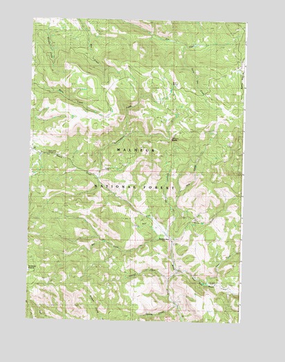
Johnson Saddle, OR USGS Topographic Map
Click on map above to begin viewing in our Map Viewer.

This topographic map contains these locations and features:
Feature Name Type Latitude Longitude GNIS ID View Map
Bear CreekStreamN44.5357°W119.0444°1117356View Map
Bear SpringSpringN44.5988°W119.0430°1117397View Map
Beech Creek Forest CampLocaleN44.5679°W119.1136°1167040View Map
Beech Creek SummitGapN44.5713°W119.1247°1156941View Map
Clear CreekStreamN44.5157°W119.0219°1139785View Map
Cottonwood CampLocaleN44.5588°W119.0869°1167331View Map
Cottonwood CreekStreamN44.5590°W119.0852°1119321View Map
Cottonwood Recreation SiteLocaleN44.5624°W119.0861°1638098View Map
Cottonwood SpringSpringN44.5686°W119.0856°1156944View Map
East Fork Beech CreekStreamN44.5204°W119.0383°1141530View Map
Ennis CreekStreamN44.5321°W119.0405°1133817View Map
Forty Day CreekStreamN44.6152°W119.0361°1119721View Map
Fox CampLocaleN44.6185°W119.0066°1638095View Map
Hog CreekStreamN44.5421°W119.0391°1121873View Map
Johnson CreekStreamN44.5357°W119.0444°1122470View Map
Johnson SaddleGapN44.5757°W119.0433°1122494View Map
Laycock CreekStreamN44.5174°W119.0433°1123006View Map
Little Bear CreekStreamN44.5374°W119.0472°1123128View Map
Mountain RestLocaleN44.5340°W119.0427°1133818View Map
Mountain RestLocaleN44.5340°W119.0436°1638099View Map
Raddue Guard StationBuildingN44.5632°W119.0777°1125769View Map
Raddue SpringSpringN44.5631°W119.0752°1156943View Map
Shrier SpringSpringN44.5647°W119.0704°1156942View Map

Note: Coordinates in the location and feature list above are referenced to NAD83 datum.


Copyright (C) 2008-2025 Ryan Niemi / Sunset Dynamics ... All Rights Reserved