TopoQuest Logo
Do you find TopoQuest useful?
Help keep TopoQuest running and adding new maps/features by donating!
Bitcoin:  19c7KJd3qBynnjoSw5npx9KScwjBe4ifkT
Litecoin:  LXs6TkuXGGXo1vDsWCkWVdjQX94eUKd6ui
Home View Maps Find Maps Find Places Resources & Links


Jonesville, South Carolina Topographic Map

USGS Map Title: Jonesville, SC
USGS Map MRC: 34081G6
DRG (GeoTIFF) Download: o34081g6.tif


Neighboring USGS Topographic Map Quads:


  Pacolet, SC  
34081H7
 

  Pacolet Mills, SC  
34081H6
 

  Wilkinsville, SC  
34081H5
 

  Glenn Springs, SC  
34081G7
 

  Jonesville, SC  
34081G6
 

  Kelton, SC  
34081G5
 

  Cross Anchor, SC  
34081F7
 

  Union West, SC  
34081F6
 

  Union East, SC  
34081F5


Map MRC Location:

N35°
W82°
N35°
W81°
H8 H7 H6 H5 H4 H3 H2 H1
G8 G7 G6 G5 G4 G3 G2 G1
F8 F7 F6 F5 F4 F3 F2 F1
E8 E7 E6 E5 E4 E3 E2 E1
D8 D7 D6 D5 D4 D3 D2 D1
C8 C7 C6 C5 C4 C3 C2 C1
B8 B7 B6 B5 B4 B3 B2 B1
A8 A7 A6 A5 A4 A3 A2 A1
N34°
W82°
N34°
W81°

Jonesville, SC USGS 1:24K Topographic Map Preview:
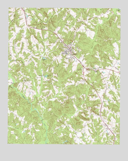
Jonesville, SC USGS Topographic Map
Click on map above to begin viewing in our Map Viewer.

This topographic map contains these locations and features:
Feature Name Type Latitude Longitude GNIS ID View Map
Barkham School (historical)SchoolN34.7718°W81.7304°1232821View Map
Beaverdam CreekStreamN34.7940°W81.7182°1220439View Map
Bishop BranchStreamN34.7985°W81.6929°1220757View Map
Bogan PondReservoirN34.8001°W81.6665°1239530View Map
Bogan Pond Dam D-2304DamN34.8001°W81.6665°1239529View Map
BonhamPopulated PlaceN34.7768°W81.6465°1220888View Map
Bonham Fire DepartmentBuildingN34.7763°W81.6469°2578308View Map
Cedar Grove ChurchChurchN34.8262°W81.7415°1221458View Map
Cedar Grove School (historical)SchoolN34.7910°W81.7112°1232854View Map
Cedar Grove School (historical)SchoolN34.8260°W81.7423°1232855View Map
Church of GodChurchN34.8332°W81.6262°1232858View Map
Eison BranchStreamN34.8743°W81.6687°1222253View Map
Elford Grove School (historical)SchoolN34.8487°W81.6329°1232874View Map
Fair Forest Presbyterian Church GraveyardCemeteryN34.8308°W81.7466°1222339View Map
Fairforest Baptist Church (historical)ChurchN34.8312°W81.7462°1232880View Map
Fosters ChapelChurchN34.8432°W81.6890°1247811View Map
Fosters SchoolSchoolN34.8296°W81.6826°1222510View Map
Gallmans PondReservoirN34.8676°W81.7293°1239500View Map
Gallmans Pond Dam D-2148DamN34.8668°W81.7298°1239499View Map
Gault School (historical)SchoolN34.8176°W81.6359°1232899View Map
Gilead Baptist ChurchChurchN34.8499°W81.6751°1245737View Map
Gilead Baptist Church GraveyardCemeteryN34.8486°W81.6761°1232901View Map
Gist BridgeBridgeN34.7715°W81.7118°1232903View Map
Hancock CemeteryCemeteryN34.7785°W81.6301°1232920View Map
JonesvillePopulated PlaceN34.8360°W81.6809°1246204View Map
Jonesville Baptist ChurchChurchN34.8371°W81.6857°1232943View Map
Jonesville DivisionCivilN34.8430°W81.6897°1938315View Map
Jonesville Elementary SchoolSchoolN34.8376°W81.6779°1232944View Map
Jonesville Fire DepartmentBuildingN34.8329°W81.6806°2578491View Map
Jonesville High SchoolSchoolN34.8376°W81.6820°1232945View Map
Jonesville Police DepartmentBuildingN34.8358°W81.6795°2734244View Map
Jonesville Town PondReservoirN34.8550°W81.6807°1239525View Map
Jonesville Town Pond Dam D-2161DamN34.8568°W81.6798°1239524View Map
Littlejohn CemeteryCemeteryN34.8571°W81.7098°1224079View Map
Lockhart JunctionPopulated PlaceN34.8190°W81.6520°1231497View Map
Longs ChapelChurchN34.8187°W81.6707°1224188View Map
McClure CreekStreamN34.8018°W81.7434°1246579View Map
Mean CrossroadsPopulated PlaceN34.8082°W81.7320°1246614View Map
Mitchell CemeteryCemeteryN34.8607°W81.6957°1232976View Map
New Hope CemeteryCemeteryN34.8090°W81.6659°1232992View Map
New Hope United Methodist ChurchChurchN34.8082°W81.6668°1249833View Map
Rocky CreekStreamN34.7610°W81.7057°1225973View Map
Rocky Creek School (historical)SchoolN34.7974°W81.6501°1233018View Map
Rogansville (historical)Populated PlaceN34.7657°W81.7248°1233020View Map
Spear CreekStreamN34.7868°W81.7229°1250984View Map
Swink CreekStreamN34.7724°W81.7115°1251096View Map
Thompson BridgeBridgeN34.8057°W81.7443°1233053View Map
Town of JonesvilleCivilN34.8348°W81.6810°2405921View Map
Turners PondReservoirN34.7530°W81.6841°1239504View Map
Turners Pond Dam D-2150DamN34.7535°W81.6848°1239503View Map
Union County HomeBuildingN34.7646°W81.6376°1233062View Map
Union County Pond D-2151 DamDamN34.7618°W81.6382°1239505View Map
Upper Fairforest Baptist ChurchChurchN34.7676°W81.6407°1251281View Map
Upper Fairforest CemeteryCemeteryN34.7666°W81.6409°1233072View Map
Ward CemeteryCemeteryN34.8154°W81.6859°1233076View Map
Weber - Haile CemeteryCemeteryN34.8307°W81.6901°1233077View Map
White Pines LakeReservoirN34.8118°W81.7248°1239502View Map
White Pines LakeReservoirN34.8124°W81.7075°1227553View Map
White Pines Lake Dam D-2149DamN34.8118°W81.7084°1239501View Map
Whitlock LakesReservoirN34.8289°W81.7101°1227577View Map
Woodson Baptist ChurchChurchN34.7668°W81.6812°1251509View Map
Woodson School (historical)SchoolN34.7662°W81.6818°1233090View Map

Note: Coordinates in the location and feature list above are referenced to NAD83 datum.


Copyright (C) 2008-2024 Ryan Niemi / Sunset Dynamics ... All Rights Reserved