TopoQuest Logo
Do you find TopoQuest useful?
Help keep TopoQuest running and adding new maps/features by donating!
Bitcoin:  19c7KJd3qBynnjoSw5npx9KScwjBe4ifkT
Litecoin:  LXs6TkuXGGXo1vDsWCkWVdjQX94eUKd6ui
Home View Maps Find Maps Find Places Resources & Links


Baltimore, Ohio Topographic Map

USGS Map Title: Baltimore, OH
USGS Map MRC: 39082G5
DRG (GeoTIFF) Download: o39082g5.tif


Neighboring USGS Topographic Map Quads:


  Pataskala, OH  
39082H6
 

  Millersport, OH  
39082H5
 

  Thornville, OH  
39082H4
 

  Carroll, OH  
39082G6
 

  Baltimore, OH  
39082G5
 

  Rushville, OH  
39082G4
 

  Amanda, OH  
39082F6
 

  Lancaster, OH  
39082F5
 

  Bremen, OH  
39082F4


Map MRC Location:

N40°
W83°
N40°
W82°
H8 H7 H6 H5 H4 H3 H2 H1
G8 G7 G6 G5 G4 G3 G2 G1
F8 F7 F6 F5 F4 F3 F2 F1
E8 E7 E6 E5 E4 E3 E2 E1
D8 D7 D6 D5 D4 D3 D2 D1
C8 C7 C6 C5 C4 C3 C2 C1
B8 B7 B6 B5 B4 B3 B2 B1
A8 A7 A6 A5 A4 A3 A2 A1
N39°
W83°
N39°
W82°

Baltimore, OH USGS 1:24K Topographic Map Preview:
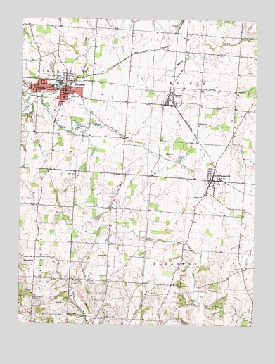
Baltimore, OH USGS Topographic Map
Click on map above to begin viewing in our Map Viewer.

This topographic map contains these locations and features:
Feature Name Type Latitude Longitude GNIS ID View Map
Alt ParkParkN39.8603°W82.5999°1806791View Map
BaltimorePopulated PlaceN39.8453°W82.6007°1064378View Map
Baltimore Campground (historical)LocaleN39.8120°W82.6104°1068240View Map
Baltimore CemeteryCemeteryN39.8462°W82.5982°1806795View Map
Baltimore Police DepartmentBuildingN39.8458°W82.6056°2732870View Map
Baltimore Post OfficePost OfficeN39.8460°W82.6062°1985009View Map
Baltimore United Methodist ChurchChurchN39.8456°W82.6029°1963000View Map
Baltimore Village HallBuildingN39.8453°W82.6017°2126008View Map
Baptist Corners CemeteryCemeteryN39.7733°W82.5059°1806796View Map
Basil Joint Fire District Station 610 HeadquartersBuildingN39.8473°W82.6062°2549413View Map
Basil Memorial CemeteryCemeteryN39.8450°W82.6240°1806837View Map
Baughman School (historical)SchoolN39.8709°W82.5665°1056131View Map
Bethel CemeteryCemeteryN39.8114°W82.5957°1037916View Map
Dumontsville CemeteryCemeteryN39.7776°W82.6132°1806808View Map
DumontvillePopulated PlaceN39.7773°W82.6163°1064562View Map
Dumontville Post Office (historical)Post OfficeN39.7778°W82.6166°1985023View Map
Dumontville United Methodist ChurchChurchN39.7773°W82.6168°1963003View Map
Estate Golf ClubLocaleN39.7812°W82.5804°1806809View Map
Fairfield Baptist CemeteryCemeteryN39.8399°W82.5498°2765662View Map
Floral Hills Memory GardensCemeteryN39.7676°W82.5904°1040532View Map
Geiger CemeteryCemeteryN39.8145°W82.5235°1806813View Map
Geohegan - Old Baltimore CemeteryCemeteryN39.8463°W82.5982°1806814View Map
Gideon CemeteryCemeteryN39.7526°W82.5891°1806815View Map
Gideon United Brethren Church (historical)ChurchN39.7515°W82.5893°1806816View Map
Hampson CemeteryCemeteryN39.8026°W82.5260°1041278View Map
Heistand CemeteryCemeteryN39.8268°W82.5905°1806821View Map
Industry Air ParkAirportN39.8430°W82.5785°1082480View Map
Johnson ParkParkN39.8431°W82.5988°1042114View Map
Kellers CourtPopulated PlaceN39.8425°W82.5411°2460913View Map
Kilbarger PondReservoirN39.7723°W82.5904°1078802View Map
Kilbarger Pond DamDamN39.7717°W82.5899°1078801View Map
Kumler CemeteryCemeteryN39.8635°W82.5895°2765657View Map
Liberty-Union High SchoolSchoolN39.8473°W82.6088°1056161View Map
Liberty-Union Middle SchoolSchoolN39.8470°W82.6079°1056162View Map
Living Word Assembly of God ChurchChurchN39.8462°W82.6024°1963006View Map
Maple Grove ChurchChurchN39.8690°W82.5646°1042954View Map
McNamee CemeteryCemeteryN39.8324°W82.5312°1043080View Map
New Saint Peters CemeteryCemeteryN39.7981°W82.5764°1806841View Map
Old Basil CemeteryCemeteryN39.8453°W82.6127°1806844View Map
Old Saint Peters CemeteryCemeteryN39.7974°W82.5756°1806851View Map
Old School Baptist CemeteryCemeteryN39.8406°W82.5496°1806852View Map
Olive ChurchChurchN39.7831°W82.5760°1044152View Map
PawPaw CreekStreamN39.8428°W82.6135°1066136View Map
Pleasant Township Fire Department Station 570BuildingN39.7653°W82.5449°2549611View Map
Pleasant Township Fire Department Station 571BuildingN39.8093°W82.5224°2733196View Map
Pleasant Valley Golf CourseLocaleN39.7698°W82.5921°1806859View Map
PleasantvillePopulated PlaceN39.8098°W82.5221°1061558View Map
Pleasantville Elementary SchoolSchoolN39.8073°W82.5224°1056172View Map
Pleasantville Post OfficePost OfficeN39.8098°W82.5221°1985015View Map
Pleasantville Post OfficePost OfficeN39.8093°W82.5233°1985016View Map
Ponderosa West HeliportAirportN39.7709°W82.6179°1082779View Map
Pope School (historical)SchoolN39.7831°W82.5757°1056173View Map
Presbyterian CemeteryCemeteryN39.8679°W82.5079°1806861View Map
Saint Peters United Church of ChristChurchN39.7973°W82.5752°1045342View Map
Shelley CemeteryCemeteryN39.8578°W82.6174°1046177View Map
ThurstonPopulated PlaceN39.8403°W82.5460°1047053View Map
Thurston - Walnut Township Fire DepartmentBuildingN39.8471°W82.5453°2549419View Map
Thurston Post OfficePost OfficeN39.8410°W82.5472°1985019View Map
Township of PleasantCivilN39.7689°W82.5359°1086081View Map
Township of WalnutCivilN39.8691°W82.5274°1086085View Map
Trinity United Church of ChristChurchN39.8459°W82.6185°1963011View Map
Union CemeteryCemeteryN39.8114°W82.5756°1047265View Map
Village of BaltimoreCivilN39.8459°W82.6047°2398025View Map
Village of PleasantvilleCivilN39.8098°W82.5223°2398987View Map
Village of ThurstonCivilN39.8411°W82.5484°2399978View Map
Warner CemeteryCemeteryN39.8678°W82.5846°1047570View Map
Zeigler CemeteryCemeteryN39.7832°W82.5775°1806879View Map

Note: Coordinates in the location and feature list above are referenced to NAD83 datum.


Copyright (C) 2008-2025 Ryan Niemi / Sunset Dynamics ... All Rights Reserved