TopoQuest Logo
Do you find TopoQuest useful?
Help keep TopoQuest running and adding new maps/features by donating!
Bitcoin:  19c7KJd3qBynnjoSw5npx9KScwjBe4ifkT
Litecoin:  LXs6TkuXGGXo1vDsWCkWVdjQX94eUKd6ui
Home View Maps Find Maps Find Places Resources & Links


Bremen, Ohio Topographic Map

USGS Map Title: Bremen, OH
USGS Map MRC: 39082F4
DRG (GeoTIFF) Download: o39082f4.tif


Neighboring USGS Topographic Map Quads:


  Baltimore, OH  
39082G5
 

  Rushville, OH  
39082G4
 

  Somerset, OH  
39082G3
 

  Lancaster, OH  
39082F5
 

  Bremen, OH  
39082F4
 

  Junction City, OH  
39082F3
 

  Rockbridge, OH  
39082E5
 

  Logan, OH  
39082E4
 

  Gore, OH  
39082E3


Map MRC Location:

N40°
W83°
N40°
W82°
H8 H7 H6 H5 H4 H3 H2 H1
G8 G7 G6 G5 G4 G3 G2 G1
F8 F7 F6 F5 F4 F3 F2 F1
E8 E7 E6 E5 E4 E3 E2 E1
D8 D7 D6 D5 D4 D3 D2 D1
C8 C7 C6 C5 C4 C3 C2 C1
B8 B7 B6 B5 B4 B3 B2 B1
A8 A7 A6 A5 A4 A3 A2 A1
N39°
W83°
N39°
W82°

Bremen, OH USGS 1:24K Topographic Map Preview:
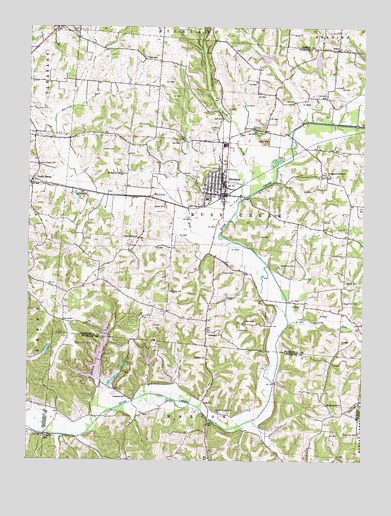
Bremen, OH USGS Topographic Map
Click on map above to begin viewing in our Map Viewer.

This topographic map contains these locations and features:
Feature Name Type Latitude Longitude GNIS ID View Map
Angler Paradise LakeReservoirN39.6563°W82.4931°1078796View Map
Angler Paradise Lake DamDamN39.6551°W82.4949°1078795View Map
AvlonPopulated PlaceN39.7440°W82.3849°1064364View Map
Avlon Post Office (historical)Post OfficeN39.7445°W82.3846°2042145View Map
Avlon United Brethren Church CemeteryCemeteryN39.7440°W82.3852°2765644View Map
Bethel CemeteryCemeteryN39.6770°W82.3815°1037907View Map
Bethel Church (historical)ChurchN39.6767°W82.3815°1065642View Map
BremenPopulated PlaceN39.7017°W82.4268°1048544View Map
Bremen - Rushcreek Fire Department Station 540BuildingN39.7015°W82.4286°2549421View Map
Bremen Police DepartmentBuildingN39.7019°W82.4283°2732416View Map
Bremen Post OfficePost OfficeN39.7015°W82.4263°1985010View Map
Britain School (historical)SchoolN39.6731°W82.4479°1065643View Map
Casper Hufford CemeteryCemeteryN39.7192°W82.4977°2765647View Map
College Hill School (historical)SchoolN39.7151°W82.4982°1065644View Map
Collins Chapel CemeteryCemeteryN39.7098°W82.4960°1039252View Map
Driver CemeteryCemeteryN39.7148°W82.4714°1039789View Map
Durbin RunStreamN39.6353°W82.4752°1039889View Map
Evangelical Reformed ChurchChurchN39.7073°W82.3888°1066000View Map
Flagdale CemeteryCemeteryN39.6542°W82.4335°1040496View Map
GenevaPopulated PlaceN39.6620°W82.4335°1061092View Map
Grace CemeteryCemeteryN39.7486°W82.4819°1040994View Map
Grace ChurchChurchN39.7495°W82.4899°1040998View Map
Grandview CemeteryCemeteryN39.7203°W82.4154°1041031View Map
Harmony CemeteryCemeteryN39.6331°W82.3760°1041335View Map
Harmony United Brethren Church (historical)ChurchN39.6334°W82.3757°1065669View Map
Hide-A-Way HillsPopulated PlaceN39.6548°W82.4771°1048834View Map
Hide-A-Way Hills Census Designated PlaceCensusN39.6551°W82.4660°2628900View Map
Hide-A-Way Hills Resort AirportAirportN39.6446°W82.4665°1082517View Map
Hilyard CemeteryCemeteryN39.6794°W82.4231°1041609View Map
Hugus Fruit FarmLocaleN39.7481°W82.4286°2515705View Map
Jerusalem CemeteryCemeteryN39.7073°W82.3893°1806825View Map
Joe (historical)Populated PlaceN39.6473°W82.4077°1067398View Map
Joe Post Office (historical)Post OfficeN39.6473°W82.4082°2009818View Map
Lake Eagle ClawReservoirN39.6543°W82.4549°1079266View Map
Lake Eagle Claw DamDamN39.6534°W82.4549°1079265View Map
Lake of Four SeasonsReservoirN39.6536°W82.4739°1078056View Map
Lake of Four Seasons DamDamN39.6482°W82.4731°1078055View Map
Lake TomahawkReservoirN39.6523°W82.4644°1078058View Map
Lake Tomahawk DamDamN39.6517°W82.4649°1078057View Map
Laurel ChapelChurchN39.6365°W82.4324°1042435View Map
Laurel Chapel CemeteryCemeteryN39.6392°W82.4291°1042436View Map
Little Rush CreekStreamN39.7009°W82.4193°1057808View Map
Max (historical)Populated PlaceN39.6340°W82.3896°1065656View Map
Max Post Office (historical)Post OfficeN39.6334°W82.3902°2009822View Map
Mennonite CemeteryCemeteryN39.6817°W82.4001°1043224View Map
Mount Zion CemeteryCemeteryN39.7076°W82.4667°1806834View Map
Mount Zion ChurchChurchN39.7076°W82.4665°1043657View Map
North BernePopulated PlaceN39.7056°W82.4985°1057876View Map
North Berne Post Office (historical)Post OfficeN39.7056°W82.4985°1985037View Map
Olive Branch CemeteryCemeteryN39.6893°W82.4588°1806853View Map
Olive Branch ChurchChurchN39.6892°W82.4590°1044156View Map
Raccoon RunStreamN39.6884°W82.4240°1066160View Map
Rush Creek Conservation District Structure 5b DamDamN39.7384°W82.3915°1078882View Map
Rush Creek Conservation District Structure 5b ReservoirReservoirN39.7398°W82.3925°1078883View Map
Rush Creek Conservation District Structure 5c DamDamN39.7401°W82.4099°1078884View Map
Rush Creek Conservation District Structure 7e DamDamN39.6867°W82.4815°1078888View Map
Rush Creek Conservation District Structure ReservoirReservoirN39.7412°W82.4113°1078885View Map
Rush Creek Conservation District Structure ReservoirReservoirN39.6867°W82.4815°1078889View Map
Sacred Heart CemeteryCemeteryN39.6648°W82.4196°1806866View Map
Sacred Heart ChurchChurchN39.6648°W82.4196°1045309View Map
Saint Emanuel Lutheran CemeteryCemeteryN39.6436°W82.4630°1963600View Map
Saint Emanuel Lutheran ChurchChurchN39.6434°W82.4635°1042841View Map
South Harvey CemeteryCemeteryN39.6412°W82.3879°1963604View Map
South Harvey ChurchChurchN39.6415°W82.3882°1046473View Map
Sugar Hill CemeteryCemeteryN39.6709°W82.3824°1046813View Map
Sugar Hill School (historical)SchoolN39.6701°W82.3827°1065645View Map
Swartz MillPopulated PlaceN39.6323°W82.4940°1063046View Map
Township of Rush CreekCivilN39.7020°W82.4281°1086083View Map
Turkey RunStreamN39.6645°W82.4027°1077085View Map
Village of BremenCivilN39.7061°W82.4296°2397448View Map
Welty CemeteryCemeteryN39.6629°W82.4213°1047679View Map
West Point School (historical)SchoolN39.6815°W82.4713°1065646View Map
Willard FieldAirportN39.6948°W82.4679°2443680View Map
Zwingley CemeteryCemeteryN39.6736°W82.4474°1048298View Map

Note: Coordinates in the location and feature list above are referenced to NAD83 datum.


Copyright (C) 2008-2024 Ryan Niemi / Sunset Dynamics ... All Rights Reserved