TopoQuest Logo
Do you find TopoQuest useful?
Help keep TopoQuest running and adding new maps/features by donating!
Bitcoin:  19c7KJd3qBynnjoSw5npx9KScwjBe4ifkT
Litecoin:  LXs6TkuXGGXo1vDsWCkWVdjQX94eUKd6ui
Home View Maps Find Maps Find Places Resources & Links


Kackley, Kansas Topographic Map

USGS Map Title: Kackley, KS
USGS Map MRC: 39097F7
DRG (GeoTIFF) Download: o39097f7.tif


Neighboring USGS Topographic Map Quads:


  Courtland, KS  
39097G8
 

  Scandia, KS  
39097G7
 

  Belleville, KS  
39097G6
 

  Jamestown NW, KS  
39097F8
 

  Kackley, KS  
39097F7
 

  Concordia NW, KS  
39097F6
 

  Scottsville, KS  
39097E8
 

  Jamestown, KS  
39097E7
 

  Concordia, KS  
39097E6


Map MRC Location:

N40°
W98°
N40°
W97°
H8 H7 H6 H5 H4 H3 H2 H1
G8 G7 G6 G5 G4 G3 G2 G1
F8 F7 F6 F5 F4 F3 F2 F1
E8 E7 E6 E5 E4 E3 E2 E1
D8 D7 D6 D5 D4 D3 D2 D1
C8 C7 C6 C5 C4 C3 C2 C1
B8 B7 B6 B5 B4 B3 B2 B1
A8 A7 A6 A5 A4 A3 A2 A1
N39°
W98°
N39°
W97°

Kackley, KS USGS 1:24K Topographic Map Preview:
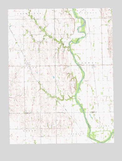
Kackley, KS USGS Topographic Map
Click on map above to begin viewing in our Map Viewer.

This topographic map contains these locations and features:
Feature Name Type Latitude Longitude GNIS ID View Map
Ada Lutheran ChurchChurchN39.7123°W97.8667°473079View Map
Ada Lutheran Church CemeteryCemeteryN39.7130°W97.8669°2739650View Map
Agmark Grain Elevator Number 11LocaleN39.6998°W97.8524°2695200View Map
Beaver CreekStreamN39.7111°W97.8017°472827View Map
Danish ChurchChurchN39.6536°W97.8103°473084View Map
Danish Lutheran CemeteryCemeteryN39.6532°W97.8106°2739676View Map
KackleyPopulated PlaceN39.7000°W97.8531°473080View Map
Lost CreekStreamN39.6592°W97.7555°485436View Map
NorwayPopulated PlaceN39.6961°W97.7739°473083View Map
Norway Volunteer Fire DepartmentBuildingN39.6967°W97.7754°2111673View Map
Oak CreekStreamN39.6669°W97.7959°473087View Map
Oakdale CemeteryCemeteryN39.6739°W97.8092°473082View Map
Our Savior Lutheran ChurchChurchN39.6970°W97.7736°2689881View Map
Salt CreekStreamN39.6711°W97.8748°473081View Map
Saron Baptist CemeteryCemeteryN39.6317°W97.8385°2739675View Map
School CreekStreamN39.7420°W97.7875°472834View Map
Sharon ChurchChurchN39.6317°W97.8384°473085View Map
Township of NorwayCivilN39.6971°W97.7632°485432View Map
Valley CemeteryCemeteryN39.6686°W97.7622°473086View Map

Note: Coordinates in the location and feature list above are referenced to NAD83 datum.


Copyright (C) 2008-2024 Ryan Niemi / Sunset Dynamics ... All Rights Reserved