TopoQuest Logo
Do you find TopoQuest useful?
Help keep TopoQuest running and adding new maps/features by donating!
Bitcoin:  19c7KJd3qBynnjoSw5npx9KScwjBe4ifkT
Litecoin:  LXs6TkuXGGXo1vDsWCkWVdjQX94eUKd6ui
Home View Maps Find Maps Find Places Resources & Links


Courtland, Kansas Topographic Map

USGS Map Title: Courtland, KS
USGS Map MRC: 39097G8
DRG (GeoTIFF) Download: o39097g8.tif


Neighboring USGS Topographic Map Quads:


  Webber, KS  
39098H1
 

  Scandia NW, KS  
39097H8
 

  Republic, KS  
39097H7
 

  Montrose, KS  
39098G1
 

  Courtland, KS  
39097G8
 

  Scandia, KS  
39097G7
 

  Randall, KS  
39098F1
 

  Jamestown NW, KS  
39097F8
 

  Kackley, KS  
39097F7


Map MRC Location:

N40°
W98°
N40°
W97°
H8 H7 H6 H5 H4 H3 H2 H1
G8 G7 G6 G5 G4 G3 G2 G1
F8 F7 F6 F5 F4 F3 F2 F1
E8 E7 E6 E5 E4 E3 E2 E1
D8 D7 D6 D5 D4 D3 D2 D1
C8 C7 C6 C5 C4 C3 C2 C1
B8 B7 B6 B5 B4 B3 B2 B1
A8 A7 A6 A5 A4 A3 A2 A1
N39°
W98°
N39°
W97°

Courtland, KS USGS 1:24K Topographic Map Preview:
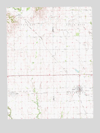
Courtland, KS USGS Topographic Map
Click on map above to begin viewing in our Map Viewer.

This topographic map contains these locations and features:
Feature Name Type Latitude Longitude GNIS ID View Map
Balch CemeteryCemeteryN39.7979°W97.9807°472826View Map
City of CourtlandCivilN39.7831°W97.8962°2393655View Map
City of FormosoCivilN39.7790°W97.9932°2394792View Map
CourtlandPopulated PlaceN39.7814°W97.8928°472819View Map
Courtland CanalCanalN39.8639°W97.9837°471886View Map
Courtland CemeteryCemeteryN39.7833°W97.8770°472820View Map
Courtland City HallBuildingN39.7830°W97.8948°2694381View Map
Courtland Community HallBuildingN39.7830°W97.8948°2692709View Map
Courtland Community LibraryBuildingN39.7830°W97.8948°2694724View Map
Courtland Covenant ChurchChurchN39.7818°W97.8934°2690459View Map
Courtland Post OfficePost OfficeN39.7826°W97.8953°2693680View Map
Courtland United Methodist ChurchChurchN39.7838°W97.8954°2689387View Map
Courtland Volunteer Fire DepartmentBuildingN39.7829°W97.8948°2111231View Map
Courtland Wastewater Treatment FacilityLocaleN39.7764°W97.8875°2692028View Map
Courtland West CanalCanalN39.7778°W97.9064°472821View Map
FormosoPopulated PlaceN39.7800°W97.9923°472818View Map
Formoso City HallBuildingN39.7792°W97.9934°2694380View Map
Formoso Community ChurchChurchN39.7789°W97.9942°2688688View Map
Formoso Post OfficePost OfficeN39.7801°W97.9935°2693720View Map
Formoso Public LibraryBuildingN39.7792°W97.9934°2694712View Map
Formoso Wastewater PlantLocaleN39.7727°W97.9993°2693442View Map
Gerro Gordo (historical)LocaleN39.7936°W97.9509°482268View Map
Jewell County Fire District Station 6BuildingN39.7800°W97.9928°2111458View Map
Laurel Hill CemeteryCemeteryN39.8415°W97.9611°472823View Map
LovewellPopulated PlaceN39.8653°W97.9817°472822View Map
Miller CanalCanalN39.8678°W97.8809°472581View Map
Mount Pleasant CemeteryCemeteryN39.8320°W97.8850°472825View Map
Persinger CemeteryCemeteryN39.8605°W97.9045°472824View Map
Pike Valley Elementary SchoolSchoolN39.7851°W97.8961°480208View Map
Pike Valley Junior High SchoolSchoolN39.7851°W97.8966°485098View Map
Prospect (historical)LocaleN39.8008°W97.8962°482500View Map
Republic County Rural Fire District 12BuildingN39.7826°W97.8953°2111775View Map
Township of CourtlandCivilN39.7842°W97.8762°472828View Map
Township of GrantCivilN39.7839°W97.9890°472007View Map
Township of SinclairCivilN39.8707°W97.9881°471897View Map
Township of White RockCivilN39.8710°W97.8760°472571View Map

Note: Coordinates in the location and feature list above are referenced to NAD83 datum.


Copyright (C) 2008-2025 Ryan Niemi / Sunset Dynamics ... All Rights Reserved