TopoQuest Logo
Do you find TopoQuest useful?
Help keep TopoQuest running and adding new maps/features by donating!
Bitcoin:  19c7KJd3qBynnjoSw5npx9KScwjBe4ifkT
Litecoin:  LXs6TkuXGGXo1vDsWCkWVdjQX94eUKd6ui
Home View Maps Find Maps Find Places Resources & Links


Keaau Ranch, Hawaii Topographic Map

USGS Map Title: Keaau Ranch, HI
USGS Map MRC: 19154F8
DRG (GeoTIFF) Download: o19154f8.tif


Neighboring USGS Topographic Map Quads:


  Papaikou, HI  
19155G1


  Hilo, HI  
19155F1
 

  Keaau Ranch, HI  
19154F8


  Mountain View, HI  
19155E1
 

  Pahoa North, HI  
19154E8


Map MRC Location:

N20°
W155°
N20°
W154°
H8 H7 H6 H5 H4 H3 H2 H1
G8 G7 G6 G5 G4 G3 G2 G1
F8 F7 F6 F5 F4 F3 F2 F1
E8 E7 E6 E5 E4 E3 E2 E1
D8 D7 D6 D5 D4 D3 D2 D1
C8 C7 C6 C5 C4 C3 C2 C1
B8 B7 B6 B5 B4 B3 B2 B1
A8 A7 A6 A5 A4 A3 A2 A1
N19°
W155°
N19°
W154°

Keaau Ranch, HI USGS 1:24K Topographic Map Preview:
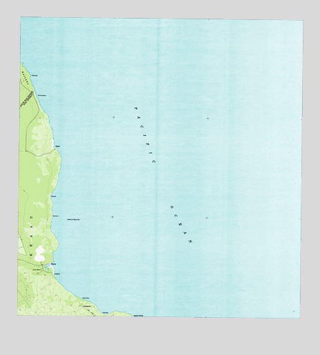
Keaau Ranch, HI USGS Topographic Map
Click on map above to begin viewing in our Map Viewer.

This topographic map contains these locations and features:
Feature Name Type Latitude Longitude GNIS ID View Map
AnapukaBayN19.7223°W154.9922°358604View Map
H??enaPopulated PlaceN19.6437°W154.9836°358840View Map
Hilo TrailTrailN19.6706°W154.9936°359194View Map
KahuluiBayN19.6637°W154.9820°359842View Map
KaleleSummitN19.6394°W154.9814°360106View Map
Kea?au BeachBeachN19.6434°W154.9827°1905430View Map
Kea?au RanchLocaleN19.6444°W154.9892°360897View Map
KipaepaeSummitN19.6264°W154.9693°361252View Map
Paki BayBayN19.6291°W154.9679°362995View Map
P?pa?iBayN19.6926°W154.9813°363117View Map
P?pa?i (historical)Populated PlaceN19.6918°W154.9821°1905546View Map
P?pua?aBayN19.6719°W154.9829°363172View Map
Pauk?pahuBayN19.7139°W154.9894°363192View Map
WahinemakanuiIslandN19.6622°W154.9761°364436View Map

Note: Coordinates in the location and feature list above are referenced to NAD83 datum.


Copyright (C) 2008-2024 Ryan Niemi / Sunset Dynamics ... All Rights Reserved