TopoQuest Logo
Do you find TopoQuest useful?
Help keep TopoQuest running and adding new maps/features by donating!
Bitcoin:  19c7KJd3qBynnjoSw5npx9KScwjBe4ifkT
Litecoin:  LXs6TkuXGGXo1vDsWCkWVdjQX94eUKd6ui
Home View Maps Find Maps Find Places Resources & Links


Kearney Park, California Topographic Map

USGS Map Title: Kearney Park, CA
USGS Map MRC: 36119F8
DRG (GeoTIFF) Download: o36119f8.tif


Neighboring USGS Topographic Map Quads:


  Biola, CA  
36120G1
 

  Herndon, CA  
36119G8
 

  Fresno North, CA  
36119G7
 

  Kerman, CA  
36120F1
 

  Kearney Park, CA  
36119F8
 

  Fresno South, CA  
36119F7
 

  Helm, CA  
36120E1
 

  Raisin, CA  
36119E8
 

  Caruthers, CA  
36119E7


Map MRC Location:

N37°
W120°
N37°
W119°
H8 H7 H6 H5 H4 H3 H2 H1
G8 G7 G6 G5 G4 G3 G2 G1
F8 F7 F6 F5 F4 F3 F2 F1
E8 E7 E6 E5 E4 E3 E2 E1
D8 D7 D6 D5 D4 D3 D2 D1
C8 C7 C6 C5 C4 C3 C2 C1
B8 B7 B6 B5 B4 B3 B2 B1
A8 A7 A6 A5 A4 A3 A2 A1
N36°
W120°
N36°
W119°

Kearney Park, CA USGS 1:24K Topographic Map Preview:
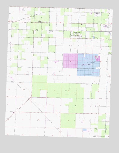
Kearney Park, CA USGS Topographic Map
Click on map above to begin viewing in our Map Viewer.

This topographic map contains these locations and features:
Feature Name Type Latitude Longitude GNIS ID View Map
Adams WasteCanalN36.6327°W119.8935°233398View Map
Center Rolinda DitchCanalN36.7149°W119.9618°220821View Map
Central WastewayCanalN36.6627°W119.8938°220857View Map
City of Fresno Sewage Treatment PlantLocaleN36.6972°W119.9026°1654201View Map
Dickenson WasteCanalN36.6766°W119.9888°222362View Map
Dry Creek CanalCanalN36.6991°W119.8901°222637View Map
FloydPopulated PlaceN36.7349°W119.9929°1682756View Map
Floyd School (historical)SchoolN36.7133°W119.9968°1665610View Map
Fresno City and County Historical Society ArchivesBuildingN36.7238°W119.9193°1811627View Map
Fresno Memorial GardensCemeteryN36.7336°W119.8821°223937View Map
Fruit ValeBuildingN36.7238°W119.9193°1811629View Map
Garfield DitchCanalN36.7111°W119.9263°224061View Map
Hawn DitchCanalN36.7408°W119.8807°225040View Map
Honor FarmLocaleN36.7222°W119.9143°225525View Map
Houghton - Kearney Elementary SchoolSchoolN36.7273°W119.9512°225687View Map
Houghton CanalCanalN36.7430°W119.9029°234045View Map
Houghton School (historical)SchoolN36.7355°W119.9565°1682757View Map
Kearney ParkParkN36.7258°W119.9193°226445View Map
Kearney Park School (historical)SchoolN36.7102°W119.9349°1682758View Map
Kearney SubstationLocaleN36.7066°W119.8801°1654288View Map
Little Houghton CanalCanalN36.7499°W119.9429°227278View Map
Machado DairyLocaleN36.6758°W119.8761°2703066View Map
McMullin (historical)Populated PlaceN36.6574°W119.9688°1665641View Map
Milky Way DairyLocaleN36.7369°W119.9792°2702952View Map
Nevills (historical)Populated PlaceN36.7463°W119.9032°1665646View Map
North Central Fire Protection District Station 22BuildingN36.7231°W119.9251°2624545View Map
Paragon DitchCanalN36.7266°W119.9082°230332View Map
Perrin School (historical)SchoolN36.6327°W119.8763°1665650View Map
PrattonPopulated PlaceN36.7466°W119.8996°252769View Map
RolindaPopulated PlaceN36.7352°W119.9618°1659541View Map
Rolinda Station (historical)LocaleN36.7433°W119.9646°1682764View Map
Teilman DitchCanalN36.7258°W119.8774°236078View Map
Vogel DitchCanalN36.7072°W119.9532°237120View Map
West Rolinda DitchCanalN36.7063°W119.9704°237519View Map

Note: Coordinates in the location and feature list above are referenced to NAD83 datum.


Copyright (C) 2008-2025 Ryan Niemi / Sunset Dynamics ... All Rights Reserved