TopoQuest Logo
Do you find TopoQuest useful?
Help keep TopoQuest running and adding new maps/features by donating!
Bitcoin:  19c7KJd3qBynnjoSw5npx9KScwjBe4ifkT
Litecoin:  LXs6TkuXGGXo1vDsWCkWVdjQX94eUKd6ui
Home View Maps Find Maps Find Places Resources & Links


Kennan NW, Wisconsin Topographic Map

USGS Map Title: Kennan NW, WI
USGS Map MRC: 45090F6
DRG (GeoTIFF) Download: o45090f6.tif


Neighboring USGS Topographic Map Quads:


  Babbs Island, WI  
45090G7
 

  Oxbo, WI  
45090G6
 

  Lugerville, WI  
45090G5
 

  Ingram NE, WI  
45090F7
 

  Kennan NW, WI  
45090F6
 

  Lac Sault Dore, WI  
45090F5
 

  Ingram, WI  
45090E7
 

  Hawkins, WI  
45090E6
 

  Kennan, WI  
45090E5


Map MRC Location:

N46°
W91°
N46°
W90°
H8 H7 H6 H5 H4 H3 H2 H1
G8 G7 G6 G5 G4 G3 G2 G1
F8 F7 F6 F5 F4 F3 F2 F1
E8 E7 E6 E5 E4 E3 E2 E1
D8 D7 D6 D5 D4 D3 D2 D1
C8 C7 C6 C5 C4 C3 C2 C1
B8 B7 B6 B5 B4 B3 B2 B1
A8 A7 A6 A5 A4 A3 A2 A1
N45°
W91°
N45°
W90°

Kennan NW, WI USGS 1:24K Topographic Map Preview:
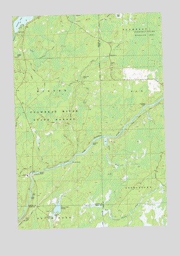
Kennan NW, WI USGS Topographic Map
Click on map above to begin viewing in our Map Viewer.

This topographic map contains these locations and features:
Feature Name Type Latitude Longitude GNIS ID View Map
Bergeron RapidsRapidsN45.6586°W90.7304°1561593View Map
Big Bull RapidsRapidsN45.6639°W90.7035°1561690View Map
Bull CreekStreamN45.6602°W90.7243°1562389View Map
Camp FlambeauLocaleN45.6566°W90.7410°1562609View Map
Carpenters RapidsRapidsN45.6958°W90.6399°1562737View Map
Connors SpringSpringN45.7266°W90.7471°1563328View Map
Cornsheller RapidsRapidsN45.6739°W90.6863°1563414View Map
Flambeau Correctional CenterSchoolN45.6566°W90.7410°2713173View Map
Kimberly-Clark Wildlife AreaParkN45.7413°W90.6315°1567488View Map
Kraft Camp (historical)LocaleN45.6572°W90.7363°1833770View Map
Little Connors CreekStreamN45.7319°W90.7499°1568230View Map
Little FallsFallsN45.6433°W90.7385°1568257View Map
Price CreekStreamN45.6308°W90.7499°1571928View Map
Price Creek SpringSpringN45.7133°W90.6921°1571929View Map
Skinner Creek FlowageReservoirN45.6369°W90.7166°1574239View Map
Sobieski C14690.1 DamDamN45.6350°W90.7201°1793455View Map
Stony BrookStreamN45.6772°W90.6760°1574939View Map

Note: Coordinates in the location and feature list above are referenced to NAD83 datum.


Copyright (C) 2008-2025 Ryan Niemi / Sunset Dynamics ... All Rights Reserved