TopoQuest Logo
Do you find TopoQuest useful?
Help keep TopoQuest running and adding new maps/features by donating!
Bitcoin:  19c7KJd3qBynnjoSw5npx9KScwjBe4ifkT
Litecoin:  LXs6TkuXGGXo1vDsWCkWVdjQX94eUKd6ui
Home View Maps Find Maps Find Places Resources & Links


Hawkins, Wisconsin Topographic Map

USGS Map Title: Hawkins, WI
USGS Map MRC: 45090E6
DRG (GeoTIFF) Download: o45090e6.tif


Neighboring USGS Topographic Map Quads:


  Ingram NE, WI  
45090F7
 

  Kennan NW, WI  
45090F6
 

  Lac Sault Dore, WI  
45090F5
 

  Ingram, WI  
45090E7
 

  Hawkins, WI  
45090E6
 

  Kennan, WI  
45090E5
 

  Sheldon NE, WI  
45090D7
 

  Jump River Fire Tower NW, WI  
45090D6
 

  Jump River Fire Tower NE, WI  
45090D5


Map MRC Location:

N46°
W91°
N46°
W90°
H8 H7 H6 H5 H4 H3 H2 H1
G8 G7 G6 G5 G4 G3 G2 G1
F8 F7 F6 F5 F4 F3 F2 F1
E8 E7 E6 E5 E4 E3 E2 E1
D8 D7 D6 D5 D4 D3 D2 D1
C8 C7 C6 C5 C4 C3 C2 C1
B8 B7 B6 B5 B4 B3 B2 B1
A8 A7 A6 A5 A4 A3 A2 A1
N45°
W91°
N45°
W90°

Hawkins, WI USGS 1:24K Topographic Map Preview:
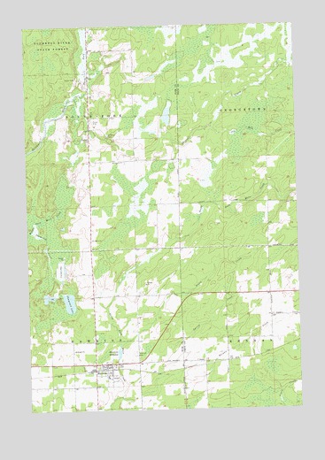
Hawkins, WI USGS Topographic Map
Click on map above to begin viewing in our Map Viewer.

This topographic map contains these locations and features:
Feature Name Type Latitude Longitude GNIS ID View Map
Diderrich Ranch Airport (historical)AirportN45.5366°W90.7049°1582006View Map
Fairview School (historical)SchoolN45.5669°W90.6379°1833502View Map
Four Corners School (historical)SchoolN45.5377°W90.6390°1833509View Map
HawkinsPopulated PlaceN45.5150°W90.7199°1566157View Map
Hawkins Elementary SchoolSchoolN45.5108°W90.7140°1867794View Map
Hawkins Emergency Medical ServicesBuildingN45.5110°W90.7150°2698226View Map
Hawkins MillpondReservoirN45.5186°W90.7086°1566160View Map
Hawkins Road School (historical)SchoolN45.5161°W90.6590°1833511View Map
Hawkins Volunteer Fire DepartmentBuildingN45.5111°W90.7150°2696719View Map
Hillcrest CemeteryCemeteryN45.5180°W90.7007°1566431View Map
Morgan CreekStreamN45.5041°W90.7085°1569729View Map
National ChurchChurchN45.5808°W90.7057°1570113View Map
North Fork Skinner CreekStreamN45.6019°W90.7268°1570438View Map
Old Mill CreekStreamN45.5919°W90.6643°1570781View Map
Plaza Cranberry FarmsLocaleN45.5914°W90.6967°2723764View Map
Riverside EstatesPopulated PlaceN45.5122°W90.7103°2611833View Map
Saint Marys CemeteryCemeteryN45.5891°W90.7118°1573307View Map
Saint Marys ChurchChurchN45.5555°W90.7201°1573321View Map
Shamrock CreekStreamN45.5583°W90.7468°1573957View Map
Shamrock LakeLakeN45.5351°W90.7311°1573958View Map
Shamrock Lake 4ReservoirN45.5383°W90.7335°1792672View Map
Shamrock Lake WP156 DamDamN45.5383°W90.7335°1792671View Map
South Fork School (historical)SchoolN45.5883°W90.7210°1867854View Map
South Fork TownhallBuildingN45.5883°W90.7210°1867855View Map
Spring CreekStreamN45.5075°W90.7063°1574621View Map
Stony CreekStreamN45.5225°W90.7079°1574951View Map
Town of South ForkCivilN45.5954°W90.7412°1584177View Map
Village of HawkinsCivilN45.5114°W90.7148°1583366View Map

Note: Coordinates in the location and feature list above are referenced to NAD83 datum.


Copyright (C) 2008-2025 Ryan Niemi / Sunset Dynamics ... All Rights Reserved