TopoQuest Logo
Do you find TopoQuest useful?
Help keep TopoQuest running and adding new maps/features by donating!
Bitcoin:  19c7KJd3qBynnjoSw5npx9KScwjBe4ifkT
Litecoin:  LXs6TkuXGGXo1vDsWCkWVdjQX94eUKd6ui
Home View Maps Find Maps Find Places Resources & Links


Kensington, Kansas Topographic Map

USGS Map Title: Kensington, KS
USGS Map MRC: 39099G1
DRG (GeoTIFF) Download: o39099g1.tif


Neighboring USGS Topographic Map Quads:


  Kensington NW, KS  
39099H2
 

  Kensington NE, KS  
39099H1
 

  Bachelors Run, KS  
39098H8
 

  Gretna, KS  
39099G2
 

  Kensington, KS  
39099G1
 

  Athol, KS  
39098G8
 

  Kirwin Reservoir, KS  
39099F2
 

  Kirwin, KS  
39099F1
 

  Cedar, KS  
39098F8


Map MRC Location:

N40°
W100°
N40°
W99°
H8 H7 H6 H5 H4 H3 H2 H1
G8 G7 G6 G5 G4 G3 G2 G1
F8 F7 F6 F5 F4 F3 F2 F1
E8 E7 E6 E5 E4 E3 E2 E1
D8 D7 D6 D5 D4 D3 D2 D1
C8 C7 C6 C5 C4 C3 C2 C1
B8 B7 B6 B5 B4 B3 B2 B1
A8 A7 A6 A5 A4 A3 A2 A1
N39°
W100°
N39°
W99°

Kensington, KS USGS 1:24K Topographic Map Preview:
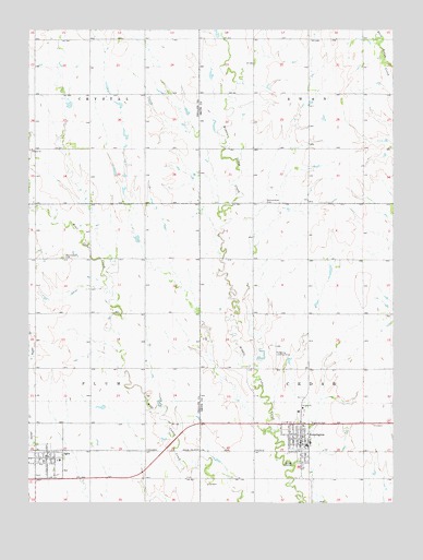
Kensington, KS USGS Topographic Map
Click on map above to begin viewing in our Map Viewer.

This topographic map contains these locations and features:
Feature Name Type Latitude Longitude GNIS ID View Map
AgraPopulated PlaceN39.7617°W99.1193°471935View Map
Agra American Legion HallLocaleN39.7622°W99.1187°2692247View Map
Agra CemeteryCemeteryN39.7572°W99.1220°2673342View Map
Agra Church of ChristChurchN39.7616°W99.1215°2690194View Map
Agra City HallBuildingN39.7622°W99.1192°2693034View Map
Agra Post OfficePost OfficeN39.7623°W99.1193°2693596View Map
Agra United Methodist ChurchChurchN39.7605°W99.1175°2689338View Map
Bloomfield (historical)LocaleN39.7714°W99.0684°482456View Map
City of AgraCivilN39.7614°W99.1196°2393891View Map
City of KensingtonCivilN39.7668°W99.0331°2395511View Map
F Lee Doctor LibraryBuildingN39.7613°W99.1187°2694705View Map
First Saint John Lutheran ChurchChurchN39.7706°W99.0355°2690240View Map
Germantown (historical)LocaleN39.8292°W99.0495°482605View Map
Germantown CemeteryCemeteryN39.8298°W99.0447°471947View Map
Johnson ChurchChurchN39.8433°W99.1245°471948View Map
KensingtonPopulated PlaceN39.7670°W99.0318°471944View Map
Kensington Post OfficePost OfficeN39.7654°W99.0321°2693801View Map
Kensington School Community LibraryBuildingN39.7653°W99.0307°2694716View Map
Kensington Senior Community CenterBuildingN39.7671°W99.0315°2692565View Map
Kensington Wastewater PlantLocaleN39.7582°W99.0207°2693480View Map
Phillips County Fire District 3ABuildingN39.7608°W99.1187°2111722View Map
Reneberg Landing Strip (historical)AirportN39.7914°W99.0406°471945View Map
Rural Fire Protection District 1BuildingN39.7674°W99.0315°2111801View Map
Saint John Lutheran ChurchChurchN39.7751°W99.0313°471949View Map
Thunder Ridge Elementary SchoolSchoolN39.7660°W99.0288°2497359View Map
Thunder Ridge High SchoolSchoolN39.7652°W99.0300°2497570View Map
Thunder Ridge Middle SchoolSchoolN39.7612°W99.1145°480198View Map
Township of CedarCivilN39.7855°W99.0104°471943View Map
Township of CrystalCivilN39.8722°W99.1230°471794View Map
Township of PlumCivilN39.7853°W99.1226°471942View Map
Township of SwanCivilN39.8725°W99.0107°471796View Map
United Church of KensingtonChurchN39.7684°W99.0335°2690241View Map
West Cedar (historical)LocaleN39.8295°W99.1237°482453View Map
West Cedar CemeteryCemeteryN39.8147°W99.1136°471946View Map

Note: Coordinates in the location and feature list above are referenced to NAD83 datum.


Copyright (C) 2008-2024 Ryan Niemi / Sunset Dynamics ... All Rights Reserved