TopoQuest Logo
Do you find TopoQuest useful?
Help keep TopoQuest running and adding new maps/features by donating!
Bitcoin:  19c7KJd3qBynnjoSw5npx9KScwjBe4ifkT
Litecoin:  LXs6TkuXGGXo1vDsWCkWVdjQX94eUKd6ui
Home View Maps Find Maps Find Places Resources & Links


Keuka Park, New York Topographic Map

USGS Map Title: Keuka Park, NY
USGS Map MRC: 42077E1
DRG (GeoTIFF) Download: o42077e1.tif


Neighboring USGS Topographic Map Quads:


  Potter, NY  
42077F2
 

  Penn Yan, NY  
42077F1
 

  Dresden, NY  
42076F8
 

  Pulteney, NY  
42077E2
 

  Keuka Park, NY  
42077E1
 

  Dundee, NY  
42076E8
 

  Hammondsport, NY  
42077D2
 

  Wayne, NY  
42077D1
 

  Reading Center, NY  
42076D8


Map MRC Location:

N43°
W78°
N43°
W77°
H8 H7 H6 H5 H4 H3 H2 H1
G8 G7 G6 G5 G4 G3 G2 G1
F8 F7 F6 F5 F4 F3 F2 F1
E8 E7 E6 E5 E4 E3 E2 E1
D8 D7 D6 D5 D4 D3 D2 D1
C8 C7 C6 C5 C4 C3 C2 C1
B8 B7 B6 B5 B4 B3 B2 B1
A8 A7 A6 A5 A4 A3 A2 A1
N42°
W78°
N42°
W77°

Keuka Park, NY USGS 1:24K Topographic Map Preview:
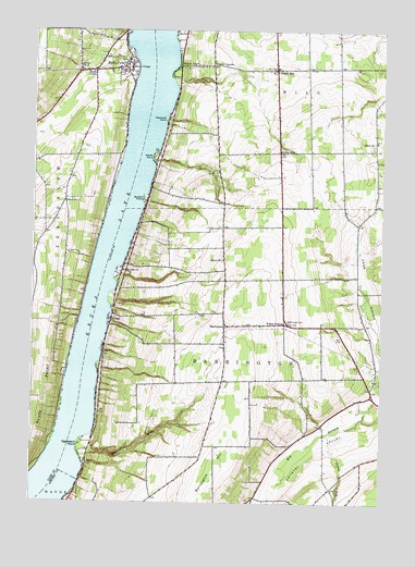
Keuka Park, NY USGS Topographic Map
Click on map above to begin viewing in our Map Viewer.

This topographic map contains these locations and features:
Feature Name Type Latitude Longitude GNIS ID View Map
A and L FarmLocaleN42.5486°W77.0314°2707701View Map
BarringtonPopulated PlaceN42.5470°W77.0561°943085View Map
Barrington Community ChurchChurchN42.5442°W77.0564°2514799View Map
Bluff PointPopulated PlaceN42.6142°W77.1036°944359View Map
Bluff Point United Methodist ChurchChurchN42.6144°W77.1086°2615624View Map
Branchport - Keuka Park Fire DepartmentBuildingN42.6156°W77.0941°2701015View Map
Buzzard Crest VineyardsLocaleN42.5494°W77.0908°2547266View Map
Chub HollowValleyN42.5280°W77.0004°946651View Map
Creekside Mennonite SchoolSchoolN42.5593°W77.0527°2669007View Map
CrosbyPopulated PlaceN42.5487°W77.0966°947792View Map
Eggleston GlenValleyN42.5136°W77.1036°949426View Map
Eggleston PointCapeN42.5153°W77.1069°949428View Map
Gravel RunStreamN42.5184°W77.0186°951588View Map
Gravel Run Mennonite SchoolSchoolN42.5046°W77.0071°2669026View Map
Hewitt PointCapeN42.5915°W77.0819°952655View Map
Keuka CollegeSchoolN42.6153°W77.0905°954570View Map
Keuka Lake ChurchChurchN42.5612°W77.0933°954573View Map
Keuka ParkPopulated PlaceN42.6153°W77.0922°954574View Map
Keuka Park CemeteryCemeteryN42.6178°W77.0961°2514569View Map
Keuka Park Census Designated PlaceCensusN42.6124°W77.0916°2631232View Map
Keuka Park Post OfficePost OfficeN42.6152°W77.0927°2617988View Map
Penn Yan Assembly of GodChurchN42.5871°W77.0375°2616214View Map
Porter CornerPopulated PlaceN42.5476°W77.0347°972964View Map
Porters Corners CemeteryCemeteryN42.5483°W77.0333°943086View Map
Raymond PointCapeN42.6015°W77.0772°962250View Map
Scenic Valley Mennonite SchoolSchoolN42.5172°W77.0284°2669103View Map
School Number 1 (historical)SchoolN42.5645°W77.0566°974881View Map
School Number 3 (historical)SchoolN42.6153°W77.0633°2377033View Map
School Number 3 (historical)SchoolN42.6156°W77.1086°975253View Map
School Number 4 (historical)SchoolN42.5798°W77.1136°975332View Map
School Number 7 (historical)SchoolN42.5959°W77.0025°975528View Map
School Number 8 (historical)SchoolN42.5934°W77.0366°975585View Map
School Number 9 (historical)SchoolN42.6153°W77.0394°2377034View Map
Second MiloPopulated PlaceN42.6148°W77.0386°964775View Map
Second Milo CemeteryCemeteryN42.6141°W77.0394°2514572View Map
Simmons VineyardLocaleN42.5911°W77.1019°2514920View Map
Sunset PointCapeN42.5806°W77.0852°966846View Map
Thayer CornersLocaleN42.6159°W77.0605°967195View Map
Town of BarringtonCivilN42.5298°W77.0487°978711View Map
Town of MiloCivilN42.6150°W77.0031°979220View Map
Willow GrovePopulated PlaceN42.6156°W77.0725°971357View Map

Note: Coordinates in the location and feature list above are referenced to NAD83 datum.


Copyright (C) 2008-2024 Ryan Niemi / Sunset Dynamics ... All Rights Reserved