TopoQuest Logo
Do you find TopoQuest useful?
Help keep TopoQuest running and adding new maps/features by donating!
Bitcoin:  19c7KJd3qBynnjoSw5npx9KScwjBe4ifkT
Litecoin:  LXs6TkuXGGXo1vDsWCkWVdjQX94eUKd6ui
Home View Maps Find Maps Find Places Resources & Links


Potter, New York Topographic Map

USGS Map Title: Potter, NY
USGS Map MRC: 42077F2
DRG (GeoTIFF) Download: o42077f2.tif


Neighboring USGS Topographic Map Quads:


  Canandaigua Lake, NY  
42077G3
 

  Rushville, NY  
42077G2
 

  Stanley, NY  
42077G1
 

  Middlesex, NY  
42077F3
 

  Potter, NY  
42077F2
 

  Penn Yan, NY  
42077F1
 

  Prattsburg, NY  
42077E3
 

  Pulteney, NY  
42077E2
 

  Keuka Park, NY  
42077E1


Map MRC Location:

N43°
W78°
N43°
W77°
H8 H7 H6 H5 H4 H3 H2 H1
G8 G7 G6 G5 G4 G3 G2 G1
F8 F7 F6 F5 F4 F3 F2 F1
E8 E7 E6 E5 E4 E3 E2 E1
D8 D7 D6 D5 D4 D3 D2 D1
C8 C7 C6 C5 C4 C3 C2 C1
B8 B7 B6 B5 B4 B3 B2 B1
A8 A7 A6 A5 A4 A3 A2 A1
N42°
W78°
N42°
W77°

Potter, NY USGS 1:24K Topographic Map Preview:
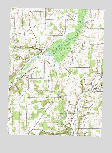
Potter, NY USGS Topographic Map
Click on map above to begin viewing in our Map Viewer.

This topographic map contains these locations and features:
Feature Name Type Latitude Longitude GNIS ID View Map
Big GullyValleyN42.6262°W77.1655°943890View Map
East PotterPopulated PlaceN42.7390°W77.1441°972428View Map
Flint Creek CampgroundsLocaleN42.6952°W77.2266°2615203View Map
French CemeteryCemeteryN42.7469°W77.2221°950685View Map
FriendPopulated PlaceN42.6628°W77.1836°972516View Map
Friend United Methodist ChurchChurchN42.6631°W77.1833°2514811View Map
Friend's Burial GroundCemeteryN42.6489°W77.1678°2514514View Map
Italy ValleyValleyN42.7020°W77.2083°953851View Map
Nettle Valley CemeteryCemeteryN42.6933°W77.1930°958378View Map
Nettle Valley CreekStreamN42.7095°W77.1878°958379View Map
Old Fort CemeteryCemeteryN42.6624°W77.1839°959283View Map
Pendleton FarmsLocaleN42.7328°W77.2206°2547279View Map
PotterPopulated PlaceN42.7042°W77.2066°961030View Map
Potter SwampSwampN42.7237°W77.1664°961052View Map
Potter Volunteer Fire DepartmentBuildingN42.7037°W77.2102°2700848View Map
Saint John's Lutheran ChurchChurchN42.7392°W77.1442°2616938View Map
School Number 10 (historical)SchoolN42.6762°W77.1405°974944View Map
School Number 12 (historical)SchoolN42.6837°W77.2297°975027View Map
School Number 16 (historical)SchoolN42.6384°W77.1825°975121View Map
School Number 2 (historical)SchoolN42.7078°W77.1541°975185View Map
School Number 6 (historical)SchoolN42.6534°W77.1425°975474View Map
School Number 8 (historical)SchoolN42.6545°W77.2244°975588View Map
Sherman HollowValleyN42.6984°W77.1880°965080View Map
Sugar Shack Blueberry FarmLocaleN42.7239°W77.1472°2514922View Map
Sutherland CemeteryCemeteryN42.7256°W77.1464°966864View Map
Thomas CemeteryCemeteryN42.7394°W77.1720°967391View Map
Town of PotterCivilN42.7141°W77.1807°979391View Map
Valley View SchoolSchoolN42.7003°W77.1310°2669124View Map
VoakPopulated PlaceN42.7315°W77.1330°973193View Map
Voak CemeteryCemeteryN42.7310°W77.1304°2514512View Map
White Clover Sheep FarmLocaleN42.7275°W77.2433°2560403View Map
YatesvillePopulated PlaceN42.6720°W77.1375°973303View Map
Yatesville CemeteryCemeteryN42.6716°W77.1399°2514513View Map

Note: Coordinates in the location and feature list above are referenced to NAD83 datum.


Copyright (C) 2008-2025 Ryan Niemi / Sunset Dynamics ... All Rights Reserved