TopoQuest Logo
Do you find TopoQuest useful?
Help keep TopoQuest running and adding new maps/features by donating!
Bitcoin:  19c7KJd3qBynnjoSw5npx9KScwjBe4ifkT
Litecoin:  LXs6TkuXGGXo1vDsWCkWVdjQX94eUKd6ui
Home View Maps Find Maps Find Places Resources & Links


Banner Mountain, Wyoming Topographic Map

USGS Map Title: Banner Mountain, WY
USGS Map MRC: 42106F1
DRG (GeoTIFF) Download: o42106f1.tif


Neighboring USGS Topographic Map Quads:


  Brookhurst, WY  
42106G2
 

  Lockett, WY  
42106G1
 

  Parkerton, WY  
42105G8
 

  Otter Creek, WY  
42106F2
 

  Banner Mountain, WY  
42106F1
 

  Protsmans Knob, WY  
42105F8
 

  Ice Cave Mountain, WY  
42106E2
 

  Reno Hill, WY  
42106E1
 

  Buck Peak, WY  
42105E8


Map MRC Location:

N43°
W107°
N43°
W106°
H8 H7 H6 H5 H4 H3 H2 H1
G8 G7 G6 G5 G4 G3 G2 G1
F8 F7 F6 F5 F4 F3 F2 F1
E8 E7 E6 E5 E4 E3 E2 E1
D8 D7 D6 D5 D4 D3 D2 D1
C8 C7 C6 C5 C4 C3 C2 C1
B8 B7 B6 B5 B4 B3 B2 B1
A8 A7 A6 A5 A4 A3 A2 A1
N42°
W107°
N42°
W106°

Banner Mountain, WY USGS 1:24K Topographic Map Preview:
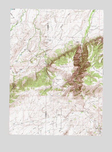
Banner Mountain, WY USGS Topographic Map
Click on map above to begin viewing in our Map Viewer.

This topographic map contains these locations and features:
Feature Name Type Latitude Longitude GNIS ID View Map
Agnes DamDamN42.7050°W106.1139°1606100View Map
Agnes ReservoirReservoirN42.7050°W106.1139°1606101View Map
Banner MountainSummitN42.6933°W106.0536°1597910View Map
Banner RanchLocaleN42.7050°W106.0781°1597911View Map
Beaver CreekStreamN42.7305°W106.1239°1598060View Map
Brooks CampLocaleN42.6355°W106.1170°1598386View Map
Cardine-Keith DamDamN42.6933°W106.1222°1608134View Map
Cardine-Keith ReservoirReservoirN42.6933°W106.1222°1608135View Map
Davis CreekStreamN42.6411°W106.0164°1599128View Map
Davis RanchLocaleN42.6322°W106.0072°1599132View Map
Deer Creek Canyon Chromite MineMineN42.6727°W106.0411°1726251View Map
Deer Creek ParkFlatN42.6347°W106.0731°1599205View Map
Duck CreekStreamN42.6625°W106.0195°1599393View Map
Hess DrawValleyN42.6794°W106.0661°1600304View Map
Keith RanchLocaleN42.7091°W106.1039°1600684View Map
Kimball RanchLocaleN42.7311°W106.0145°1600720View Map
King CreekStreamN42.6480°W106.0270°1600723View Map
Koch DepositMineN42.6567°W106.0561°1726252View Map
Koch Deposit Number OneMineN42.6567°W106.0558°1726250View Map
Lamb Upper DamDamN42.7433°W106.0689°1606096View Map
Lamb Upper ReservoirReservoirN42.7433°W106.0689°1606097View Map
Lower Deer Creek CanyonValleyN42.7166°W106.0289°1601172View Map
Negro Creek ParkFlatN42.6797°W106.0600°1601668View Map
Negro HillSummitN42.6652°W106.1095°1601670View Map
Nona CreekStreamN42.7064°W106.0875°1601706View Map
Paul CreekStreamN42.6300°W106.0208°1602060View Map
Phillips SpringSpringN42.7173°W106.0365°1602126View Map
Portugese PastureFlatN42.6902°W106.0106°1602280View Map
Red CreekStreamN42.7125°W106.0864°1602428View Map
Rissler DamDamN42.6883°W106.1106°1606122View Map
Rissler DrawValleyN42.6916°W106.1222°1602540View Map
Rissler RanchLocaleN42.6977°W106.1172°1602541View Map
Rissler ReservoirReservoirN42.6882°W106.1092°1602542View Map
Silver State Ditch Number 1CanalN42.7397°W106.1142°1605465View Map
Skeen CreekStreamN42.7311°W106.0914°1602944View Map
Smith CreekStreamN42.7305°W106.1239°1602993View Map
Smith RanchLocaleN42.7477°W106.0128°1603002View Map
Spring CreekStreamN42.6411°W106.0706°1603260View Map
Steeple PastureFlatN42.6711°W106.0497°1603353View Map
Trout CanyonValleyN42.6858°W106.1197°1603781View Map
V R CampLocaleN42.6491°W106.0264°1603894View Map
V R DitchCanalN42.7222°W106.0239°1603895View Map
V R DitchCanalN42.7322°W106.0089°1603896View Map
West Fork Deer CreekStreamN42.6514°W106.0225°1604051View Map
West Fork Deer CreekStreamN42.6511°W106.0222°1604356View Map

Note: Coordinates in the location and feature list above are referenced to NAD83 datum.


Copyright (C) 2008-2024 Ryan Niemi / Sunset Dynamics ... All Rights Reserved