TopoQuest Logo
Do you find TopoQuest useful?
Help keep TopoQuest running and adding new maps/features by donating!
Bitcoin:  19c7KJd3qBynnjoSw5npx9KScwjBe4ifkT
Litecoin:  LXs6TkuXGGXo1vDsWCkWVdjQX94eUKd6ui
Home View Maps Find Maps Find Places Resources & Links


Brookhurst, Wyoming Topographic Map

USGS Map Title: Brookhurst, WY
USGS Map MRC: 42106G2
DRG (GeoTIFF) Download: o42106g2.tif


Neighboring USGS Topographic Map Quads:


  The Reefs, WY  
42106H3
 

  Pratts Soda Lakes, WY  
42106H2
 

  Campbell Hill, WY  
42106H1
 

  Casper, WY  
42106G3
 

  Brookhurst, WY  
42106G2
 

  Lockett, WY  
42106G1
 

  Crimson Dawn, WY  
42106F3
 

  Otter Creek, WY  
42106F2
 

  Banner Mountain, WY  
42106F1


Map MRC Location:

N43°
W107°
N43°
W106°
H8 H7 H6 H5 H4 H3 H2 H1
G8 G7 G6 G5 G4 G3 G2 G1
F8 F7 F6 F5 F4 F3 F2 F1
E8 E7 E6 E5 E4 E3 E2 E1
D8 D7 D6 D5 D4 D3 D2 D1
C8 C7 C6 C5 C4 C3 C2 C1
B8 B7 B6 B5 B4 B3 B2 B1
A8 A7 A6 A5 A4 A3 A2 A1
N42°
W107°
N42°
W106°

Brookhurst, WY USGS 1:24K Topographic Map Preview:
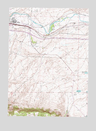
Brookhurst, WY USGS Topographic Map
Click on map above to begin viewing in our Map Viewer.

This topographic map contains these locations and features:
Feature Name Type Latitude Longitude GNIS ID View Map
Bentley DamDamN42.8233°W106.2356°1605871View Map
Bentley ReservoirReservoirN42.8233°W106.2356°1605872View Map
Bradshaw PitMineN42.8164°W106.1889°1746850View Map
BrookhurstPopulated PlaceN42.8575°W106.2364°1597232View Map
Brookhurst Census Designated PlaceCensusN42.8619°W106.2272°2407908View Map
Claude CreekStreamN42.8594°W106.2139°1586744View Map
Dry Muddy CreekStreamN42.8591°W106.1322°1587867View Map
Dry Muddy DamDamN42.8300°W106.1672°1605965View Map
Dry Muddy ReservoirReservoirN42.8300°W106.1672°1605966View Map
Elkhorn CreekStreamN42.8664°W106.2217°1588254View Map
Elkhorn Valley Rehabilitation HospitalBuildingN42.8443°W106.2425°2673178View Map
Flaherity DamDamN42.7700°W106.2072°1605935View Map
Flaherity ReservoirReservoirN42.7700°W106.2072°1605936View Map
FryLocaleN42.8675°W106.1333°1597327View Map
Hat Six RanchLocaleN42.7566°W106.1561°1589372View Map
Jones DrawValleyN42.8230°W106.1892°1590225View Map
KTWO-AM (Casper)TowerN42.8427°W106.2192°1608793View Map
KUYO-AM (Evansville)TowerN42.8702°W106.2039°1608800View Map
Lathrop L-Three PitMineN42.8503°W106.2403°1746849View Map
Mary Steed DamDamN42.8233°W106.1489°1605921View Map
Mary Steed ReservoirReservoirN42.8233°W106.1489°1605922View Map
Milne RanchLocaleN42.7764°W106.1250°1591631View Map
Mountain View Regional HospitalBuildingN42.8406°W106.2262°2673177View Map
Natrona County Fire Protection District East StationBuildingN42.8515°W106.2205°2673481View Map
Nicholaysen DamDamN42.8083°W106.2006°1605957View Map
Nicholaysen Number 2 DamDamN42.8233°W106.1739°1605911View Map
Nicholaysen ReservoirReservoirN42.8083°W106.2006°1605958View Map
Nicholaysen Reservoir Number 2ReservoirN42.8233°W106.1739°1605912View Map
PearsonLocaleN42.8580°W106.1484°1597455View Map
Pratt LakesLakeN42.8714°W106.2075°1593023View Map
Sinclair Casper Refining Company Fire DepartmentBuildingN42.8563°W106.2410°2673666View Map
Steed ReservoirReservoirN42.7793°W106.1252°1595019View Map
StroudsPopulated PlaceN42.8550°W106.2414°1597511View Map
Wagner and Bayer DamDamN42.8000°W106.1272°1605905View Map
Wagner and Bayer ReservoirReservoirN42.8007°W106.1281°1595963View Map
Wagner DamDamN42.7766°W106.1456°1605943View Map
Wagner ReservoirReservoirN42.7797°W106.1397°1595966View Map

Note: Coordinates in the location and feature list above are referenced to NAD83 datum.


Copyright (C) 2008-2025 Ryan Niemi / Sunset Dynamics ... All Rights Reserved